
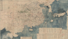
1769 Chinese Refugee Diaspora Map of Ming China (enormous)


This item has been sold.
大明一統二京十三省図 / Great Ming Unification Two Capitals and Thirteen Provinces Map / Da Ming Yi Yong Er Jing Shi San Shen Tu
Ming cartographic heritage.
Choose a Collection:
- Digital Map Information
- Suitable for large format printing
- Full resolution TIFF file
- ICC color profile embedded
- Delivered instantly via download link
This Item
Enquire
Ming cartographic heritage.
This previously unknown 1769 Chinese-language manuscript map of Ming China and Korea is among the most important East Asian cartographic discoveries to emerge in recent years. Monumental in scale and exceptionally detailed, it preserves official Ming Dynasty geographic knowledge long thought lost, likely produced in Tokugawa Japan by descendants of Chinese scholars who fled the fall of the Ming Dynasty in 1644. Rich with elegant calligraphy, extensive topographical and political detail, and numerous textual annotations, the map offers an unparalleled window into the geography, historical memory, and intellectual traditions of the Ming loyalist diaspora. As a unique manuscript with no known counterpart, it represents a once-in-a-lifetime opportunity to acquire an extraordinary artifact of Chinese cartography, Sino-Japanese cultural exchange, and the enduring legacy of the Great Ming.A Closer Look
With a focus on China, the map covers from the Andaman Sea to the western shores of Hokkaido and from the Gobi Desert and Mount Paektu (Baekdu or Changbai, North Korea) to the Malay Peninsula (squished up and distorted in the lower left). The map is abundant with rich political and topographical detail including the Great Wall of China, countless towns, roads, trade routes, mountains, and riverways. Throughout, there are numerous areas where town names and annotations have been painted over, revised, or blocked out with a paste-down. The topography is quite detailed although it becomes less so when focusing on non-Chinese regions such as Korea, Japan, Central Asia, and Malaya. Those who can admire Chinese calligraphy will note that the characters on this map are exceptionally beautiful and well executed.Text in the lower right quadrant states that this map was drawn in Japan in Meiwa 6 or 1769. There appears to be some ambiguity in the text relating to the word 'Nambu,' which could mean either Northern Japan in the vicinity of Hachinohe, or 'Southern Japan' as we interpreted it. Although no specific authorship is ascribed, based on the subject matter, style, textual annotations, and title, we can make certain educated speculations. Following the fall of the Ming Dynasty to the Manchurian Qing in 1644, numerous Ming Chinese scholars, reluctant to live under Qing Manchurian rule, fled into exile in southern Japan, primarily Nagasaki, where they and their descendants had a tremendous influence on Tokugawa-era Japanese thought and religion. This map's focus on Ming China, compounded by the statement that may have been drawn in Southern Japan during the Meiwa period, suggests that it was produced by the descendants of these Chinese exiles or, potentially, their sinophile disciples. Note how the specific route between Ningbo, China, and Nagasaki, Japan, is highlighted with an annotation reading '1800 miles to reach the Kyushu Coast of Japan' (author's translation). The Ningbo-Nagasaki trade route was the primary route by which Chinese exiles, as well as scholarship, entered Japan. Moreover, the title, which includes the term 大明 (Great Ming), is inherently Chinese and is unlikely to have been applied by a Japanese mapmaker of the Meiwi Period.
The sources for this map are only partially evident. Still, it is noteworthy that the title 大明一統二京十三省図, or Great Ming Unification Two Capitals and Thirteen Provinces, is one generally associated with official Ming Dynasty maps. The use of this specific title was punishable by death under the Qing. All of this suggests that the map was drawn from official Ming sources secreted into Japan by Chinese exiles fleeing Qing influence. The primary source is most likely the 大明一統 志 (Daming yitong zhi) or Records of the Unity of the Great Ming , a massive Ming geography, compiled in the 1450s, of which only portions survive today. The map also bears some similarity to Ming-era maps such as the 大明混一圖 (Da Ming Hun Yi Tu), or Great Ming Amalgamated Map. This is most evident in the form of the China coastline, the course of the Yellow River, the Gobi, and the absence of Taiwan (which did not appear on Chinese maps until the Qing maps of 1708), all of which are suggestive of the Da Ming Hun Yi Tu.
There are several interesting text blocks. One, at the bottom center, lists 44 foreign countries. Many of these are hard to translate, being derived from Arabic, Malay, and other languages. Still, some are identifiable, including Ryukyu (Okinawa), Khmer (Cambodia), Siam (Thailand), Sumatra, Java, Ceylon, and Srivijaya (a legendary, powerful thalassocratic city-state on Sumatra that exercised trade influence over most of Southeast Asia).
The text block on the lower right corner features a history of the map starting with the Emperor Hongwu (1368 - 1398), founder of the Ming Dynasty, then the conquest of Mongolia and the Gobi by Emperor Yung Lei (3rd Ming Emperor), the founding of Yunnan and Guizhou, and the consolidation of 14 provinces into the traditional Ming 13. It is also here that the map's date of creation, Meiwa 6 (1769), is noted.
The text block just to the left of the history block described above features a list of the 13 provinces of Ming China.
Publication History and Census
As a manuscript piece, this map is a unique, once-in-a-lifetime discovery.Condition
Very good. Backed on kozo tissue. Original fold lines. A few very minor areas of wormholes and loss.
References
Elman, B., East Asian Science Techonology and Society: An International Journal, 'Sinophiles and Sinophobes in Tokugawa Japan: Politics,Classicism, and Medicine During the EighteenthCentury,' May 12, 2008, DOI 10.1007/s12280-008-9042-9.