
1826 Donnet / Langlois Wall Map of France - Enormous!

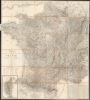
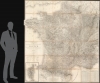
Carte Topographique, Minéralogique et Statistique de la France, Réduite de celle de Cassini, a L'Échelle de 1:388800.
Redefining the French national identity in the Bourbon Restoration.
- Digital Map Information
- Suitable for large format printing
- File Size: 122.13 MB
- File Type: ZIP / TIFF
- ICC color profile embedded
- Delivered instantly via download link
Redefining the French national identity in the Bourbon Restoration.
A massive 1826 map of France by Alexis Donnet and Hyacinthe Langlois. The map was issued as the definitive map of France during the Bourbon Restoration (1814 - 1830), as the nation recovered and reorganized in the wake of the Napoleonic Wars (1803 - 1815).A Closer Look
Despite its enormous size, this map is actually a reduction of the great Cassini Triangulation, a groundbreaking map of France on the staggering scale of 1:86400. While impressive and seminal, the Cassini map, being many times larger than the present map, was neither practical for looking at France as a whole nor viable for mass dissemination to government offices, schools, businesses, and other such entities. Moreover, as the finest map of France, the Cassini map was nationalized by the Dépot de la Guerre, which, during the Napoleonic Wars (1803 - 1815), suppressed it for military reasons. Following Napoleon's 100 Days, the Dépot de la Guerre began to loosen its hold on cartographic material, as an economically, socially, and politically floundering nation needed a new relatable national image. This map was thus published to make the Cassini triangulation practically disseminable and provide the French with a fresh national overview.As a whole, the map is exquisitely detailed, reflecting the extraordinary work of two generations of the Cassini family. Every village, road, city, battle site, chateau, and church is noted, all overlaid on a detailed topographic map that indicates elevations, rivers, mountains, forests, fields, canals, swamps, and mineralogical data. Mileage on major routes between towns is noted. There is a map of Corsica and a key in the lower left corner. A statistical and administrative table appears in the lower right corner.
Publication History and Census
This map first appeared in 1817, just two years into the Bourbon Restoration. The current example is the 1826 second edition. Alexis Donnet designed this map based on the 1756 to 1815 Cassini model. It was engraved by R. Whal, Dandeleux, et Malo, with the lettering by Pelicier et Lallemand. Updates to the 1815 Cassini were completed by Fremin, a geographer at the Dépot de la Guerre. It was printed by Imprimerie Malo and published in Paris by Hyacinthe Langlois. The work typically appears bound in a single volume, this being the only example we have seen dissected and laid on linen as a massive folding wall map. There are several subsequent editions, each with considerable revisions, published in 1844, 1849, and 1855. We note 6 examples of the 1826 edition in European institutions, but see no comparable examples in the United States. We note one example (1817) sold at Sotheby's in 2022 for about 5,000 USD, including premium.Cartographers
Alexis Donnet (1782 - 1867), aka Aleixo, was a French map geographical engineer, architect, map publisher, and cartographer active in France in the first half of the 19th century. Donnet was born in Lyon. During the First Empire he was an ingénieur-géographe attached to Cadastre de la France. His work is scarce on the market, but well represented in official collections within France, particularly the Bibliothèque Nationale de France (BnF). In addition to cartographic work, he published an architectural study of the theaters of Paris (1821). Further Details...
Hyacinthe Langlois (fl. c. 1800 - 1852) was a Parisian publishing house specializing in maps, atlases, and travel literature. They do not appear to have any relation with Eustache-Hyacinthe Langlois, a contemporary artist and engraver, who spent most of his adult life in Rouen. Further Details...
A. R. Fremin (fl. c. 1810 - c. 1860) was a French geographer active in the early to mid 19th century. He is known to have been a student of the cartographer Jean-Baptiste Poirson. Fremin drew and compiled maps for many prominent French cartographic publishers of the period including Tardieu, Logerot, Dufour, Monin, Duvotenay, Dyonnet, and Vuillemin. Little else is known of Fremin's life and work. Further Details...
Condition
Good. Dissected and laid on linen with original slipcase. Slipcase has seen better days, but remains serviceable. Map exhibits a few water stains and toning, especially along fold lines, and is coming loose form the backing in places, but is generally stable.
References
OCLC 642817369.