
1832 Berghaus 'Atlas von Asia' Map of Southeast Asia


This item has been sold.
Hinterindien.
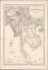
Most engrossingly detail map of Southeast Asia to appear the first half of the 19th century.
- Digital Map Information
- Suitable for large format printing
- DPI: 600
- File Size: 1252.23 MB
- File Type: ZIP / TIFF
- ICC color profile embedded
- Delivered instantly via download link
Most engrossingly detail map of Southeast Asia to appear the first half of the 19th century.
This is a striking 1832 Heinrich Berghaus and Francis Buchanan-Hamilton map of Southeast Asia, comprising Burma, Siam (Thailand), Loas, Cambodia, Vietnam, Malaya, and Singapore. It was issued for Berghaus' looseleaf Atlas von Asien, the best informed general cartographic work on Asia to appear in the mid-19th century.A Closer Look
Coverage embraces from the Ganges River delta to Hainan Island and from Tibet (as far as Lhasa) to Singapore. The map benefits from the cartography compiled by Francis Buchanan-Hamilton, who accompanied the 1795 Michael Symes mission to Ava. We also recognize the influence of the maps produced in the wake of the 1826 John Crawfurd Mission to Ava and the subsequent 1828 Crawfurd Mission to Siam. It is the most engrossingly detailed map of these regions to appear in the first half of the 19th century.Publication History and Census
This map was published in 1832 by Heinrich Berghaus and Justus Perthes. It was engraved in Berlin by Wilhelm Brose. The map is no. 8 of Berghaus's Atlas von Asien, all the individual maps of which are exceedingly desirable. We know of examples in the David Rumsey Collection, the Bibliothèque nationale de France, and a host of German collections, but little or no presence on the private market.Cartographers
Heinrich Karl Wilhelm Berghaus (May 3, 1797 - February 17, 1884) was a German (Prussian) geographer, linguist, and ethnologist who founded the Potsdam Geographische Kunstschule. He was born in Kleve, Germany, and, as a young man, trained as a surveyor. He put his training to work in 1811, working in the French Department of Lippe as a bridge and road engineer. When the Kingdom of Westphalia dissolved in 1813, he volunteered for the Prussian army administration, traveling with General Bogislav Friedrich Emanuel von Tauentzien (1760 - 1824) as far as Brittany. In 1816, he joined the staff of the Prussian trigonometrical survey, conducting surveys throughout the nation. Among his many accomplishments, Berghaus is credited with inventing the 'thematic atlas' in 1845. In addition to his own work, he trained some of the most important German geographers and cartographers of the late 19th century, including August Heinrich Petermann (1822 - 1878) and his nephew Hermann Berghaus (1828 - 1890). The elder Berghaus also was a friend and associate of the naturalist Alexander von Humboldt (1769 - 1859), producing some of the maps in his publications. In 1837, he inherited rights to Daniel Gottlob Reymann's (1759 - 1837) monumental Geographischer Specialatlas von Deutschland. Berghaus is best known for his own influential and wide-ranging atlases, namely Atlas von Asien, published between 1833 and 1837, and Berghaus' Physikalischer Atlas, published in multiple editions in the 1830s - 1840s. Although Atlas von Asien was a commercial failure, it was regarded as a work of supreme quality, boosting the reputation of the publisher Justus Perthes and setting up their next collaboration, Berghaus' Physikalischer Atlas, for success. In addition to his geographical work, Berghaus was also an accomplished linguist and ethnologist and published an important 1851 article on American Indian language and ethnology (Geographisches Jahrbuch, 1851). Further Details...
Johan Georg Justus Perthes (September 11, 1749 - May 2, 1816) was one of the most important German cartographic engravers of the 19th century. He was born in the Thuringian town of Rudolstadt, the son of a court physician. In 1778, he began working as a bookseller in Gotha. Perthes began his publishing empire shortly thereafter with the 1784 issue of the famed survey of European nobility known as the Almanac de Gotha. In the next year, 1785, he founded the cartographic firm of Justus Perthes Geographische Anstalt Gotha. His son Wilhelm Perthes (1793 - 1853) joined the firm in 1814. Wilhelm had prior publishing experience at the firm of Justus Perthes' nephew, Friedrich Christoph Perthes, who ran a publishing house in Hamburg. After Justus Perthes died in 1816, Wilhelm took charge and laid the groundwork for the firm to become a cartographic publishing titan. From 1817 to 1890. the Perthes firm issued thousands of maps and more than 20 different atlases. Along with the visionary editors Hermann Berghaus (1797 - 1884), Adolph Stieler (1775 - 1836), and Karl Spruner (1803 - 1892), the Perthes firm pioneered the Hand Atlas. When Wilhelm retired, management of the firm passed to his son, Bernhardt Wilhelm Perthes (1821 – 1857). Bernhardt brought on the cartographic geniuses August Heinrich Peterman (1822 - 1878) and Bruno Hassenstein (1839 - 1902). The firm was subsequently passed to a fourth generation in the form of Berhanrd Perthes (1858 – 1919), Bernhard Wilhelm's son. The firm continued in the family until 1953 when, being in East Germany, it was nationalized and run as a state-owned enterprise as VEB Hermann Haack Geographisch-Kartographische Anstalt Gotha. The Justus family, led by Joachim Justus Perthes and his son Wolf-Jürgen Perthes, relocated to Darmstadt where they founded the Justus Perthes Geographische Verlagsanstalt Darmstadt. Further Details...
Wilhelm Brose (17xx - 18xx) was a German engraver active in the early 19th century. He engraved for Herman Berghaus and the Justus Perthes firm. He is likely related to Karl Heinrich Brose (1783 - 1861), also an engraver with Perthes, Berghaus, and Flemming. Further Details...
Source
Berghaus, H., Atlas von Asien, (Gotha: Justus Perthes) 1832 - 1837.
Heinrich Berghaus's Atlas von Asien was an 18-map loose-leaf atlas issued by Justus Perthes between 1832 and 1858. Of the 18 proposed maps, only 15 were published. Individual maps were large with unprecedented detail. These include 10 land maps and 7 nautical charts derived from British, Dutch, and Portuguese colonial, scientific, and diplomatic missions. Despite this, the project was a financial failure due to the high cost of engraving such large and intricate maps. It took more than 25 years for the maps to be fully published and, according to the Perthes archive, only 20 sets were ultimately bound and sold. The publication run per map ran between 200 to 550 maps, most of which were offered separately. The breadth, detail, and comprehensiveness of the work surpassed any previous mapping of the respective subjects. Although not a direct financial success, the Atlas von Asien was a monumental cartographic accomplishment that put the Perthes firm on par with the great cartographic firms of England and France. The Atlas von Asien was largely forgotten until recent times, when it has become desirable among collectors and institutions.
Condition
Very good. Slight margin foxing.