
1914 Wood Maps of Inner Asia (Jammu and Kashmir, Tibet) w/ Annotations

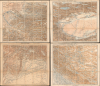
Карта южной пограничной полосы азиатской россіи XIX. ТАШКЕНТЪ ; XX. КАШГАРЪ ; КАБУЛЪ (XXVII) ПЕШАВАРЪ ; XXVIII ЛЕ, СИМЛА, ДЕЛИ/ [Map of the Southern Border Zone of Asiatic Russia XIX. Tashkent ; XX. Kashgar ; Kabul (XVII) Peshawar ; XXVIII Leh, Shimla, Delhi].
Mansucript record of a multinational Survey the Himalayas on the Eve of the Great War.
- Digital Map Information
- Suitable for large format printing
- Full resolution TIFF file
- ICC color profile embedded
- Delivered instantly via download link
Mansucript record of a multinational Survey the Himalayas on the Eve of the Great War.
This unique set of four Russian military topographic maps of Central and Inner Asia (each measuring 22.25 x 26.25 in.) bears English-language manuscript notes recording Filippo De Filippi's scientific expedition of 1913 - 1914. The expedition greatly improved scientific mapping of the Karakoram Pass, an ancient caravan route through the Himalayas connecting India and China (more specifically, Leh and Tibet), and attempted to trace the Yarkand River's origins. Though billed as an Italian expedition, it was in fact a multinational team that drew on the expertise of earlier Russian and British explorers, Filippi's own previous surveys in the region, and local Survey of India workers deeply familiar with the region's landscape, languages, and climate. This scientific cosmopolitanism is especially notable given the recent 'Great Game' tensions between Britain and Russia, ameliorated by the early 20th century, and when set against the backdrop of World War I (1914 - 1918), which broke out while the expedition was in the field. The map's annotations, most likely made by Major Henry Wood of the Survey of India, connect Srinagar, Skardu, Leh, the eastern Karakoram, and Kashgar, identifying successive bases for exploration, illustrating the expedition unfolding in situ.A Closer Look
The four sheets belong to the series 'Map of the Southern Borderlands of Asiatic Russia' prepared by the Military Topographic Department of the Main Staff of the Imperial Russian Army. Together they extend from Bukhara and the Amu Darya eastward across the Pamirs and Tarim Basin, and south through Afghanistan, the Indus Valley, Kashmir, Ladakh, and western Tibet. Their coverage is substantially broader than the expedition's itinerary, placing its mountain investigations within the surrounding network of settlements, caravan routes, and railways. In contemporary parlance, the maps cover 'Russian Turkestan,' 'Chinese Turkestan,' Afghanistan, and large parts of British India, including semi-autonomous princely states (most notably, Jammu and Kashmir).Relief shading articulates the mountain chains. Blue rivers, lakes, and glaciers mark the drainage systems central to the expedition's investigations. Dense settlement names and connecting routes fill the inhabited valleys. The contrast between these corridors and the sparsely named highlands is especially pronounced on the eastern sheets. Across this printed geography, Wood's red manuscript lines trace the expedition's progress, while blank ink notes at the top of each sheet record the time period when the expedition traversed the respective areas.
Progress into 'Unexplored Territory'
On the Kabul and Peshawar sheet (lower-left), a red route follows the approach of the expedition through Rawalpindi to Srinagar (СРИНАГАРЪ), where the members stopped for a few weeks to prepare for their grueling field surveys, then continues eastward toward Dras (Драсъ). On the adjoining Leh, Simla, and Delhi sheet (bottom-right), the route resumes from Srinagar through Dras and Kargil (Каргилъ), with branches toward Skardu (here as Искардъ) and Leh (Ле). Marginal entries record the winter at Skardu, travel between Skardu, Kargil, and Leh, and the subsequent movement toward Depsang (Депсангъ) in May 1914. A boxed cross identifies the first base camp for exploration during June and July; a corresponding symbol appears within the map near the northern end of the marked route.The Kashgar (top-right) sheet carries the continuation northward from the Karakoram Pass. Red lettering marks unexplored territory, while a marginal note identifies Kufelang (Куфелангъ) as the second base camp for exploration in August and September 1914. Further entries concern mountain exploration in October and November, with the expedition eventually reaching Yarkand (ЯРКАНТЪ) and Kashgar (КАШГАРЪ). In the end, the main contribution of Filippi's expedition was the survey work carried out in the 'Unexplored Territory' marked here, adjacent to the Karakoram Pass.
Surveying the Eastern Karakoram
Filippo De Filippi (1869 - 1938) organized the expedition to combine geographical exploration with geodesy, geology, meteorology, and other branches of physical science. A principal problem was the relationship between the Rimo glaciers, the sources of the Yarkand River, and the mountain country farther west toward the Oprang, now generally known as the Shaksgam. Establishing these relationships required following valleys and determining watersheds, not simply identifying prominent summits. The expedition's separate parties therefore undertook complementary investigations from shared bases.Major Henry Wood (1872 - 1940), a Royal Engineers officer who joined the Survey of India in 1898, brought professional surveying experience to this undertaking. Wood, John Alfred Spranger, and Indian surveyor Shib Lal investigated the upper Yarkand, while other members surveyed the Rimo glacier system and adjoining country. The Survey of India also supplied surveyor Jamna Prasad. This multinational and Indian participation is important to understanding an undertaking conventionally described as an Italian expedition, as well as the overall work of the Survey of India, British in name but mostly Indian and Nepali in terms of employees.
De Filippi's expedition report records Wood joining Spranger and the guide Petigax at Kufelang to explore western tributaries of the Yarkand. Their observations challenged expectations about where those streams originated. Meanwhile, persistent flooding prevented De Filippi's party from crossing the river to pursue its proposed exploration toward the Oprang.
Why Russian maps?
The use of English-language annotations by a British surveyor on Russian-language maps, which drew on earlier work carried out primarily by Indian and Nepali workers, for an expedition led by Italians, reflects the multinational effort required to produce modern topographic maps in the extremely harsh terrain and climate of the Himalayas. Wood and Filippi's use of Russian maps is curious, as the Survey of India would presumably have the most up-to-date maps of the Himalayan region (whereas the Russian mapping of Central Asia would indeed be better). But a potential clue lies in Filippi's published account of the expedition, discussing the expedition's preparatory period in Srinagar in September 1913:A few days later [c. September 23] came Lieutenant (now Major) Kenneth Mason of the Indian Trigonometrical Survey, who had just successfully completed an important piece of geodetic work, joining up the Indian Survey with that of Russian Turkestan. [footnote: As early as 1843 Colonel Everest had suggested this connection, so as to obtain the measure of a meridian arc from Cape Comorin at the southern extremity of India to Nova Zembla in the Arctic Ocean: W . H. Purdon, On the Trigonometrical Survey and Physical Configuration of the Valley of Kashmir, Jour. Roy. Geog. Soc., Vol. xxxi, 1861, p. 14. The suggestion was not taken up until 1909, in one of the triennial meetings of the International Geodetic Association. Its execution was entrusted to English and Russian geodesists, and took 3 years of hard work. A chain of 33 stations was made, at an average height of about 16,250 feet above sea-level (the highest being about 18,850 feet), crossing the districts of Gilgit and Hunza, the Himalayas and Pamir. The official account of this important piece of work forms Vol. vi of the Records of the Survey of India, under the title Completion of the Link connecting the Triangulations of India and Russia ; Trig. Surv., Dehra Dun, 1914. Major Kenneth Mason has also published a short account in Geog. Jour., Vol. xliii, 1914, p. 664.]' (Filippi, The Italian Expedition, pp. 18)It is therefore possible that, lacking a published map combining the most recent Survey of India work with Russian topographic surveys, Wood instead employed the most recent Russian maps seen here in tandem with a separate set of the most recent Survey of India maps.
From the Great Game to the Great War
These cartographic collaborations were related to an overall warming of Anglo-Russian relations. The 'Great Game,' the decades-long clandestine standoff between the British and Russian empires that had turned the high Himalayan and Pamir passes into sensitive buffer zones, was only a recent memory. But De Filippi's mission took advantage of the fragile detente following the 1907 Anglo-Russian Convention to connect the Great Trigonometrical Survey of India with the Russian geodetic network. Indeed, when the expedition reached Kashgar, the city's Russian merchants and diplomats repeatedly feted them. However, the expedition's final phase was marred by news of the outbreak of World War I, which delayed the comprehensive publication of their scientific findings for years. Due in part to wartime service requirements, the expedition broke up after leaving Kashgar, with some returning to Ladakh and India, while Filippi traveled through Russian Central Asia to return to Italy. However, as the war had already broken out by this time, Filippi's heavy scientific instruments, which had been lugged along the entire route of the expedition, had to be left at the railway station in Tashkent as Russia's railways were fully dedicated to mobilizing troops.Publication History
The printed maps were originally issued by the Military Topographic Department of the Main Staff of the Imperial Russian Army, and were published between 1896 and 1911. They are part of a set titled 'Map of the Southern Border Zone of Asiatic Russia,' which was ultimately based on the cartographic work of 'Col. Bolshev,' that is, Andrei Alexandreiovivh Bolshev, and his colleagues, who spent two decades compiling a map of Russian Asia that appeared in 1884. The maps in themselves are rare, but this particular set with annotations, almost certainly produced by Wood himself while in the field, is a unique and exceptional item.Cartographers
Filippo De Filippi (April 6, 1869 - September 23, 1938) was an Italian geographical explorer, expedition organizer, physician, and author active in Italy and Central Asia during the late 19th and early 20th centuries, whose principal contribution to cartography lay in organizing scientific surveys and publishing their results. Born in Turin to Giuseppe De Filippi and Olimpia Sella, he graduated in medicine and surgery from the University of Turin in 1891 and subsequently worked at the universities of Bologna and Genoa. An experienced Alpine mountaineer, he joined Luigi Amedeo di Savoia, Duke of the Abruzzi (1873 - 1933), on the 1897 Mount Saint Elias expedition in Alaska and prepared its published narrative. In 1901 he married the American writer Caroline Fitzgerald; he traveled through the Caucasus and Russian Turkestan in 1903. He also compiled the account of the duke's 1906 Ruwenzori expedition, although he had not participated in that journey. In 1909, he accompanied the duke to the Karakoram and subsequently wrote the expedition's narrative, incorporating scientific observations and discussion of the mapping of the upper Baltoro Glacier through photogrammetric methods. His most substantial contribution to geographical surveying was the scientific expedition he organized and led in 1913 - 1914 through Baltistan, Ladakh, the Karakoram, and Chinese Turkestan. Its multidisciplinary program combined geodetic, gravitational, magnetic, meteorological, and natural-history investigations with triangulation and topographical surveying around the Rimo Glacier and the watershed separating the Indus drainage from the interior basins of Central Asia. De Filippi published the general narrative as Storia della spedizione scientifica italiana nell'Himalaia, Caracorum e Turchestan cinese (1913 - 1914) in 1924 (translated into English in 1933), while specialist collaborators prepared the extensive scientific reports and accompanying cartographic material. After wartime service with the Italian Red Cross and an information mission in London, he settled at Villa La Capponcina in Settignano near Florence in 1921, continuing his geographical and editorial work. He served as secretary-general of the International Geographical Union from 1928 - 1931 and became a member of the Pontifical Academy of Sciences in 1936. He died at Settignano on September 23, 1938. Further Details...
Henry Wood (October 28, 1872 - January 21, 1940) was a British military officer (rising eventually to Colonel) and topographic surveyor with the Survey of India, active in India, Tibet, and the Karakoram during the late 19th and early 20th centuries. Born at Hursley, Hampshire, he was commissioned in the Royal Engineers in 1892 and joined the Survey of India in 1898. His Himalayan investigations helped establish that Gauri Sankar and Mount Everest were separate mountains, resolving a persistent confusion in European geographical literature. In 1904, he participated in the survey through southern Tibet from Gyantse toward Simla, tracing the upper Tsangpo toward its source. He subsequently directed topographical survey parties in central and southern India. In 1914, as a major, Wood joined the scientific expedition of Filippo De Filippi (1869 - 1938), which had begun the previous year, contributing substantially to the exploration and mapping of the Karakoram and the headwaters of the Yarkand River. His publications included The Identification and Nomenclature of Himalayan Peaks and Explorations in the Eastern Karakoram and Upper Yarkand Valley. During the First World War, he served in France and Salonika, applying modern artillery-survey methods. Returning to the Survey of India afterward, he planned further exploration of the Shaksgam, but official permission was withheld. Wood retired in 1927 and settled near Farnham, Surrey. A founding member of the Himalayan Club, he received the Royal Geographical Society's Murchison Grant in 1930. He died at his home, Driftways, Lower Bourne, Farnham, on January 21, 1940. Further Details...
Andrey Alexandrovich Bolshev (Андрей Александрович Большев; 1828 – 1904) was a Russian surveyor, geographer, and cartographer who served as a Major General and headed the Topographic Department of the Imperial Army's General Staff. Born in Novgorod province, he studied at the Russian Empire's Military Topographic School (Военно-топографическое училище) and joined the Military Topographic Depot (Военно-топографическом депо). He is best known for overseeing the production of a massive 1884 map of 'Russian Asia' (Карта Азиатской России) that he and his team spent twenty years researching. He was deeply involved in the Imperial Russian Geographical Society (Русское географическое общество) and was considered one of Russia's foremost experts on the geography of Siberia and the Russian Far East. His younger brother, Colonel Loggin Alexandrovich Bolshev (Логгин Александрович Большев; 1834 - 1880), was also a military cartographer who made significant contributions to geographical knowledge of 'Russian Asia,' most notably leading an 1874 expedition to map most of the coast of the Sea of Japan and the Tatar Strait from Plastun Bay to Chikhachev Bay. Further Details...
Russian Military Topographic Depot (Военно-топографическом депо; January 27, 1812 - October 16, 1863) was a Russian Imperial Army surveying, mapmaking, publishing, and archival institution based in St. Petersburg during the 19th century. Its predecessor, the Map Depot (Депо карт), was established in 1797 after the creation of an imperial drafting office in 1796 and centralized the collection, compilation, and publication of maps for military and government use. Reorganized in 1812 as the Military Topographic Depot under the war minister, the institution coordinated astronomical observations, geodetic measurements, topographic surveys, map compilation, engraving, and printing, while preserving maps, plans, statistical descriptions, and records of military operations. Its original organization comprised six branches responsible for special assignments, astronomical and trigonometric work, map compilation and drawing, archives, engraving and printing, and administration. During Napoleon’s invasion of Russia in 1812, it reissued existing maps for military use; after the conflict, systematic surveying expanded, particularly in the empire's western provinces and frontier territories. The Corps of Topographers, established in 1822, strengthened the personnel and technical training available for these operations. Fyodor Fyodorovich Schubert (1789 - 1865), a leading administrator of the corps and the depot's surveying work, promoted instruction in mathematics, geodesy, drawing, and topographic description. The depot thus connected field observations with centralized cartographic production and the preservation of military geographical information. Its responsibilities were not uniform across the empire: from 1854, the Military Topographic Department of the Separate Caucasian Corps headquarters concentrated military surveying and mapping in the Caucasus. On October 16, 1863, the depot was abolished and its functions transferred to the Military Topographic Section of the Directorate of the General Staff (управления Генерального штаба). In 1866, the former Corps provided the technical and personnel basis for the Corps of Military Topographers (Корпус военных топографов), which underwent several reorganizations and name changes throughout the 20th century. During the Cold War, it was known as the Military Topographic Directorate of the General Staff (Военно-топографическое управление Генерального штаба, often abbreviated as VTU). Even today, as part of the armed forces of the Russian Federation, it retains a similar name and function as in imperial times. Further Details...
Survey of India (1767 - Present) is India's central engineering agency in charge of mapping and surveying the country. It was founded in 1767 by Major James Rennell, who took the post of first Surveyor General, with the mission to map and consolidate the territories of the British East India Company. The Survey undertook the Great Trigonometrical Survey between 1802 and 1852 in an attempt to accurately measure the Indian Subcontinent - considered one of the greatest feats of mapping of all time. It also sponsored clandestine surveys, at times disguised as Buddhist pilgrims, to infiltrate and map Tibet, then a closed country. With India's independence in 1947, the Survey was folded into the new Indian government, which it remains part of to this day. Further Details...
Condition
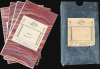
Very good. Lower left sheet is more toned than the others. Dissected and laid down on linen with Sifton Praed stamps. Linen backing is stable on all maps. Folds into original slipcase labeled Afghanistan.
References
Filippi, F. de (Lowe-Porter, H., trans.), The Italian Expedition to the Himalaya, Karakoram, and Eastern Turkestan (1913 - 1914), (London: Edward Arnold and Co.) 1933. De Filippi, F., 'Dr. F. De Filippi's Asiatic Expedition. Fourth Report', The Geographical Journal, vol. 45, no. 3 (March 1915), pp. 228 - 230. 'Himalaya, Karakoram, and Eastern Turkistan (1913 - 1914)', review of Filippo De Filippi's expedition account, The Himalayan Journal, vol. 5 (1933). K. M., 'Henry Wood', in 'In Memoriam', The Himalayan Journal, vol. 12 (1940). Surdich, Francesco, 'De Filippi, Filippo', Dizionario Biografico degli Italiani, vol. 33 (1987).