
1966 Civic Education Service Map (and Packet) of Laos, Second Indochina War


This item has been sold.
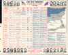
Laos Headline-Focus Wall Map 5.
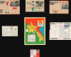
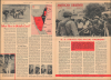
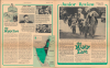
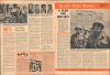
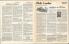
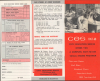
Full Civic Education Educational Packet, including maps and articles.
Full Civic Education Educational Packet, including maps and articles.
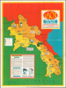
This is a rare 1966 Civic Education Service pictorial wall map of Laos during the Vietnam War (Second Indochina War). This example is not just the map, but the full educational packet, with supplementary maps and news articles - the first such example we've come across. Produced just prior to the point where U.S. troop levels in Vietnam peaked, it reflects an effort to educate the American public about the country's involvement in a region with which few were familiar.A Closer Look
The map depicts the region from Thailand and Burma to the Gulf of Tonkin and from China to Cambodia and South Vietnam. Strikingly colored, Laos, shaded yellow, occupies the map's center. The bright yellow indicates which portions of the country were controlled by non-communist forces, per the legend along the left side. The shaded portion of Laos is the part of the country under the control of Communist forces (Pathet Lao), or the 'area of Laos held by Reds' as the legend states. Vignettes accompany captions concerning life in Laos, such as the nation's most important export (lumber), a Laotian mountain village, and some of the traditional dress of the tribal Meo people. Vientiane, the capital of Laos, and Luang Prabang, the location of the Laotian Royal Palace, are both labeled, as are several other towns and villages.The Laotian Civil War and the Vietnam War
This map was created at the height of the Laotian Civil War, which raged from 1959 - 1975, and was fought between the Communist Pathet Lao and the Royal Lao Government. The Laotian Civil War became tied to the American presence in South Vietnam and a proxy war between the Cold War powers, known collectively as the Second Indochina War (1954 - 1975). Thus, not only were the opposing Laotian forces fighting each other, but troops of North Vietnam, the U.S., Thailand, and South Vietnam were also involved. From its earliest years, the Pathet Lao was closely affiliated and dependent on the Vietnamese communists, while the Kingdom of Laos received substantial support from the U.S., including one of the largest CIA operations in its history. Most of the Ho Chi Minh Trail, a key logistical artery for the North Vietnamese to infiltrate men and supplies into South Vietnam, traversed most of the length of Laos before entering South Vietnam. Communist Pathet Lao forces emerged victorious at the end of the war in 1975, with up to 300,000 people fleeing Laos into Thailand after their takeover.Ho Chi Minh Trail
The Ho Chi Minh Trail served both the Viet Minh during the First Indochina War and the Viet Cong during the Vietnam War. Mainly a supply route, it is considered to be 'one of the great achievements of military engineering of the 20th century' by the United States National Security Agency. The Trail proved to be an incredible military accomplishment, considering that it was the site of the single most intense bombing campaign in history, with bombs dropping on average every seven minutes. More than two million tons of ordinance were dropped by the U.S. on Laos, more than the combined total dropped on Germany and Japan in World War II (1939 - 1945), in a failed effort to destroy the Communists' supply lines. Even today, millions of unexploded cluster munitions pose a serious danger to civilians in eastern Laos.Publication History and Census
This map was created and published by Civic Education Service in 1966, accompanied here by samples of other materials published by the Service. It is part of a series of 'Headline-Focus Wall Maps' published by the Service; after 1970, the publication of these wall maps was continued under Scholastic Magazines, Inc. until 1977. A second edition of the present map, titled 'Laos: Land of a Million Elephants,' was published in 1969, which includes fewer illustrations but more text and images. Neither edition is recorded in institutional collections, and they are scarce on the private market.Cartographer
The Civic Education Service (fl. c. 1939 - 1945, 1963 - 1972) was a publishing firm based in Washington, D.C. that produced maps and other visual material for academic purposes. Our research has led us to believe that an organization known as the Civic Education Service existed from c. 1939 - c. 1945 (during World War II) and from c. 1963 - c. 1972. We have been unable to determine if this is the same organization that was closed for almost twenty years, or if the organization that published maps and other educational materials in the 1960s and 1970s was unrelated to the Civic Education Service that published books, maps, and other materials during World War II. Further Details...
Condition
Map is in excellent condition with only light wear along original fold lines. Other documents vary from excellent to very good.