
1877 Van Alst Plat Map of Long Island City, Queens

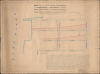

Map showing the amended grades of Fifth and Sixth Streets, west of Vernon Avenue...
LIRR hub between Queens, Manhattan, and Brooklyn.
- Digital Map Information
- Suitable for large format printing
- Full resolution TIFF file
- ICC color profile embedded
- Delivered instantly via download link
LIRR hub between Queens, Manhattan, and Brooklyn.
This is a unique 1877 map of Hunters Point in Long Island City, Queens, prepared by surveyor and local grandee Peter G. Van Alst. Dedicated to regrading streets in the area to facilitate traffic, the map was prepared as Hunters Point transformed into a small urban center in its own right, having become the major Long Island Railroad (LIRR) hub in the preceding years.A Closer Look
This map adopts an interesting method to present both the two-dimensional street grid, as in a typical city plan, as well as the three-dimensional vertical grade of the streets in question. It was prepared by a special commission (which included Van Alst) created by an act passed by Long Island City with the goal of regrading Fifth and Sixth Streets and amending intersecting and adjoining streets (namely, West Avenue) to reduce their grades. Both streets gained considerable elevation, as much as 18.25 feet, between the waterfront and Vernon Avenue. These changes would have been important in improving the flow of traffic in the area, which had become increasingly busy in the preceding 15 years as it developed into the main rail-ferry link between Queens and Manhattan or Brooklyn (the City of Brooklyn).This area is Hunters Point, the toponymic origin of which has nothing to do with hunting animals but is derived from a British sea captain named George Hunter, who purchased the property in 1817 but later died at sea, the property then passing to his wife, Ann. It was then sold to Union College (based in Schenectady), which subdivided the land and sold it to real estate developers. It is the southwestern-most corner of Queens, a major transit hub traversed today by the Queens-Midtown Tunnel, the Long Island Railroad, and the IRT Flushing Line (7 Train) of the New York City Subway.
The street names in the area have largely changed from those seen here. However, the grid layout is identical, except for the waterfront, where landfill has extended into the East River. The most recognizable is Vernon Avenue, now Vernon Boulevard. West Avenue is today's 5th Street, and Front Street at the bottom is now 2nd Street. On the old street grid, streets running east-west were numbered from 1 starting at the Newtown Creek dividing Kings and Queens Counties and progressing northwards, but the new street names (adopted in the early 20th century) ran in the opposite direction, thus Fourth Street here is now 50th Avenue, Fifth Street is now 49th Avenue, Sixth Street is now 48th Avenue, and so on.
Historical Context
Around the time this map was prepared, Hunters Point, like other waterfront communities on Long Island, was in the process of rapid industrialization and urbanization. The major catalyst in the case of Hunters Point was the 1861 arrival of the Long Island Rail Road (LIRR) terminal, which relocated from Brooklyn to the Hunters Point waterfront, just to the south of the area seen here. This move made the neighborhood the primary transfer point for commuters and freight traveling between Queens and Manhattan via the 34th Street ferry. When Long Island City, including Hunters Point, was incorporated in 1870, the area had already been heavily industrialized, being ideally situated at the confluence of the East River and Newtown Creek. Meanwhile, the resulting influx of commuter traffic spurred the rapid construction of row houses in the 1870s, many of which still stand today in the Hunters Point Historic District, to house professionals and merchants. In other words, the area presented here was some of the most desirable real estate on Long Island, making the improvement of roads there a top priority for the newly incorporated Long Island City. This land had, in fact, been part of the Van Alst farm, belonging to the family of the very man who made this map, who was born at the family homestead to the north of the area seen here, in Dutch Kills.Publication History and Census
This map was prepared by Peter G. Van Alst, both a member of the commission and a trained surveyor, on May 28, 1877. It includes some pencil manuscript annotations, including one below the title stating 'referred to on page 31,' suggesting it accompanied a report or longer document prepared by the regrading commission. This is the only known example of the map, and one of only a handful of surviving maps prepared by Van Alst, the others belonging to the collections of the Queens Public Library, the New York Historical Society, and the New York Public Library.Cartographer
Peter G. Van Alst (May 28, 1828 - October 15, 1900) was a surveyor, civil engineer, and politician who played an important role in the development of Queens on Long Island in the late 19th century. Van Alst was born in Dutch Kills to a prominent, long-established Dutch 'Knickerbocker' family. He studied at the District School and the Astoria Institute and from 1845 apprenticed as a surveyor under H.F. Betts in Williamsburg. When Betts died in 1853, Van Alst bought his shop and equipment, operating them in partnership with J.V. Mesrole for two years before Mersole left and Van Alst established the firm in his own name. He quickly became the leading surveyor active in the rapidly-growing western part of Queens County. In 1873, Van Alst produced the first cadastral map of Long Island City, incorporated in 1870 and including the towns and settlements of Dutch Kills, Hunters Point, Astoria, Steinway, Sunnyside, and several others (previously part of Newtown, later Elmhurst). He likewise prepared foundational maps of various neighborhoods (wards), schematics for the grading and layout of roads, and plans for utilities (especially sewer lines). Due to his expertise, Van Alst was appointed several times as a city commissioner to oversee contracts related to public works. By the end of his career, Van Alst had played a major role in transforming western Queens from a collection of small villages surrounded by farmland into the sprawling urban landscape that it remains today. A K-12 public magnet school (P.S. 171) and a playground in Astoria are named for Van Alst, as was an avenue (now 21st St.) and eponymous subway station (still officially 21st Street–Van Alst) on the IND Crosstown Line (G Train). Further Details...
Condition
Good. Attractive edge wear. Overall toning. Laid down on original linen. Some manuscript annotations.