
1927 F.M.S. Surveys Folding Wall Land Map of British Malaya

This item has been sold.
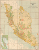
Malaya 1927 Showing Alienated Land.
Height of British Colonialism Land co-optation in Malaya.
- Digital Map Information
- Suitable for large format printing
- File Size: 134.17 MB
- File Type: ZIP / TIFF
- ICC color profile embedded
- Delivered instantly via download link
Height of British Colonialism Land co-optation in Malaya.
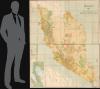
This is a rare and important large format (72 x 56.25 in) 1927 F.M.S. Survey folding wall map of the Malay Peninsula, including Singapore and the Straits Settlements. Among other features, it provides a comprehensive view of land usage (or in this case, 'Alienation' of the lands from Malay populations into British company ownership) across the Malay Peninsula at the height of the colonial era.A Closer Look
The map covers the entirety of the Federated States of Malaya, the Straits Settlements, and the unfederated Malay states (protectorates) of Johor, Kedah, Kelantan, Perlis, and Terengganu. The region's road (including tracks and paths) and rail networks (including proposed railways), as well as waterways, are traced in detail. Cities, towns, and villages are indicated throughout, while details on ocean depth, buoys, lighthouses, and other features are provided for the coasts of the peninsula. However, the greatest attention is paid to 'land alienation,' usually meaning the transfer of property rights but here used to refer to land use more generally, with color shading indicating agricultural use, mining, forest reserves, concessions, and 'other.' Legends appear at the bottom-left, including a list of abbreviations, while a pastedown covers a slightly wider area than the main map and indicates elevation.Handwritten annotations in pencil and ink also note several locations, including estates, mostly in the vicinity of Penang. These estates belonged to enterprising and often colorful British plantation owners, and their names and histories are often retained in local place names and lore today, as with the purportedly haunted '99-Door Mansion' of the Byram-Caledonia Estate near Penang.
Historical Context
In both its printed distinctions and handwritten annotations, this map provides a detailed view of land use in colonial Southeast Asia. At this time, the Malay Peninsula was notable for its major role in the global rubber and tin industries and was also a major producer of palm oil. In the early 20th century, the Federated Malay States, particularly Perak and Selangor, became the world's leading producers of tin, transitioning from labor-intensive Chinese open-cast mining to highly capitalized British-owned steam-dredging operations. Simultaneously, the landscape of the Malay Peninsula was transformed by the rubber boom. Spurred by the rapid growth of the global automobile industry, vast tracts of jungle were cleared for plantations, making Malaya responsible for over half of the world's rubber supply by the early 1920s. From the late 1910s, the British colonial administration encouraged the production of palm oil to hedge against the volatile price fluctuations of rubber, laying the groundwork for what would eventually become a dominant global industry.The Straits Settlements (Singapore, Penang, and Malacca) acted as the vital commercial and financial hubs for this activity, providing the shipping, insurance, and smelting facilities necessary to export these raw materials to global markets. This period of intense economic growth relied heavily on a migrant labor system, drawing hundreds of thousands of workers from South India and China, which fundamentally reshaped the region's demographic and social fabric.
Publication History and Census
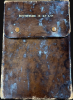
This map was prepared by the Topographical Survey of the Federated Malay States and the Straits Settlements. The map bears the stamp of Edward Stanford, Ltd., suggesting it was sold by them, and folds into a case bearing a stamp advertising the firm Boustead and Company, which was an important trading and finance firm in the development of Singapore as a major port in the 19th and early 20th centuries. Towards the end of the 19th century, Boustead and Company became major players in the rubber and tin industries, shipping from Malaya to Singapore and from thence to global markets, as well as major importers of oil to Malaya, handling the local business of the Shell Transport and Trading Company. Founded by Edward Boustead (1800 - 1888) in 1828, the firm still operates.In 1926 and 1927, the survey released the first editions of several variations of updated large-format maps of the Malay Peninsula. These not only provided new information but also utilized better printing technology to display vivid color to highlight information and depict topographic detail. The map is very rare; we have only been able to locate one example of the present edition, held by the Staatsbibliothek zu Berlin, and two examples of the 1931 edition, held at the Universiti Tunku Abdul Rahman and the United Nations Library and Archives in Geneva.
Cartographer
Federated Malay States Survey (1922 - 1945), better known as the F.M.S. Survey Department, was established in the early 20th century to produce detailed surveys of British Malaya and the Straits Settlements. The survey department had offices in most major Malayan ports, including Singapore, Kuala Lumpur, Penang (Georgetown), and Malacca. They were the first official survey organization to publish detailed scientifically produced maps of the region. Further Details...
Condition
Very good. Dissected and mounted on linen. Some show through of adhesive where covers are attached. Pastedown and some handwritten annotations.
References
OCLC 1226405158.