
1841 Moresby / Depot de la Marine Chart of the Maldives

This item has been sold.
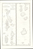
Carte des Iles Maldives. No. 942.
Earliest obtainable modern chart of the Maldives.
- Digital Map Information
- Suitable for large format printing
- File Size: 28.83 MB
- File Type: ZIP / TIFF
- ICC color profile embedded
- Delivered instantly via download link
Earliest obtainable modern chart of the Maldives.
This is a rare large-format 1841 French Dépôt-général de la Marine nautical chart of the Maldives Islands in the Indian Ocean. Based on a now-unobtainable 1838 British chart by Robert Moresby, the first modern hydrographic survey of the islands, this is the earliest obtainable specific modern chart of the Maldives.A Closer Look
The sheet is divided into two vertical columns, the one on the left covering the northern part of the archipelago, including Malé, the historic political and population center of the islands, while the right-side column covers the southern half of the archipelago down to the Addu or Seenu Atoll. Soundings, hazards, and shoals are recorded throughout and along the coasts of the atolls. Notes on tides (marées), the location of good water, the names of indigenous peoples, the effects of currents and effects of the monsoon, and additional navigational aids, such as 'dry reef' (récif à sec) and 'lightly colored clay (argile legerement coloré), are included. A table to the left of the title provides conversion between feet, meters, and brasses.Historical Context
Much of French imperial history in the 19th century was the result of competition with and a sense of inferiority vis-à-vis the British. France held several overseas territories but lacked anything on the order of the wealth and prestige the British gained from their effective control of India. These concerns led the French to consider establishing their own string of colonies in the Indian Ocean, eventually extending to the East Indies and China. In fact, this desire was in theory only solidifying earlier French claims: in addition to Réunion, which was and has remained part of France, the French also laid claim to Seychelles, Mauritius, and the Chagos Archipelago in the 18th century as part of a larger Isle de France colony, but these territories were seized by Britain in the course of the Napoleonic Wars (1803 - 1815) (Réunion was occupied but returned to France at the end of the conflict).Seeking to recover some of their lost prestige and power, in 1840, France gained a protectorate over the island of Nosy Be and part of the mainland of Madagascar where troops were stationed in the following year. In 1841, the territory of Mayotte was purchased from the King of Boina, Madagascar, and has been part of France to this day. These moves were a prelude to more aggressive actions later in the 19th century, including a protectorate over all of Madagascar in 1882 and then its complete colonization in 1897, as well as claiming several atolls around Madagascar for France (the 'Scattered Islands' of Îles Éparses).
The Anglo-French rivalry in the Indian Ocean was a strange one, however, part of a long period of tense friendship sometimes called the 'Entente Cordiale'. The leading voice for colonial expansion in France at the time, Foreign Minister (and at times Prime Minister) François Guizot (1787 - 1874), was Anglophone and an Anglophile by instinct (he translated Gibbon's The History of the Decline and Fall of the Roman Empire into French), who saw Britain as a partner rather than an enemy. Aside from a desire to keep the peace (the Napoleonic Wars still fresh in their minds), the two countries worked together in this era to expand commercial exchanges and suppress the slave trade (though not slavery itself). They even cooperated on some military actions, including a joint blockage of the Rio de la Plata. Even after Guizot's tenure, the French were loath to challenge the British directly, knowing they would be at a significant disadvantage in any naval confrontation. As in Asia more broadly, the French settled into a secondary role in the Indian Ocean, with Réunion and Madagascar as strongholds, jealously watching the ever-expanding writ of Great Britian.
Unlike some of the other key strategic archipelagos in the Indian Ocean, such as the Chagos Archipelago, the Maldives were never under French rule in the 18th century. Instead, they had been under Portuguese and then Dutch control until the British seized them in 1796. The British established a loose protectorate over the islands from their base in Ceylon (Sri Lanka). This protectorate status was formalized and strengthened in the late 19th century, but as long as trade continued uninterrupted and British hegemony was recognized, day-to-day affairs were handled by an indigenous sultanate. Nevertheless, from a French perspective, given the Maldives obvious importance for navigation, a thorough understanding of the atolls and their waters was critical for travel to India, Southeast Asia, and China, even if the prospects for French control of the islands were dim.
Publication History and Census
This chart is based on the 1835 British surveys of Robert Moresby and his assistant Frederick Thomas Powell, printed in 1838 and 1839 by John and Charles Walker in London ('Trigonometrical Survey of the Maldive Islands'), now virtually unobtainable. Moresby and Powell's chart significantly improved upon earlier, preliminary surveys by Horsburgh and others (see Maldives-horsburgh-1814, previously sold by us) and helped facilitate the British domination of the Indian Ocean. Moresby earlier surveyed the Red Sea and therefore did much to make the 'short route to India' via the Suez Canal the maritime superhighway of the British Empire.The present map is the earliest obtainable modern hydrological survey specifically of the Maldives. It is unrecorded in institutional collections (an OCLC listing exists for this chart - OCLC 556508854 - but no institutions are listed as holding it) and very scarce to the market. This map should not be confused with the much more rudimentary mid-18th-century map by Bellin with the same title that appeared in Prévost's Histoire Générale des Voyages (previously sold by us, IslesMaldives-bellin-1750).
Cartographers
Dépôt des Cartes et Plans de la Marine (fl. 1720 - present), often called the Dépôt Général de la Marine, was a French hydrographic mapping organization founded in 1720 under Charles-Hercule of Albert de Luynes (1674 - 1734). Much like the U.S. Coast Survey, the British Admiralty, and the Spanish Deposito Hydrografico, the Dépôt was initiated as a storehouse and distribution center of existing nautical and marine charts. Eventually the Dépôt initiated its own mapping activities in an attempt to improve and expand upon existing material. Some of the more prominent cartographers and hydrographers associated with the of Dépôt Générale des Cartes were, Philippe Buache, Jacques-Nicholas Bellin, Giovanni Rizzi-Zannoni, Rigobert Bonne, and Jean Nicolas Buache. Further Details...
Robert Moresby (June 15, 1794 - June 15, 1854) was British Royal Navy and Indian Navy officer and hydrographer. Moresby is most famous for his 1829 - 1833 trigonometrical hydrographic survey of the Red Sea, a seminal work that opened the sea to steam navigation and for which Richard Burton called him 'the Genius of the Red Sea'. Afterwards, from 1834 to 1836 he completed the first complete hydrographic survey of the Maldives - an exceptionally complex region to survey due to its size and the sheer number of coral atolls. He then surveyed the Chagos Archipelago, and the vast submerged reef southeast of the Seychelles. His survey work under often extreme heat conditions, proved hard on his health and by 1839 forced him to give up hydrographic work altogether. After several years of recuperation in India, he returned to the sea in 1842 as captain of the luxurious 'Peninsular and Oriental' steamer, HMS Hindostan. In addition to his survey work, Moresby was also an excellent landscape painter whose artwork record scenes from his many voyages. Further Details...
Chassant (fl. c. 1830 - 1860) was a French line and chart engraver active in Paris in the middle part of the 19th century. Chassant was active with the French Dépôt de Marine from the 1830s into the 1860s. He was a master engraver and, some have argued, his dramatic hachuring work to illustrate topography suggests he may have been wasted on nautical charts. Most of his engraving was completed in partnerships with Jacques-Marie Hacq (September 22, 1785 – 18??). Chassant did not sign any of his engravings with a first name or other identifier, so it is difficult to track him down. He may be Alphonse Antoine Louis Chassant (August 1, 1808 - September 7, 1907), who in later life was an art historian and librarian of the city of Évreux. He wrote several books, including works on engraving. We cannot alas verify the connection and it may be pure guesswork. Further Details...
Jacques-Marie Hacq (September 22, 1785 – 18??) was a French letter and line engraver, and historian, active in Paris during the middle part of the 19th century. Hacq was born in Paris and trained under J. P. Besançon, who he succeeded at the Dépôt de la Guerre in 1830. He engraved for the Dépôt de la Guerre as early as 1830 and for the Dépôt des Cartes et Plans de la Marine from, at least, 1840 to 1852. In addition to his work for the French Government, he also completed maps and engravings for Lesage, Lapie, Dufour, Duperrez, Gouvion St. Cyr, and Dumont d'Urville. His historical works include a history of the Napoleonic Wars and a history of Paris under the reign of Louis XIII. During most of his career in Paris he lived at 58 Rue de la Harpe. Further Details...
Condition
Very good. Light spot (about 1 in in diameter) of discoloration, center left.