
1885 Roberto Arménio Military Maps of Uruguay and the Uruguay River

This item has been sold.
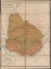
Mapa Militar de la República O. del Uruguay. 1885 [Maps 1 and 5 of 7]
Maps for the use by the Uruguan military.
- Digital Map Information
- Suitable for large format printing
- Full resolution TIFF file
- ICC color profile embedded
- Delivered instantly via download link
Maps for the use by the Uruguan military.
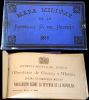
These are Roberto Arménio's rare maps focusing on Uruguay's frontiers with Brazil and Argentina: one showing the administrative regions of the Uruguayan Army overall, and the other detailing Uruguay's fortifications along the Uruguay River (which forms the Uruguayan border with Argentina). These were produced in 1885 for the use of officers of the Uruguayan Army and Navy, and appeared in Arménio's pamphlet, Mapa Militar de la República Oriental del Uruguay, which outlined ambitious plans to reform and modernize Uruguay's military. The two maps are offered in conjunction with the pamphlet.A Closer Look
The main 'Mapa Militar,' mounted on linen for folding, presents the whole of contemporary Uruguay, divided into Arménio's proposed three major administrative regions of the Army: the Cuerpo de Ejercito del Sud y Este (commanding the southern coastal region), the Cuerpo de Ejercito del Centro (governing the interior of the country and Uruguay's southern border with Brazil), and the Cuerpo de Ejercito del Norte y Oeste (essentially all of Uruguay north of the Rio Negro, facing the upper Uruguay River and the long interior border with Brazil).Through the legend, the map highlights fortified encampments, observation posts, and other fortifications. Some of these were of the most modern sort: the map notes Grusson emplacements, which were pre-fabricated, armored, and rail-mobile field emplacements manufactured in Germany beginning in the 1870s. The map also notes roads, postal routes, and railroads (constructed and projected).
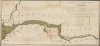
The second map - numbered 'five' among the pamphlet's maps - is a west-oriented map of the lower Rio Uruguay. As with the main map, it details the placement of fortifications (both encampments and earthworks) and rotating emplacements (both fixed platforms and the mobile Grusson emplacements).
Roberto Arménio and Uruguayan Military Reforms
This map and the publication it accompanied were the work of Roberto Arménio, an Italian military engineer who, beginning in 1882, served in Uruguay's newly developed Military Engineering Office. He became a technical advisor to President Máximo Santos and was instrumental in Santos' program of military reform. This was not an isolated phenomenon. Europe was already in the throes of modernization after the sharp lessons of the Franco-Prussian War (which Arménio had witnessed), and the European influence was felt in Uruguay. The militaries of the former Spanish Empire were dominated by militias governed by Spanish colonial regulations. But with the advent of railways, the telegraph, and modern armaments, warfare became sufficiently specialized that it required a professional military with formal training. In addition, such training differentiated the state's professional Army from militias belonging to opposition parties in the interior. Thus, military reforms strengthened the Uruguayan state against foreign and domestic threats. Arménio was instrumental in promulgating Uruguay's new (first) military code. He was also part of the project of setting up military institutes and academies, as well as quasi-civil institutions such as the Escuela Nacional de Artes y Oficios. The students of this school, administered directly by the Ministry of War, were detainees of the police or military; these compulsory students were taught to read and were educated in a trade during their detention. Printing was prominent among these trades. The school published an array of works, including official government statistical publications and several maps. While the Escuela is named neither on this map nor in examples of the pamphlet it accompanied, the style and execution of the lettering on this map is very consistent with other maps published by the Escuela at the same time.Publication History and Census
These maps were printed in 1885 and were included in Roberto Arménio's Mapa Militar de la República O. del Uruguay, 1885. While the accompanying text appears in several institutional collections, we see the set of maps only in the Biblioteca Nacional de Uruguay. We do not see separate examples of either of these maps in OCLC.Cartographers
Roberto Arménio (1836 - December 25, 1900) was Neapolitan civil and military engineer. Born to Neapolitan nobility, he entered the cadet school of the Bourbon Army, graduating as an officer. He studied military engineering and joined the army's engineer corps. He was an aide to Garibaldi during the Italian wars of Unification and served with him during the Franco-Prussian War. He continued an engineering career, both for the military of Brazil and also in the civil realm in Lisbon, where he pioneered the famous Santa Justa Lift. From 1882 to 1888, he resettled in Uruguay, serving in the newly developed Military Engineering Office for the Uruguayan Army and becoming a technical advisor to President Máximo Santos. Among his other projects, he reorganized the Escuela Nacional de Artes y Oficios, and instituted an array of military reforms. Under his direction, a number of important maps and plans were created, focusing especially on hydrographic and military maps of Uruguay's frontiers, maps of Uruguay's railways, and maps of the country's rivers. He also proposed - but never executed - a canalization of the Rio Negro. In the 1890s, he continued to advise the Uruguayan chief of staff, but was not paid for these efforts. His labors were not profitable, and he died in poverty in his adopted country. Further Details...
La Escuela de Artes Y Oficios (1878 - 1887) was a school developed in Montevideo, Uruguay, as part of that country's modernization process, both as an instrument of education and of social control. It was founded on December 31, 1878, during the presidency of Lorenzo Latorre. At that time it was located within a military compound and was administered directly by the Ministry of War: its students were young people detained by the police or the army. These were taught to read, and instructed in a trade during their detention. Printing - both letterpress and lithography - appear to have numbered among these trades: the school published an array of works during its existence, ranging from books of poetry to official statistical government publications. They published at least one map: Mapa de la republica oriental del Uruguay, whose cartographer is not credited. Its publication through a military office would classify it as an official document. The Escuela remained an office of the military until 1887, at which point it was passed to the Ministry of Justice, Worship and Public Instruction, and its name changed to Escuela Nacional de Artes y Oficios, under the administration of Roberto Arménio. The institution survived several changes of name, and is known now as Univesidad del Trabajo del Uruguay. Further Details...
Source
Arménio, Roberto, Mapa Militar de la República O. del Uruguay, (Montevideo: La Escuela de Artes Y Oficios) 1885.
Condition
Good. Mended splits in linen on main map, some wear at corners and near folds. Few mends to secondary map with no loss. Pamphlet in good condition overall.