
1710 Rokashi Hotan First Japanese Buddhist Map of the World

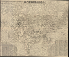
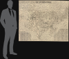
南瞻部洲萬國掌菓之圖 / Nansen bushū bankoku shōka no zu / [Map of the Countries in Jambudvipa].
First Buddhist map of the world.
- Digital Map Information
- Suitable for large format printing
- File Size: 187.54 MB
- File Type: ZIP / TIFF
- ICC color profile embedded
- Delivered instantly via download link
First Buddhist map of the world.
This is the seminal 1710 (Hoei 7) woodblock Buddhist world map composed by the monk Rokashi Hotan. It is the first Japanese printed map to depict the world, including Europe and America, from a Buddhist cosmographical perspective. Inspired by the 1653 publication of Si-yu-ki (or Xiyuji 西域記), a pilgrimage narrative of the Chinese monk Hsuang-Tsang's (or Xuanzang 玄奘, 602 - 604 CE) travels to India in search of sacred Sanskrit writings, it attempts to reconcile Buddhist and Western cartography.A Closer Look
This map makes a lot more sense when one understands that Rokashi Hotan scaled it not by distance but rather by religious importance. India, the birthplace of the Buddha, is the central locale in the Jambu-Dvipa conception and on this map. Other countries, including China, Japan itself, and even more so the distant continents of Africa, Europe, and the Americas, Rokashi Hotan considered 'but mote-like countries in the Jambu-Dvipa' and 'as small as a millet-grain.'Despute the Buddhist focus, Hotan's map attempts to update Buddhist mythological cartography, as exemplified in the 1634 manuscript map Gotenjikunozu (Map of the Five Regions of India, 五天竺之図), to correspond with the Si-yu-ki, as well as with contemporary and ancient religious texts, Chinese annals, travel narratives, and even some European maps. Rokashi Hotan lists these texts, 102 in all, at the top of the map. The consequent product of Rokashi Hotan's work is this magnificent amalgam of disparate ideas and traditions.
Manasarovar
In essence, this is a traditional Buddhist worldview in the Gotenjikunozu mold centered on the world-spanning continent of Jambu-Dvipa. At its center is Lake Anavatapta, a whirlpool-like quadruple helix lake believed to be the center of the universe. This lake, which is commonly associated with Lake Manasarovar in northern India, is believed in Buddhist mythology to be the legendary site where Queen Maya conceived the Buddha. From the quadruple beast-headed helix (the heads of a horse, a lion, an elephant, and an ox) of Manasarovar, or Lake Anavatapta, radiate the four sacred rivers: the Indus, the Ganges, the Brahmaputra, and the Sutlej.Japan, China, and Korea
South of Jambu-Dvipa, India is recognizable for its peninsular form. Japan itself appears as a series of islands in the upper right and, like India, is one of the few recognizable elements - at least from a cartographic perspective. China and Korea appear to the west of Japan and are vaguely identifiable geographically, which itself represents a significant advancement over the Gotenjikunozu map. Nevertheless, the various rivers, major cities, provinces (道 of Korea), prefectures (府 of China), islands and mountains of China and Korea are noted in detail, with the Joseon capital of Hanseong / Hanyang simply called 'Joseon' (朝鮮). Meanwhile, the contemporary Qing capital of Beijing is labelled with two names, Shuntian (順天) in larger text and Beijing (北京) in smaller text, perhaps a reflection of the common disregard and even contempt in Japan for China's still somewhat-recent Manchu overlords. Southeast Asia makes an appearance as an island cluster to the east of India, with some names identifiable (羯茶國 for Keda, 末羅遊 for Melayu) while others are fantastical (長人國 'Land of the Giants') or unclear.Europe and Africa
On the opposite side of the map a series of islands is intended to represent Europe (エウロバ, using kana instead of kanji), which had no place at all in earlier Buddhist world maps, making this one of the first Japanese maps to depict Europe. Umukari (Hungary), Oranda, Baratan, and Komo (three names for Holland, the last meaning 'red hair,' a common term for the Dutch at the time), Arubaniya (Albania?), Itarya (Italy), Suransa (France), and Inkeresu (England) are all named. Africa appears as a small island in the Western Sea identified as the 'Land of Western Women' (西女國). In both Europe and Africa, the fringes of the continent are also populated by giants, dwarves, and 'longhairs' (長毛國).America
Of special note is Rokashi Hotan's mapping of the Americas at right. Prior to this map, America had rarely, if ever, been depicted on Japanese maps, so Rokashi Hotan turned to the Chinese map Daimin Kyuhen Zu (Map of China under the Ming Dynasty and its surrounding Countries), from which he copied both the small island-like form of South America (just south of Japan), and the curious land bridge (the Aleutian Islands?) connecting Asia to what the Japanese historians Nobuo Muroga and Kazutaka Unno conclude 'must undoubtedly be a reflection of North America' (page 63). The land bridge suggests that the mapmaker had some access to European cartography, as it closely resembles Nicholaas Witsen's cartography of 1687 (such access would be unsurprising considering the Dutch presence in Nagasaki). The small number of placenames provided also lend credence to this interpretation, particularly Moso-koku (抹桑國), which could easily be a reference to Mexico.A Buddhist Map
While this map represents a significant step forward in the Japanese attempt to combine religious and contemporary geographic knowledge, it remains, in essence, a Buddhist map. It is likely that Rokashi Hotan was aware of imported European-style maps circulating in China at the time. The Mateo Ricci Map ('Kunyu Wanguo Quantu') is one such example, and copies of it were known to have reached Japan in the early 17th century. Curiously, Rokashi Hotan chose to ignore it and other Eurocentric data in exchange for a religious worldview, while at the same time attempting to reconcile Buddhist and Western geography.Rokashi Hotan's map became the model on which all future Japanese Buddhist world maps were drawn well into the 19th century. The confused cosmological view upon which his map is based, referencing at once religious, secular, and non-Buddhist teachings, foreshadowed the growing religio-secular conflict that would emerge in Japan during the coming centuries. Ultimately, this is one of the most important, beautiful, and influential printed maps that have ever emerged in Japan.
Publication History and Census
Two identical versions of this woodblock map appeared in 1710, both noted as having been drawn by Zuda Rokashi (頭陀浪華子, also often translated as Zuda Naniwashi, that is, Hōtan 鳳譚). The more common was published by Nagata Chōbē (永田調兵衞), while the present example is a less common printing by the bookseller Bundaiken Uhei (文臺軒宇平). A strong, crisp image suggests that this is one of the first examples Bundaiken Uhei printed, as wooden plates tend to wear quickly, and many other examples show signs that the woodblock was more heavily worn. Due to inconsistent cataloging (especially traditional characters versus Japanese simplified Shinjitai versus Romaji), a full census of this map is difficult to establish. It appears to be well-distributed among Japanese research libraries and institutions, while outside of Japan it is held by the National Museum of Taiwan History, the Hong Kong University of Science and Technology, and perhaps twelve institutions in North America.Cartographers
Zuda Rokashi Hotan (1654-1728) was a prominent Buddhist scholar-priest active in Japan during the late 17th and early 19th centuries. Zuda Rokashi, or Hotan his religious name, is the founder of Kyoto's Kegonji Temple. Rokashi Hotan is best known in cartographic circles for his composition of the important Buddhist world map, Nansunbushu Bankoku Shoka no Zu (Outline Map of All Countries of the Universe). This map, which attempted to reconcile traditional Buddhist cosmography with modern scientific cartography and European cartographic innovations is one of the most important maps ever printed in Japan. Its composition and wide popularity influence Japanese Buddhist cartography well into the 19th century. Further Details...
Bundaiken Uhei (fl. 1680 - 1720) was Japanese bookseller and publisher active in Kyoto during the early part of the 18th century. His is best known for his publication of Rokashi Hotan's important Buddhist world map, Nansunbushu Bankoku Shoka no Zu (Outline Map of All Countries of the Universe). This map, which attempted to reconcile traditional Buddhist cosmography with modern scientific cartography and European cartographic innovations is one of the most important maps ever printed in Japan. Its composition and wide popularity influence Japanese Buddhist cartography well into the 19th century. Further Details...
Condition
Excellent. Original wrappers.
References
Cortazzi, H., Isles of Gold: Antique Maps of Japan, p.38 and plate 48. Unno, K., Cartography in Japan, pp. 346-477. Yamashita Kzaumasa, Japanese Maps of the Edo Period, p.33. Nobuo Muroga, Kazutaka Unno, 'The Buddhist World Map in Japan and Its Contact with European Maps', Imago Mundi, Vol. 16 (1962), pp. 49-69. Ramming, M., 'The Evolution of Cartography in Japan', Imago Mundi, Vol. 2 (1937), pp. 17-21. National Library of Australia, MAP RM 3882. University of British Columbia, G3201.S2 1710 H6, G3201.S2 1710 H6a. Christie's, Natural History, Plate Books and Cartography, June 7, 2006, sale 7225, lot 94. Bean, G. H., A List of Japanese Maps of the Tokugawa Era, Jenkintown 1951, 1710.1. Ramming, M., 'Remarks on the Reproduced Japanese Maps', Imago Mundi, Vol. 10 (1953), p. 128. Harley, J.B. and Woodward, D., The History of Cartography, vol. 2, p. 427-429, fig. 11.59. Rumsey 5763.001. OCLC 67171547.