
1933 Fairchild Aerial View of New York City

This item has been sold.
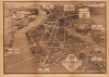
Aerial View of New York City, Main Automobile Roads / Nostrands Map of New York House Numbers Subway Guide / Visitors Map and Hotel Directory of New York.
Fairchild aerial photography promoting Robert Moses's ambitious highway infrastructure.
- Digital Map Information
- Suitable for large format printing
- Full resolution TIFF file
- ICC color profile embedded
- Delivered instantly via download link
Fairchild aerial photography promoting Robert Moses's ambitious highway infrastructure.
This is a c. 1933 view of New York City, taken by aerial photography pioneer Sherman Fairchild, used here for the Hotel Association of New York City. It presents the city during the strange decade of the 1930s, when the Great Depression (1929 - 1939) gripped the country, but also when many of the city's distinctive buildings, bridges, and tunnels were built.A Closer Look
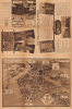
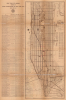
The view measures 15 x 21 inches on a sheet 31.5 x 21 inches. The aerial view (by Fairchild Aerial Surveys, Inc.) is taken from the harbor to the south of the city and looks northwards, with major connections in and out of the city indicated, including bridges, tunnels, ferries, and major roads and highways, with federal and state route numbers indicated. Above the view, promotional text and multiple photographs appear of major landmarks in the city, including the recently-built skyscrapers of Rockefeller Center, the Chrysler Building, and the Empire State Building, with the title panel displaying a view from the latter looking southwards towards downtown Manhattan and Brooklyn. A list is provided of major points of interest in different parts of the city.The verso is equally rich in information. Covering Manhattan south of 125th St. along with portions of Brooklyn and New Jersey, this map by George Nostrand notes streets, subway lines, elevated streetcar lines, bridges, tunnels, ferry lines, and piers. Prominent public buildings such as museums, train stations, government offices, and parks are also labeled. An alphanumeric grid surrounds the map, corresponding to a street index at right. At left, a list of hotels belonging to the Hotel Association of New York City appears, listing their nightly rates for various types of rooms.
Historical Context
The explosion in automobile ownership of the 1920s presented the densely populated New York City with a dilemma, given the limited road connections between Manhattan, other boroughs, and New Jersey. Remarkably, despite the financial strain of the Great Depression, multiple bridges and tunnels were completed in the 1930s which gave the city the infrastructure it still relies on today. Financing these projects was nearly impossible through traditional municipal means, as the city was broke and investors were wary of unstable municipal bonds. The solution came through the rise of Public Authorities, semi-autonomous entities like the Triborough Bridge Authority, which could bypass city debt limits by issuing their own bonds backed by future toll revenues. This model, bolstered by massive infusions of federal New Deal cash from the Public Works Administration (PWA) and Works Progress Administration (WPA), turned infrastructure into a self-funding machine that operated outside the direct control of elected officials.At the center of this whirlwind was Robert Moses, who was nominally only the Parks Commissioner for most of this period, but in reality was the 'Power Broker' whose influence over these authorities allowed him to reshape New York according to a rigid, automobile-centric vision. Moses viewed the private car as the ultimate symbol of progress and freedom, leading him to prioritize an interconnected web of parkways and bridges over the city's aging mass transit system. While his arterial system successfully linked the sprawling suburbs to the urban core, it came at a high social cost, frequently necessitating 'slum clearance' while also locking the city into a decades-long dependence on the internal combustion engine.
Publication History and Census
This view was based on an aerial photograph taken by Sherman Fairchild and copyrighted by advertiser E. B. Winslow, while the map was prepared by George Nostrand, then working for the Ohman Map Co., as a promotional piece for the Hotel Association of New York City. It is undated, but from the buildings and infrastructure present must date to 1933 or 1934; the photograph of a completed Rockefeller Center indicates a date of 1933 or later, while the lack of the Lincoln Tunnel would suggest a likely date before 1934 (when construction on the tunnel began) and certainly before 1937 (when the tunnel opened to traffic). The appearance of the Triborough Bridge may suggest a somewhat later date as it opened in 1936, but it had been under construction in some form since 1929, making it an unreliable guide for dating. Due to uncertainty over the date and title, this work looks to have been cataloged multiple times in the OCLC. Altogether, 7 institutions - Stanford University (David Rumsey Map Collection), the University of Michigan, the New York Public Library, the University of Wisconsin-Milwaukee, the University of Chicago, Michigan State University, and the University of South Carolina - catalog this piece with various titles, with proposed dates between 1930 and 1939.Cartographers
Sherman Mills Fairchild (April 7, 1896 – March 28, 1971) was an American inventor, entrepreneur, pilot, and photographer active in New York in the first half of the 20th century. He was the son of George Winthrop Fairchild, a Republican Congressman and Co-Founder of IBM. He inherited his father's vast estate in 1924, becoming IBM's largest shareholder. After studying at Harvard, the University of Arizona, and Columbia University, Fairchild invented the synchronized camera shutter and flash – a significant advancement in photography. Sherman was chronically in poor health, nonetheless, when World War I broke out he volunteered for the military. Due to his health, he was rejected by the military, so he decided to contribute to the war effort in another way. He took a contract with the U.S. Government to develop a new kind of aerial camera capable of taking sequentially timed photographs for advanced aerial terrain mapping. This invention led to the founding of the Fairchild Aerial Camera Corporation (later the Fairchild Camera and Instrument Company) in 1920. In 1921, he purchased a surplus World War I Fokker D. VII biplane and expanded with his own aerial survey company, Fairchild Aerial Surveys. His first map, the first aerial photo-survey of a major city, was of Newark, New Jersey. This was quickly followed by a large aerial survey of Manhattan, also completed in 1921. Other cities followed. Later the Fairchild Corporation developed even more advanced cameras, including the Fairchild Lunar Mapping Camera, used by NASA to take photos of the Moon from orbit. He also founded Fairchild Aviation Corporation, which built the FC-1 and FC-2 Aircraft. The firm went on to become one of the largest military and defense contractors in the world. Fairchild died in 1971, leaving behind a $200+ million dollar estate to varies charities and foundations. Further Details...
Edward Burton Winslow (1886 - 1942), known as 'Windy' was a salesman and advertiser active in the New York City publishing and printing world. Winslow was born in Saco, Maine around 1886, He studied at Thornton Academy then went on to Colby College, where he was active in the Drama Club, Glee Club, and Orchestra as well as known as a talented artist. By 1905, he was in New York, where he where in was involved in printing and advertising. From about 1912 to 1918, he worked for the marketing firm George Batten Company before moving to the sales department of the American Colortype Company, where he headed direct-mail advertising. In 1925, he joined the Art Gravure Corporation. He also worked at various points for the Winthrop Press and the printer R. L. Stillson Co. Sometime in the early 1930s, Winslow set out on his own and established a printing firm under his name. We find very little evidence of this firm in the documentary record, except that by 1942 it had relocated from New York City to Mohegan Heights in Yonkers (where Winslow had resided since at least 1915). Winslow married Gertrude Roelsch in 1911 and with her had two children. Further Details...
George J. Nostrand (fl. 1920 - 1940) was an American lithographer and publisher of maps and views, primarily of New York City. He appears to have been in the employ of the Arthur Ohman Map Co. until the firm’s closing. It is unclear when this happened exactly as some publications use Nostrand's name in the title but retain the Ohman imprint (August Ohman, founder of the Ohman Map Co., died in 1934). Thereafter, Nostrand operated from the same location under his own name as late as 1939. Further Details...
August Reinhold Ohman (May 3, 1859 - April 22, 1934) was a Swedish-American map publisher, engraver, and draftsman. Ohman arrived in the United States in 1893. He married Alice Mary Colton (1868 - 193x), Charles B. Colton's daughter, on January 5, 1897. A year later, in 1898, Ohman began working with G.W. and C.B. Colton, when the firm became known as Colton, Ohman, and Company, which existed until about 1901. After that year, Ohman operated his own firm under his own name August R. Ohman, and advertised his firm as the 'successors to the Coltons'. The Ohman Map Company, as it became known, moved to 258 Broadway around 1914, where it operated until around the time of Ohman's death. George J. Nostrand, who became a major map publisher, operated in the same building and appears to have worked for or with Ohman in some capacity, gradually taking over the company. Some of Nostrand's work is very similar to Ohman's, particularly his bird's eye view of New York City, and at least one map carries both men's names. Further Details...
Condition
Good. Thin brittle paper. Toned. A few old fold splits, stabilized with archival tissue on verso. Verso contains large map of NYC by Nostrand. Fill repair, bottom left edge of map, impacting cover graphics on recto.
References
Rumsey 8551.002. OCLC 47747968, 1052567327, 774397105, 953572583.