
1794 Laurie and Whittle Map of the Sulu Sea and the Philippine Archipelago

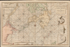

A Chart of the Passages Between the Philippine and The Isles Of Borneo And Mindanao With those to the Southward of the Sooloo Archipelago and the Isle of Mindanao.
EIC China Trade: Charting a new course.
- Digital Map Information
- Suitable for large format printing
- Full resolution TIFF file
- ICC color profile embedded
- Delivered instantly via download link
EIC China Trade: Charting a new course.
This large, rare nautical chart is Laurie and Whittle's 1794 maritime map of the southern Philippines, particularly Mindanao, Palawan, and the Sulu Sea. It presents improvements resulting from more than three decades of British East India Company voyages through these passages, and is certainly informed by, and possibly the work of, one of the EIC's most successful captains and ship owners, John Pascall Larkins.A Closer Look
This beautifully balanced and engraved chart is centered on an elegant compass rose set in the Moro Gulf south of Mindanao. It embraces Palawan in the northwest, part of the coast of Borneo to the southwest, and includes the southern parts of Panay, Negros, Cebu, Leyte, and the southernmost part of Samar. Bohol and Lazi are shown in full. The Indonesian islands of North Maluku and Morotai Island appear to the south. The Sulu Archipelago is charted in rich detail, dividing the Sulu Sea on the north from the Celebes Sea in the south.A network of rhumb lines spans the chart, and more than a dozen specific voyages are labeled, with two shipwrecks noted. Nine ships' tracks appear, dated, with pointing hands indicating the direction of travel. A multiplicity of depth soundings are recorded, along with anchorages. Prevailing currents are marked with arrows. Breakers, shallows, and other navigational threats are indicated. Many notes indicate sightings of landmarks along specific courses, including volcanoes and other such sights. Coastal profiles are included both within the body of the chart and in 7 inset diagrams.
Pearl fisheries are noted in the Sulu Archipelago. On Mindanao are noted 'The Kalagan Mountains of a stupendous height' as well as 'Gunong Salatan or the South Mountain where they get Plenty of Gold.'
Apocryphal Island of St. John
Just to the east of Mindanao, the chart includes the phantom island of St. John. A long-lived error, the island began to appear on the earliest Portuguese adaptations of manuscripts acquired from the Magellan expedition. Its first appearance in print was on Ortelius' 1570 Asiae Nova Descripto. Afterward, numerous mariners, including Dampier, claimed to have visited it. However, most were most likely mistaking it for other nearby islands or simply misunderstanding Cape St. Augustin and Davao Bay (Tagloc Bay). It was included on the present chart on the strength of a reference in a chart of the French Guillaume le Gentil (1725 - 1792), many of whose works were absorbed into the charts of Alexander Dalrymple (1737 - 1808), the British Admiralty's first Hydrographer and a strong influence on the precursors to the present work. A note points out that the authoritative 1734 Murillo Velarde map of the Philippines included no such island, and that a local chart provided to the officers of the Royal Captain in 1762 also lacked it. Carteret, whose 1767 voyage is noted on the chart, was also skeptical of the existence of St. John.An Array of East India Company Tracks
During the Seven Years' War (1756 - 1763), the French blockaded the Sunda Strait against the British; thus, East India Company ships needed to establish a different route to the Indian Ocean. In 1761, Dalrymple traveled from China to the Sulu Archipelago on the Griffin. The Griffin was lost in the archipelago on January 20, but Dalrymple nonetheless secured a trade agreement with the Sultan of Sulu. He then continued to the Makassar Strait on the Pocock (both these legs of the journey and the loss of the Griffin are shown). Dalrymple believed his convoy to be the first British vessels ever to use that route. They certainly were not the last to pass via the Makassar Strait: the chart includes the 1767 track of the Swallow commanded by Carteret (having crossed the Pacific from the Straits of Magellan), and, traveling to China via the Makassar Strait, the 1783 voyage of the EIC ship Ganges, and the 1787 journey of the Warren Hastings (under Captain Larkins). In addition to these, we see several other tracks, notably the 1762 track of the unfortunate Royal Captain (lost four anchors on its 1762 outbound voyage, only to be wrecked approaching Palawan from China in 1763).The Chartmaker
The chart, published in 1794, only bears the imprint of the publishers, Laurie and Whittle. It was accompanied in their nautical atlas by A New Chart of the Straits of Macassar, which continued the present work to the southwest, following the tracks of several of the same ships shown here as they continued towards the Makassar Strait. This, too, only bears the Laurie and Whittle imprint. The original manuscripts used to compose both of these charts, however, have survived and are cataloged by Crouch et al in The Art Of The Chart Volume 2, 2025, items 192 and 193. While the inscription on the manuscript of the present chart is illegible, the author of the Makassar Strait chart is identified as EIC captain and eventual manager John Pascall Larkins (whose own 1787 voyage commanding the Warren Hastings is noted on both charts). The content and execution of both of these manuscripts are so similar, and their theme so consistent, that we are encouraged to attribute authorship of this chart to Larkins as well - although the uniformity may come from the systematic work of Sayers and his compilers.According to Peter Geldart, Dalrymple published in 1789 An Account of the Passage of the Ship Warren Hastings by the Macclesfield Strait 1789, being Capt. John Pascal Larkin's Account of his Voyage, in the Ship Warren-Hastings, sent to Henry Browne, Esq. and Select Committee at Canton, with running dates 20 April-15 May 1788. Further, On January 30, 1786 Dalrymple published CHARTS of the SOUTHERN COASTS of the ISLANDS between St. JOHNS and the LADRONE taken on board the Nassau, Capt. Arthur Gore, and inscribed to Nathaniel Smith Esqr. by His much obliged and very obedient Servant John Paskall Larkins. So there is record of Larkins having been a source of Dalrymple prior to 1791, and there is an established pattern of Larkins producing surveys in the east that were subsequently sent back to London for compilation.
The Makassar manuscript is dated February 1791, while the Sulu Sea manuscript's dating is illegible, if it is there at all.
A clue suggests this Sulu Sea chart is earlier: the February 1791 manuscript chart contains the track of the 1771 voyage of the Snow Jason. While that track and its accompanying geography appear on both 1794 printed charts, it does not appear on the Sulu Sea manuscript, suggesting that the chartmaker might not have considered that voyage track when composing the chart. It is more plausible that the manuscript without the track was composed prior to the one including it, and that when the charts were prepared for publication, they were made consistent.
Publication History and Census
Laurie and Whittle published this chart from their offices at 53 Fleet Street, London, on May 12, 1794. It was issued independently and offered in various composite editions of the East-India Pilot, or Oriental Navigator. This is an extremely scarce chart. OCLC identifies only two separate examples, one in the University of Manchester Library and another in the Staatsbibliothek Zu Berlin. Only a handful have appeared on the market in the past 25 years.Cartographers
Laurie and Whittle (fl. 1794 - 1858) were London, England, based map and atlas publishers active in the late 18th and early 19th century. Generally considered to be the successors to the Robert Sayer firm, Laurie and Whittle was founded by Robert Laurie (c. 1755 - 1836) and James Whittle (1757-1818). Robert Laurie was a skilled mezzotint engraver and is known to have worked with Robert Sayer on numerous projects. James Whittle was a well-known London socialite and print seller whose Fleet Street shop was a popular haunt for intellectual luminaries. The partnership began taking over the general management of Sayer's firm around 1787; however, they did not alter the Sayer imprint until after Sayer's death in 1794. Apparently Laurie did most of the work in managing the firm and hence his name appeared first in the "Laurie and Whittle" imprint. Together Laurie and Whittle published numerous maps and atlases, often bringing in other important cartographers of the day, including Kitchin, Faden, Jefferys and others to update and modify their existing Sayer plates. Robert Laurie retired in 1812, leaving the day to day management of the firm to his son, Richard Holmes Laurie (1777 - 1858). Under R. H. Laurie and James Whittle, the firm renamed itself "Whittle and Laurie". Whittle himself died six years later in 1818, and thereafter the firm continued under the imprint of "R. H. Laurie". After R. H. Laurie's death the publishing house and its printing stock came under control of Alexander George Findlay, who had long been associated with Laurie and Whittle. Since, Laurie and Whittle has passed through numerous permeations, with part of the firm still extant as an English publisher of maritime or nautical charts, 'Imray, Laurie, Norie and Wilson Ltd.' The firm remains the oldest surviving chart publisher in Europe. Further Details...
John Pascall Larkins (November 15, 1756 - August, 1818) was a British East India Company captain, navigator, chartmaker, and shipowner stationed in Bengal and active in the East Indies in the latter part of the eighteenth century. The EIC was something of a family business: his father, William Larkins, was also a captain and managing owner in the company; his elder brother Thomas was a captain as well. John Pascall sailed east as early as 1768, when he was recorded as chief mate aboard the EIC ship Nassau; he was second mate aboard the same vessel between 1777 and 1780. By 1787, he was captain of the Warren Hastings, which was owned by his father and which, between 1781 and 1786, had been commanded by his brother. After his 1790–1791 voyage on Warren Hastings, he seems to have remained in England, producing charts and managing his shipholdings from home. Overall, he appears to have had a brilliant career with the EIC, in time owning and managing seven ships for the company. Not to be mistaken for his brother's son, John Pascall Larkins (1781-1857), another well-established India hand with a long career in Calcutta. Further Details...
Alexander Dalrymple (July 24, 1737 - June 19, 1808) was a Scottish geographer and hydrographer active with East India Company and later as first Hydrographer to the British Admiralty. Dalrymple was born at Newhailes, near Edinburgh, Scotland, the 11th of 15 children of James Dalrymple and his wife, Christian Hamilton, the daughter of the Earl of Haddington. He joined the East India Company in 1752, at which point he was immediate sent to Madras, India. There he advocated for increased trade with the East Indies and China, negotiating a treaty with the Sultan of Sulu and visiting Canton (Guangzhou), China. He went on to develop an interest in historical voyages and navigation. In 1772, Dalrymple published his first set of charts, four of which were of the seas around Sulu. In 1779, he headed the hydrographic office of the East India Company, and that of the Admiralty in 1795. Dalrymple was instrumental in advancing the mapping of uncharted waters, particularly in the East Indies and the Pacific Ocean. He was an advocate for the existence of a large southern continent, Terra Australis, which influenced British exploration efforts. Dalrymple’s extensive work on nautical charts and navigational information significantly improved the safety and accuracy of sea voyages. His dedication to hydrography laid the groundwork for future maritime exploration. Further Details...
Source
Laurie, R. and Whittle, J. , The Oriental pilot; or, East-India directory (London) 1794.
Condition
Excellent. Small marginal mend not impacting printed image.
References
OCLC 1605620567. Not in Rumsey. Geldart, P., Mapping the Philippine Seasp. 82; Binamira, Margarita V., 'Illusions, Confusions and Delusions – the mythical island of St. John' in The Murillo Bulletin No. 6 (2018) pp. 25-31. Crouch, D., et al., The Art Of The Chart: The Archive of IMray, Laurie, Norie and Wilso, Vol. 2 cf. 192, 193.