
1896 Admiralty Chart of the Sea of Marmara in Ottoman Turkish

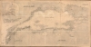

مارمارا ضنيزي / [Sea of Marmara].
Modernizing Ottoman maritime data.
- Digital Map Information
- Suitable for large format printing
- File Size: 1762.71 MB
- File Type: ZIP / TIFF
- ICC color profile embedded
- Delivered instantly via download link
Modernizing Ottoman maritime data.
A fascinating 1896 nautical chart or map of the Sea of Marmara, including the Bosphorus Straits, published by the Ottoman Matbaa-i Bahriye (Printing House of the Naval Forces). It is based on a British Admiralty chart of the same, reflecting both the advanced state of British hydrography at the time and the efforts of the late Ottoman state to close the gap with Western empires.A Closer Look
Coverage includes the Sea of Marmara, from the Dardanelles Strait and the Gallipoli Peninsula at the bottom-left to the Bosphorus Strait at the top-right. Portions of the adjoining Aegean and Black Seas are also included, as are landward features, including major roads (thick black lines), mountains, and waterways (many now filled in and built over). In addition to Istanbul (استانبول), cities at strategic locations, such as Enez (انيز) and Gemlik (كيمليك), are noted. On the water, soundings are provided throughout, in what must have been a painstaking process of transliteration. Lighthouses and beacons, shoals, islets, and anchorages are indicated, and brief descriptive notes are provided to aid the navigator. Four compass roses with magnetic variations round out the wealth of information provided by the chart.Late Ottoman Reform Efforts
Although beset by a host of problems in its final decades, including a weak economy and both internal and external threats, the Ottoman state did attempt reform, which likely helped it to survive longer than it otherwise would have. One element of these reforms was the translation and importation of foreign knowledge, including cartographic data. This sea chart is a clear manifestation of these efforts, translating a British Admiralty chart (the best available) of the most critically important waterways for the empire.Publication History and Census
This map was produced in 1896 (AH 1314) by the Matbaa-i Bahriye (The Printing House of the Naval Forces) in Istanbul, based on a British Admiralty chart originally published in 1882. The water stains near the title and around the edges, as well as the fact that it was dissected and laid on linen for folding, suggest actual use on a ship. This chart is very rare; the University of Toronto holds a chart that appears similar and may be the same work (OCLC 976971034). Otherwise, we are unaware of any examples of this chart in institutional collections or on the market.Cartographers
Matbaa-i Bahriye (ماتباايى باهريي; c. 1887 - 1926) was the printing house of the Ministry of the Navy (Bahriye Nezareti) in the last years of the Ottoman Empire and the first years of the Republic of Turkey. It was an active publishing house, producing works related to navigation, hydrography, and naval warfare, often in translation from English and other European languages. Further Details...
The British Admiralty Office (1795 - Present), or the United Kingdom Hydrographic Office, is the Branch of the English government responsible for commanding the British Navy. In 1795, King George III created the United Kingdom Hydrographic Office, known as the U.K.H.O., to provide high-quality nautical charts for the Royal Navy. Before the Admiralty's founding, surveying and creating nautical charts was primarily a commercial venture, and the cartographer himself often financed the printing of his own material. Even the great navigator Cook is known to have scrambled for funds to publish his own seminal charts - the most important and advanced of the period. The system of privately funded nautical mapping and publishing left vast portions of the world uncharted and many excellent charts unpublished. King George III, responding to significant losses in trade revenue from shipwrecks and delays caused by poor charts, recognized the need for an institutionalized, government-sponsored cartographic agency: the Admiralty. The first head of the Admiralty, a position known as Hydrographer, was the important cartographer Alexander Dalrymple. Dalrymple began by organizing and cataloging available charts before starting the laborious process of updating them and filling in the blanks. The first official Admiralty Chart appeared in 1800 and detailed Quiberon Bay in Brittany. By 1808, Captain Thomas Hurd became Hydrographer. Hurd advocated selling Admiralty charts to the general public and, by the time he retired in 1829, had issued and published about 736 charts. Stewardship then passed to Rear Admiral Sir Francis Beaufort. Under Beaufort's administration, the Admiralty truly developed as a "chart-making" rather than a "chart-cataloging" institution. Beaufort held his post from 1829 to 1854. In his 25 years at the Admiralty, Beaufort created nearly 1,500 new charts and sponsored countless surveying and scientific expeditions, including the 1831 to 1836 voyage of the H.M.S. Beagle. By 1855, the Admiralty's chart catalog listed some 1,981 charts. Further Details...
Condition
Good. Overall toning. Dissected and laid on linen in 18 panels. Dampstaining near title.
References
OCLC 976971034.