
1788 / 1888 Lopez Six-Sheet City Plan or Map of Seville, Spain

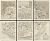
Plano geométrico de la ciudad de Sevilla...
One of the Greatest City Plans of the 18th Century.
- Digital Map Information
- Suitable for large format printing
- File Size: 122.48 MB
- File Type: ZIP / TIFF
- ICC color profile embedded
- Delivered instantly via download link
One of the Greatest City Plans of the 18th Century.
This is a c. 1888 restrike of Tomás López de Vargas Machuca's impressive 1788 six-sheet city plan or map of Sevilla (Seville), Spain, and is one of the great city plans of the 18th century. It displays Seville with the legacy of its many centuries of history, from Roman times through Muslim rule, Reconquest, and as a gateway to the Americas.A Closer Look
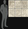
The map consists of six sheets, the printed area of each measuring 17.25 x 14 in.; when combined the sheets measure 38.5 x 46.75 in. Oriented towards the west-northwest so as to place the Guadalquivir River more or less horizontally in the foreground, the map covers the entire walled city of Seville and part of its hinterland in remarkable detail. More than 200 churches, government and military buildings, plazas, city gates, and other features are labeled and listed in an index on the verso, as are streets, which can be located using a grid surrounding the map. López records his sources in a detailed note at the bottom-left, beginning with a 1771 map of the city prepared by Francisco Manuel Coelho and engraved by Joseph Amat. López particularly notes his own additions to earlier maps, referring to recent changes in the cityscape, including new seawalls along the river added following a 1783 flood.Seville as seen here was the result of the city's very long history dating back to Roman times, with its layout and distinctive architecture strongly influenced by the city having been under Muslim 'Moorish' rule for more than 500 years. Some buildings and structures remained in use from Medieval times, such as the pontoon bridge (Triana Bridge, number 176 here) originally built in 1176 by the Almohad caliph Abu Yaqub Yusuf and only replaced in 1852 by a metal structure (the Puente de Isabel II). Other buildings, especially churches, were more recent and meant as monuments to the Reconquista and Castilian/Spanish royal prestige. The city's massive cathedral (number 147 here), adjoining the Real Alcázar, surpassed the Hagia Sophia as the largest cathedral in the world when completed in the early 16th century. The Real Alcázar itself is literally built on the foundations of Moorish structures and is even more in its influences, being a prime example of the Mudéjar style.
Historical Context
Seville had grown rich in the 16th century as the exclusive port for trade with Americas, but in the early 17th century Cádiz, more conveniently located on the coast, was also granted the privilege of trade with America. As a result, Seville declined significantly relative to Cádiz. It was revived somewhat in the 18th century by royal largesse through works such as the Real Fábrica de Tabacos (number 157, at right here), the second-largest building in Spain when completed. However, not long after this map's production, Seville suffered a terrible outbreak of yellow fever that killed as much as one-third of its population (less well-known but perhaps more deadly than an outbreak of plague in the city around 1650). After briefly serving as the Spanish capital after the fall of Madrid during the Peninsular War, Seville was occupied by Napoleon's troops and looted in 1810. However, these setbacks did not prevent the city's distinctive culture from attracting artists from throughout Europe, including Beethoven, Mozart, and Rossini, all of whom set operas in Seville.Publication History and Census
This is a c. 1888 restrike of Lopez's 1788 map using the original plates, likely produced for the centennial of the map's publication. There were two printings of the 1788 map, one with the index in the side margins and one with the index at bottom. Those with the index in the margins include the address present at bottom-left here ('Madrid, calle de Atocha, frente de la Aduana Vieja, Manzana 169, Numero 3'), suggesting that this state was the basis for the restrike. Here the index appears as two separate sheets, which are fresh lithographic printings, not from full copper plates like the map itself. The original printing of the map in either state is quite rare, held by perhaps ten institutions worldwide, mostly in Spain. We are unaware of any other examples of this later restrike, though the lack of a date or obvious differences with the original printing might result in their being cataloged as a 1788 printing.Cartographer
Tomás López de Vargas Machuca (1730 - July 19, 1802) was a Spanish cartographer active in the later part of the 18th century. Vargas was born in Toledo and studied mathematics, grammar, and rhetoric at the Colegio Imperial in Madrid. In 1752, with the patronage of the Marquis de la Ensenada, he relocated to Paris to study. López attended the Mazarin College, where he received two courses in Mathematics and lessons in geography from the Abbé de la Caille, Joseph Jérome de Lalande, and Louis Gabriel. He also studied cartography direclty under the legendary French mapmaker Jean Baptiste Bourguignon d'Anville (1697 - 1782). Back in Madrid, he collaborated with the geographer Juan de la Cruz on two educational atlases, published in 1757 and 1758. Around 1770, King Carolos III, appointed him Geógrafo de los Dominios de Su Magestad and gave him charge over the newly created Gabinete de Geografía. In this position, he dedicated the remainder of his life to a detailed mapping of Spain, producing numerous important regional maps, many correcting common mistakes made by foreign geographers. He also ran a private map publishing business in Madrid, first on San Bernardo (1761 - 65), the on Las Carretas (opposite Gamete; 1765 - 1783), and infamy on Atocha (1783 - 1802). He was a member of the Real Academia de San Fernando, the Real Sociedad Bascongada de Amigos del País and the Academia de Bellas Letras de Sevilla. López was succeeded by his two sons, Juan (1765 - 1825) and Tomás Lopez, also cartographers, who published several atlases based upon his work. The appraisal of his estate at the time was 489,800 reales (about 1,000,000 USD today), a figure indicative of his success. Further Details...
Condition
Excellent. Slight margin wear. Index sheets exhibit some soiling. Wide margins, though some of the strikes are not square to the sheet. The two index sheets are fresh lithographic printings, not from full copper plates like the map itself, but are likely letterpress.
References
Rumsey 10717.000 (earlier printing). OCLC 494226809, 1123874955, et al.