
1946 Admiralty Chart of the Strait of Gubal, Egypt

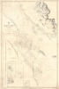

Red Sea Strait of Jubal.
Gateway to the Gulf of Suez
- Digital Map Information
- Suitable for large format printing
- DPI: 600
- File Size: 32.4 MB
- File Type: ZIP / TIFF
- ICC color profile embedded
- Delivered instantly via download link
Gateway to the Gulf of Suez
This is a 1946 British Admiralty nautical chart of the Strait of Gubal in Egypt, where the Gulf of Suez meets the Red Sea near the tip of the Sinai Peninsula. This strategically important waterway was fought over during both World War II (1939 - 1945) and the Cold War-era struggle between Egypt and Israel.A Closer Look
The chart covers the Strait at the bottom of the Gulf of Suez along the west coast of the southern part of the Sinai Peninsula. The extreme southern tip of the peninsula, Ras Muhammed, was established as a national park in the 1980s to protect against urban sprawl from Sharm El Sheikh, just beyond the scope of this chart. A tremendous amount of navigational information is included throughout, including soundings, bottoms, shoals, hazards, anchorages, compasses with magnetic variations, a tide chart, and more. As can be seen, despite being a wide body of water, the Strait is full of islands and shoals that could prove dangerous if unknown to a ship's crew. Hills, mountains, and waterways are also traced on land to aid in navigation. An illustration of the Shadwan Island Lighthouse appears at right, while profiles of mountains appear at left. Insets of Hurghada and approaches to its pier are included at bottom-left. Pencil annotations reflect this chart's actual use aboard a ship.Gateway to the Gulf of Suez
As a waterway connected to the Suez Canal and on the route between the Mediterranean and the Red Sea, these waters have long held high strategic value, especially for the British Empire. They were a main transit point for war materiel during the Second World War and therefore subject to attacks by German and Italian attacks, as with the sinking of the cargo steamship SS Thistlegorm; these shipwrecks are one of the several attractions for tourists to the region interested in deep-sea diving, especially at Hurghada, a popular resort for diving and other beach activities. During the Cold War, the Strait was a site of contention between Israel and Egypt, especially during the 1967 Six-Day War, when Israel occupied the Sinai Peninsula, the 'War of Attrition' that followed, and the 1973 Yom Kippur War. Both sides conducted naval commando raids, with the Israelis briefly seizing Shadwan Island, which the Egyptians had garrisoned, and destroying Egyptian commando boats at Hurghada during the Yom Kippur War. This allowed Israel to effectively blockade Hurghada and gain control of the Gulf of Suez, which included a deep-sea 'frogman' team sent to cut underwater communications lines between Egypt and Arabia (and from there to their allies in Syria). In return, the Egyptians attempted to mine the Gulf of Suez, sinking a couple of oil tankers but otherwise not breaking Israeli control of the waterway.Publication History and Census
This chart was produced by the British Admiralty, originally based on surveys taken in 1871-72, which were continually updated in the following decades, with the present example noting corrections to 1946. Nevertheless, institutional holdings of the chart in any edition are quite scarce. A 1929 edition is noted among the holdings of the British Library, the Bibliotheek Universiteit van Amsterdam, and the Universitäts- und Landesbibliothek Sachsen-Anhalt, while the British Library also holds editions from 1944 and 1947.Cartographer
The British Admiralty Office (1795 - Present) or the United Kingdom Hydrographic Office refers to the Branch of the English government that is responsible for the command of the British Navy. In 1795 King George III created the United Kingdom Hydrographic Office, known in short as the U.K.H.O., to provide top notch nautical charts to the vast Royal Navy. Prior the founding of the Admiralty the surveying and creation of nautical charts was primarily a commercial venture wherein the cartographer himself, more of than not, actually financed the printing of his own material. The great navigator Cook himself is known to have scrambled for funds to publish his own seminal charts - the most important and advanced of the period. The system of privately funded nautical mapping and publishing left vast portions of the world uncharted and many excellent charts unpublished. King George III, responding significant loss in trade revenue related to shipwrecks and delay due to poor charts, recognized the need for an institutionalized government sponsored cartographic agency - the Admiralty. The first head of the Admiralty, a position known as Hydrographer, was the important cartographer Alexander Dalrymple. Dalrymple started by organizing and cataloging obtainable charts before initiating the laborious process of updating them and filling in the blanks. The first official Admiralty Chart appeared in 1800 and detailed Quiberon Bay in Brittany. By 1808 the position of Hydrographer fell to Captain Thomas Hurd. Hurd advocated the sale of Admiralty charts to the general public and, by the time he retired in 1829, had issued and published some 736 charts. Stewardship of the organization then passed to Rear Admiral Sir Francis Beaufort. It was under Beaufort's administration that the Admiralty truly developed as a "chart making" as opposed to a "chart cataloging" institution. Beaufort held his post from 1829 to 1854. In his 25 years at the Admiralty Beaufort created nearly 1500 new charts and sponsored countless surveying and scientific expeditions - including the 1831 to 1836 voyage of the H.M.S. Beagle. By 1855 the Admiralty's chart catalog listed some 1,981 charts. Further Details...
Condition
Good. Wear and spotting here and there. Used at sea. Some pencil annotations. Old horizontal centerfold.
References
OCLC 1346495967 (1944 ed.), 557724333 (1947 ed.).