
1870 Rosa Manuscript Plat Maps of Ward's Island, New York City

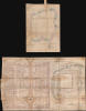
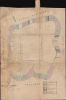
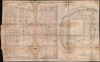
Map of Wards Island / Plan No. 3 of Partition of Waterrights at Ward's Island.
Hellish Property Dispute at Hell Gate.
- Digital Map Information
- Suitable for large format printing
- Full resolution TIFF file
- ICC color profile embedded
- Delivered instantly via download link
Hellish Property Dispute at Hell Gate.
This is a unique c. 1870 manuscript map and appraisal of property values on and around Wards Island (now part of Randalls and Wards Islands) in New York City prepared by surveyor Rudolph Rosa. It refers to an intense and consequential legal dispute over ownership of waters immediately surrounding the island, which at this time was primarily dedicated to hospitals and other institutions for people with physical and mental health problems.A Closer Look
The map sheet is oriented towards the northeast with lots traced and numbered, the water line and exterior line of properties noted, and surrounding waterways labelled. Lots extending beyond the original high water line are shaded and assigned variously to Adrian Van Sanderen (elsewhere as Sinderin, executor of William Lawrence), one Bolles, the City, the Commissioners of Emigration, W.E. Lawrence, A. R. Lawrence, and the plaintiff in the case, who was Alfred Beach. Annotations refer to sales of some lots and the price of the sale.A larger accompanying sheet consists of a table of appraised values of the lands under water around Wards Island that had been rather clumsily apportioned to early property owners on the island by the state (discussed below), the root of years of legal wrangling. This sheet effectively reproduces the map sheet, but with some changes, most of which appear to formalize corrections made on the map sheet, suggesting that the appraisal sheet is a somewhat later and more final work.
The Case
The origins of this dispute arose in the early 19th century when the island was known as Great Barn Island and owned entirely by members of the Ward and Lawrence families. In 1807, the families hired surveyor William Bridges to divide the island into the 77 lots and 4 streets illustrated here. In 1810, Bartholomew Ward sold some of his lots to John Fleetwood Marsh, but the following year a state grant carelessly guaranteed Bartholomew Ward, Jasper Ward, Abraham R. Lawrence, and Richard Lawrence:All the land under water round great Barn Island situate in the East River or Sound in the city and county of New York from high water mark to low water mark and extending on the North west side of said Island one hundred and fifty feet from Low water mark towards New York Island and from the other parts of said Island three hundred feet from low water mark…This provision laid the groundwork for major competing claims, but these would only become apparent years later. In 1852, as the City was increasingly utilizing Wards Island for hospitals and affiliated institutions, it acquired several lots from Abraham R. Lawrence along with the attached water rights. In 1858, Alfred Beach acquired the rights of the Wards to the water portion of their properties. Ten years later, Beach filed a partition action against the City and the other property owners on the island, which quickly reached the Supreme Court of the State of New York.
An interlocutory decree was issued and commissioners appointed to oversee the creation of a map (likely the present one) by surveyor Rudolph Rosa, updating the 1807 Bridges map. Eventually, in 1877, the N.Y. Supreme Court ruled that the water lots shown on Rosa's map should be allocated to the parties designated on that map. 'Beach v. the Mayor,' was an important decision referred to regularly in subsequent property disputes involving rights to water adjacent to lots.
However, that was not the end of disputes relating to the waters around Wards Island. As Beach and others sold off lots to new buyers, and they in turn sold lots to even newer buyers, disputes arose as to damage done to parcels and break walls due to increased water traffic in the East and Harlem Rivers, particularly with the advent of steamers. These disputes continued well into the 20th century, with the implications of 'Beach v. the Mayor' and the original error by the state in 1811 being argued before state courts into the 1940s.
Wider Historical Context
In the mid-19th century, Wards Island served as a critical, albeit grim, sanitary buffer for a rapidly expanding New York City, most notably through the 1847 establishment of the State Emigrant Refuge and Hospital. Created by the newly formed Board of Commissioners of Emigration, this facility was designed to manage the overwhelming influx of Irish and German immigrants fleeing famine and political unrest, many of whom arrived suffering from typhus, cholera, and severe malnutrition. Funded by a 'head tax' levied on incoming passengers, the complex quickly grew into what was likely the largest hospital system in the world during the 1850s, providing medical care and temporary shelter to thousands of destitute arrivals who were too ill to enter the general population.Beyond its medical function, the island operated as a broader containment zone for those society deemed 'undesirable' or incapable of self-sufficiency. Alongside the hospital, the island housed a refuge for the able-bodied poor and a massive potter's field, where hundreds of thousands of bodies were relocated from Manhattan cemeteries to allow for real estate development. Life on the island was defined by strict regimentation and isolation; while the hospital provided essential care that saved countless lives, the facilities were often overcrowded and institutional. By the 1860s, the island's primary focus began to shift toward psychiatric care with the opening of the New York City Asylum for the Insane, foreshadowing its eventual transformation into a dedicated center for mental health services.
Publication History and Census
The undated manuscript map sheet was almost certainly by surveyor Rudolph Rosa (fl. c. 1868 - 1876), while the similar map on the appraisal list is signed by him and dated 1874, having been made for the legal case 'Beach v. the Mayor,' which was argued before the Supreme Court of the State of New York. Curiously, though the map on the appraisal sheet is signed by Rosa, the title suggests that the map was at least partially prepared by another surveyor of the era, Andrew Findlay (fl. c. 1850 - 1890), who is not mentioned in the records of the New York Supreme Court case. In any event, based on the records of the case, Rosa prepared at least two and perhaps three surveys of Ward's Island between 1870 and 1876, of which the present map is one.Cartographer
Rudolph Eduard Heinrich Rosa (c. 1824 - June 29, 1901) was a surveyor and civil engineer active in New York City in the late 19th century. Born in Westphalia, Germany, Rosa emigrated to the United States at an uncertain date, but could well have come in the wake of the Revolutions of 1848 like so many others from the German-speaking lands. What is clear is that Rosa became an ardent patriot in his adopted homeland, organizing a volunteer regiment, the 46th New York Volunteers (nicknamed the Fremont Rifle Regiment, later officially 46th New York Infantry Regiment) at the start of the U.S. Civil War. A newspaper clipping digitized by the New York State Military Museum and Veterans Research Center refers to 'General Rosa' (he was in fact only a Colonel) as being 'an engineer officer of great experience, formerly in the Prussian army, late of the United States Coast Survey.' The 46th New York Infantry Regiment was composed primarily of German emigrees living in New York City. The regiment saw action in some of the most important campaigns and battles of the war, including Antietam, Fredericksburg, Vicksburg, and Petersburg, and suffered commensurate casualties. For his part, Rosa was injured relatively early in the war in August 1862 at the Battle of Groveton and was discharged at the end of that year. Afterwards, he and his wife Marie Heynan Rosa had several children and Rosa worked as a city surveyor, initially at 31 Pine St. and then at 22 Pine St. in Manhattan, until about 1890. Further Details...
Condition
Average. Manuscript map drawn on silk and mounted on cloth. Soiling, dampstaining, and likely mold. Map sheet 17.75 x 13.5 in. Map and property table sheet 21 x 34 in.
References
Court of Appeals of the State of New York, In the Matter of the Application of the City of New York...Metro Investing and Credit Corporation, Claimant-Appellant; the City of New York, Respondent. , (New York State Court of Appeals) 1943.