
Aikman, George (sold)

George Aikman (December 28, 1788 - October 16, 1865) was a Scottish printer, lithographer, and engraver active in the early 19th century. Aikman most likely apprenticed with his father of the same name, also an engraver, before joining the Edinburgh map and atlas firm of William Lizars. Several years later Aikman established himself independently as "George Aikman and Sons, Engravers and Lithographers", publishing numerous maps and prints in conjunction with the larger firm of William and Charles Black, and others. George Aikman's son, also George (1830 - 1905), became an apprentice with the firm around 1842, and eventually a journeyman engraver in Manchester and London, before returning to Edinburgh to take up a full partnership in the family business. Upon the elder Aikman's death in 1865, George became the sole proprietor of the firm and continued to publish until 1876 when he sold the business to pursue a passion for landscape painting.
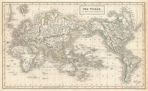
The World on Mercator's Projection.
sold
- Digital Map Information
- Suitable for large format printing
- Full resolution TIFF file
- ICC color profile embedded
- Delivered instantly via download link
This is a fine example of Adam and Charles Black's 1844 map of the world on Mercator's Projection. An interesting map of the world issued just as most of the Earth's non-polar shore has been explored. Vast stretches of unmapped territory and speculative ... (more details)
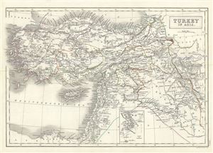
Turkey in Asia.
sold
- Digital Map Information
- Suitable for large format printing
- Full resolution TIFF file
- ICC color profile embedded
- Delivered instantly via download link
This is a beautiful Adam and Charles Black's 1844 map of Turkey in Asia. Centered on the Holy land (Palestine / Israel), the map covers the modern day countries of Turkey, Cyprus, Iraq, Israel, Palestine, Jordan, Lebanon, and Syria. Various cities, ... (more details)
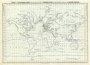
Chart of Isothermal Lines, Shewing the Mean Annual Temperature of the Different Parts of the Earth's Surface.
sold
- Digital Map Information
- Suitable for large format printing
- DPI: 300
- File Size: 7.23 MB
- File Type: ZIP / TIFF
- ICC color profile embedded
- Delivered instantly via download link
This is a fine example of Adam and Charles Black's 1851 map or chart of the World's isothermal lines showing the mean annual temperatures in the different parts of the earth's surface. The continents are named while countries are unmarked. The ... (more details)
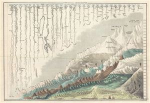
Physical Geography.
sold
- Digital Map Information
- Suitable for large format printing
- Full resolution TIFF file
- ICC color profile embedded
- Delivered instantly via download link
This is a beautiful example of Adam and Charles Black's 1844 comparative mountains and rivers of the world chart. Charts of this type were first introduced in England around 1823 and became a common feature in atlases throughout the 19th ... (more details)
An Elegant Chart comparing the Rivers and Mountains of the World.
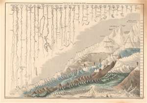
Physical Geography.
sold
- Digital Map Information
- Suitable for large format printing
- DPI: 600
- File Size: 10.43 MB
- File Type: ZIP / TIFF
- ICC color profile embedded
- Delivered instantly via download link
This is a handsome example of Adam and Charles Black's 1844 depiction of the comparative sizes of the mountains and rivers of the world. Charts of this type were first introduced in England around 1823 and became a common feature in atlases throughout the 19th century. The present example is admired as one of the more attractive British examples of the style. (more details)
Elegant Chart comparing the Rivers and Mountains of the World.
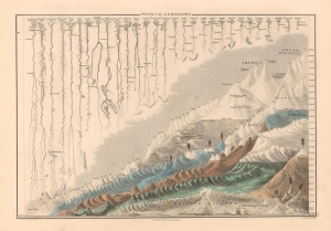
Physical Geography.
sold
- Digital Map Information
- Suitable for large format printing
- DPI: 600
- File Size: 22.56 MB
- File Type: ZIP / TIFF
- ICC color profile embedded
- Delivered instantly via download link
This is a handsome example of Adam and Charles Black's 1844 depiction of the comparative sizes of the mountains and rivers of the world. Charts of this type were first introduced in England around 1823 and became a common feature in atlases throughout the 19th century. The present example is admired as one of the more attractive British examples of the style. (more details)
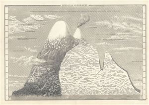
Physical Geography.
sold
- Digital Map Information
- Suitable for large format printing
- Full resolution TIFF file
- ICC color profile embedded
- Delivered instantly via download link
This is Adam and Charles Black's rare 1844 profile view of the Andes Mountains, particularly Ecuador's Mt. Chimborazo, based upon an influential 1805 illustration by the renowned German explorer and scientist Alexander von Humboldt. ... (more details)
An early comparative mountains chart originally commissioned by Alexander von Humboldt.
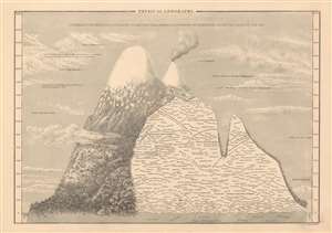
Physical Geography.
sold
- Digital Map Information
- Suitable for large format printing
- DPI: 600
- File Size: 13.69 MB
- File Type: ZIP / TIFF
- ICC color profile embedded
- Delivered instantly via download link
This is Adam and Charles Black's rare 1844 profile view of the Andes Mountains, particularly Ecuador's Mt. Chimborazo, based upon an influential 1805 illustration by the renowned German explorer and scientist Alexander von Humboldt. ... (more details)
New insight into magnetic variation.
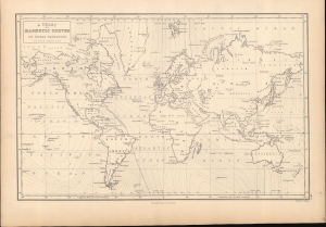
A Chart of Magnetic Curves of Equal Variation.
sold
- Digital Map Information
- Suitable for large format printing
- DPI: 600
- File Size: 238.47 MB
- File Type: ZIP / TIFF
- ICC color profile embedded
- Delivered instantly via download link
This is Adam and Charles Black's 1844 version of Peter Barlow's map of the world illustrating 'magnetic curves of equal variation'. The map is the product of Peter Barlow's groundbreaking research into magnetic variation. It is based on Barlow's unobtainable larger-scale nautical chart published in 1833, A chart of magnetic curves of equal variation between the latitudes of 60°N and 55°S. (more details)
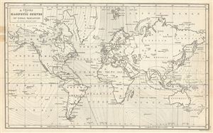
A Chart of Magnetic Curves of Equal Variation.
sold
- Digital Map Information
- Suitable for large format printing
- Full resolution TIFF file
- ICC color profile embedded
- Delivered instantly via download link
This is a fine example of Adam and Charles Black's 1844 chart of the World's Magnetic Curves of equal variation. The chart depicts the magnetic curves over the entire world, but does not show the isomagnetic lines over any continent ... (more details)
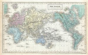
The World, on Mercator's Projection.
sold
- Digital Map Information
- Suitable for large format printing
- Full resolution TIFF file
- ICC color profile embedded
- Delivered instantly via download link
This is a fine example of Adam and Charles Black's 1851 map of the world on Mercator's Projection. An interesting map of the world issued just as most of the earth's non-polar shore has been explored. Vast stretches of unmapped ... (more details)
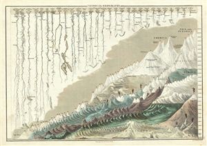
Physical Geography.
sold
- Digital Map Information
- Suitable for large format printing
- DPI: 300
- File Size: 7.22 MB
- File Type: ZIP / TIFF
- ICC color profile embedded
- Delivered instantly via download link
This is a fine example of Adam and Charles Black's 1851 comparative mountains and rivers of the world chart. Charts of this type were first introduced in england around 1823 and became a common feature in atlases throughout the ... (more details)
Gorgeous example of Black's mountains and rivers chart.
Physical Geography.
sold
- Digital Map Information
- Suitable for large format printing
- DPI: 600
- File Size: 12.67 MB
- File Type: ZIP / TIFF
- ICC color profile embedded
- Delivered instantly via download link
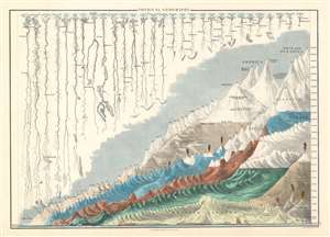
A fine example of Adam and Charles Black's 1840 comparative mountains and rivers of the world chart. Charts of this kind were first introduced in England around 1823 and became a common feature in atlases throughout the 19th century. The present example is admired as one of the more attractive British examples of the style. (more details)
An early comparative mountains chart originally commissioned by Alexander von Humboldt.
Physical Geography.
sold
- Digital Map Information
- Suitable for large format printing
- DPI: 600
- File Size: 13.59 MB
- File Type: ZIP / TIFF
- ICC color profile embedded
- Delivered instantly via download link
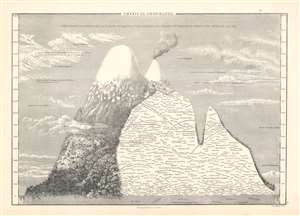
This is Adam and Charles Black's rare 1853 profile view of the Andes Mountains, particularly Ecuador's Mt. Chimborazo, based upon an influential 1805 illustration by the renowned German explorer and scientist Alexander von Humboldt. Among the first scientists to take Kant’s philosophy of Transcendental Idealism into the scientific field, Alexander von Humboldt illustrates discoveries made on his ascent (the first) of Mt. Chimborazo. (more details)