
al-Idrisi, Muhammad (sold) (أبو عبد الله محمد الإدريسي القرطبي الحسني السبتي)
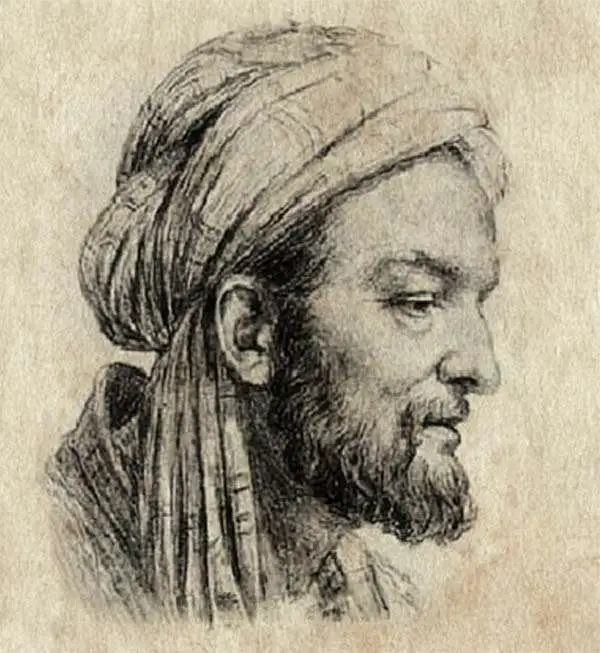
Abu Abdullah Muhammad al-Idrisi al-Qurtubi al-Hasani as-Sabti (1100 - 1165) was a Moroccan-Arab Geographer, writer, scientist and cartographer. He lived 18 years in Palermo, Sicily as part of the court of King Roger II, for whom he produced a detailed description of the Muslim world at that time, and drew one of the most advanced world maps of the medieval era (the Tabula Rogeriana.) al-Idrisi was born in Ceuta (now part of Spain) to the large and illustrious Hammudid family (which claimed descent from the Prophet Muhammad.) He is thought to have studied in Córdoba; He traveled broadly, mainly in North Africa and Muslim Spain, but is thought to have reached as far as York in England. Political instability led al-Idrisi and other scholars to seek asylum with the Norman kingdom of Sicily, and it was there that he produced his most famous geographical work: the 1154 manuscript Tabula Rogeriana, and his geography, Kitab nuzhat al-mushtaq fi'khtiraq al-'afaq, or 'A Diversion for the Man Longing to Travel to Far-Off Places'.' His work was astonishing in its scope: it included descriptions of Iceland and Greenland, as well as details of the goods likely to be found upon Chinese trade vessels, and the quality of the silk of Quanzhou. But while his work - which survives in nine manuscripts - influenced Islamic scholars, it was ignored in western Europe until well into the sixteenth century. The abridged Arabic text was finally printed in Rome in 1592, one of the first Arabic books ever printed. The first translation from the original Arabic into Latin was published in Paris in 1619 as Geographia nubiensis (The Geography of the Nubian).
AKA: أبو عبد الله محمد الإدريسي القرطبي الحسني السبتي
Earliest Printed Map to show the Hajj.
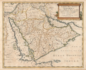
Carte des Trois Arabies Tirée en Parte de l'Arabe de Nubie, en partie de divers autres Autheurs, Par le S. N. Sanson d'Abbeville, Geographe ordinaire du Roy, A Paris.
sold
- Digital Map Information
- Suitable for large format printing
- Full resolution TIFF file
- ICC color profile embedded
- Delivered instantly via download link
This is an attractive example of Nicolas Sanson's scarce 1654 map of the Arabian Peninsula. As indicated in the title, it depicts the three Arabias: Arabie Petree, Arabie Deserte, and Arabia Heureuse; that is, Stony Arabia, Desert Arabia, and 'Happy' Arabia. The map depicts both shores of the Red Sea and the Persian Gulf, and the Indian Ocean island of Zocotora off the horn of Africa. The map includes Mecca and Medina, and the pattern of named settlements describes the Hajj routes: along the Red Sea coast, the overland routes across the peninsula from Basra, and the route to Mecca from Damascus. The Kingdom of Bahrain (Bahraim) appears as well. The largest portion of the Arabian Peninsula is here named Hyaman, ou Arabie Heureuse: 'Yemen, or Happy Arabia.' (more details)