
Aragón y Abollado, Ildefonso de (sold) (Don Yldefonso de Aragón y Abollado)
Ildefonso de Aragón y Abollado (January 5, 1760 - December 29, 1838), also spelled Yldefonso, was a Spanish engineer active in Spain and the Philippines during the late 18th and early 19th centuries. He was born in Andalusia in 1760, and in 1775 began studying as a cadet at the Real Colegio de Artillería de Segovia. In July 1777, he transferred to the Infantería de Toledo garrisoned in Cádiz. Afterwards he went on to carry out his regulatory studies at the Academia de Matemáticas de Barcelona. He entered the Cuerpo de Ingenieros on August 6, 1782. He was subsequently assigned to a variety of posts in Spain. In 1789 he was with the Dirección de Ingenieros de Andalucía, for whom he compiled a topographic map of Jerez de la Frontera. He left for the Philippines in March of 1802, where he was stationed for more than 20 years as the chief of the Manila Deposito Topografico. He became commander of the Royal Corps of Military Engineers, and is described by Retana as the 'father of Philippine statistics and scientific topography'. From his arrival in the Philippine Islands until his departure to the peninsula in 1827, he carried out fruitful work, surveying and compiling plans and maps, and overseeing the construction of numerous buildings and fortifications. Among the his maps and plans are a schematic of the Manila Artillery barracks proposing three projects (1805); a profile of the Marulal bridge in the Cavite Viejo (1812); a Map of Manila (1814, the year, moreover, in which he was promoted to Colonel of Engineers); plans of the provinces of Bulacán and Tondo (1819), a Topographic map of Pampanga, a plan of the city of Manila (1818); a choreographic plan of the of Pangarinán (1821); a geographic map of the province of Batangas (1821); and, finally, a plan of the Campo Santo de Manila, Paco (1823). He founded the Deposit Topografico de Manila in 1819, and from 1820 was a member of the Real Sociedad Económica de Manila. He returned to Spain in 1827 and died in Chiclana in 1838.
AKA: Don Yldefonso de Aragón y Abollado
First map of a Philippine Province - printed in Manila!
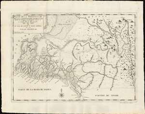
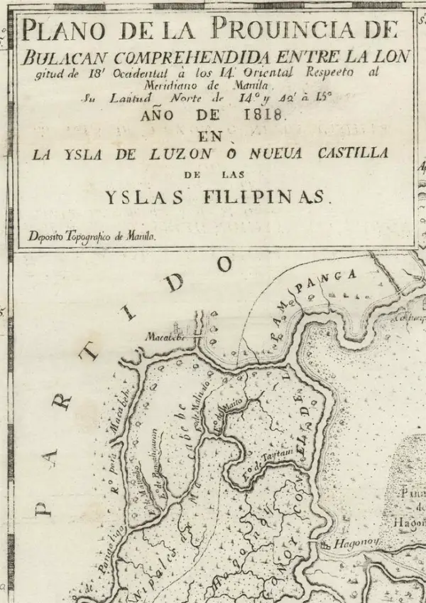
Plano de la Prouincia de Bulacan Comprehendida Entra La Lon gitud de 18' Occidental à los 14' Oriental Respecto al Meridiano de Manila Su Latiud Norte de 14° y 42' à 15° Año de 1818 en La Ysla de Luzon ò Nueua Castilla de la Yslas Filipinas.
sold
- Digital Map Information
- Suitable for large format printing
- DPI: 600
- File Size: 459.07 MB
- File Type: ZIP / TIFF
- ICC color profile embedded
- Delivered instantly via download link
An outstanding example of the 1818 Deposito Topografico / Ildefonso de Aragón map of the province of Bulacan, Philippines, accompanied by the 21-page text Provicia de Bulacan. This is the first specific map of a Philippine province, compiled as part of Ildefonso, and the Deposito's flagship effort to bring structured modern survey techniques to the archipelago. (more details)
First map of a Philippine Province - printed in Manila!
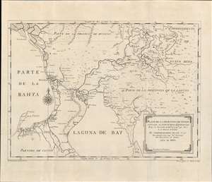
Plano de la Prouincia de Tondo situada al Norte de la Equinocial.
sold
- Digital Map Information
- Suitable for large format printing
- DPI: 600
- File Size: 14.89 MB
- File Type: ZIP / TIFF
- ICC color profile embedded
- Delivered instantly via download link
An outstanding example of the 1819 Deposito Topografico / Ildefonso de Aragón map of the province of Tondo, Philippines, accompanied by the 56-page text ' Provicia de Tondo. This is the first specific map of a Philippine province, compiled as part of Ildefonso, and the Deposito's flagship effort to bring structured modern survey techniques to the archipelago. (more details)