
Baker, Joseph (sold)
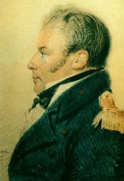
Joseph Baker (1767 - 1817) was a British naval officer and explorer best known for his service under George Vancouver during the historical Vancouver expedition to map the Pacific Northwest. Vancouver was born in the Welsh border counties. He joined the Royal Navy in 1787 where he met and befriended then-Lieutenant George Vancouver and then-Midshipman Peter Puget. When Vancouver was commissioned to complete the exploration of the American Northwest Coast, he chose Baker as he 3rd Lieutenant and Puget as his 2nd Lieutenant. During the course of the expedition Baker was assigned the task of converting surveys into working maps and his name appears on many of Vancouver's most important maps, including the first complete map of the Hawaiian Islands. Baker, along with the expedition's naturalist Archibald Menzies, completed the first recorded ascent of Hawaii's Mauna Loa volcano. Mt. Baker, in modern day Washington, is also named after him. In his journals Vancouver wrote admiringly of Baker's work:
…my third Lieutenant Mr. Baker had undertaken to copy and embellish, and who, in point of accuracy, neatness, and such dispatch as circumstances admitted, certainly excelled in a very high degree.Following the Vancouver expedition Baker briefly retired from naval service until being recalled and made Captain in 1808. Assigned to the ship HMS Tartar, Baker was charged with escort duty in the Baltic. There, in a series of skirmishes with Danish privateers, Baker fell afoul of his British superiors and was court-martialed. Although acquitted of the court martial, Baker never again served in the Royal Navy. He retired to Presteigne where he maintained a long standing friendship to Puget, who moved to the same town on his own retirement.
Quite simply the largest, most beautiful, and most important early map of Hawaii ever published.
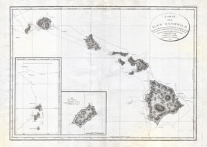
Carte des Iles Sandwich d'apres la reconnoissance qui en a ete faite dans les differentes relaches de la corvette La Decouverte et de sa conserve Le Chatham commandes par le Capt. Vancouver en 1792, 1793 et 1794.
sold
- Digital Map Information
- Suitable for large format printing
- DPI: 300
- File Size: 16.94 MB
- File Type: ZIP / TIFF
- ICC color profile embedded
- Delivered instantly via download link
A seminal map. This is a fine example of George Vancouver's 1799 map of the Hawaiian Islands, considered the largest, most important, and most beautiful map of Hawaii to appear in the 18th century. George Vancouver first sighted Hawaii on January 18, 1778, when, ... (more details)
Quite simply the largest, most beautiful, and most important early map of Hawaii ever published.
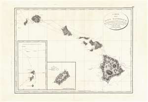
Carte des Iles Sandwich d'apres la reconnoissance qui en a ete faite dans les differentes relaches de la corvette La Decouverte et de sa conserve Le Chatham commandes par le Capt. Vancouver en 1792, 1793 et 1794.
sold
- Digital Map Information
- Suitable for large format printing
- DPI: 600
- File Size: 21.69 MB
- File Type: ZIP / TIFF
- ICC color profile embedded
- Delivered instantly via download link
This is a beautiful example of George Vancouver's seminal 1799 map of the Hawaiian Islands, considered the largest, most important, and most beautiful map of Hawaii to appear in the 18th century. George Vancouver first sighted Hawaii on January 18, 1778, when, as a midshipman on the HMS Discovery, consort ship to Captain James Cooks' HMS Resolution, becoming one of the first Europeans to see the idyllic island group. Despite Cook's having been killed by angry Hawaiian natives, Vancouver formed a good opinion of the both the archipelago and the Hawaiian people. Fourteen years later and captain of his own ship, George Vancouver chose the Hawaiian Islands as a winter base while exploring the Northwest Coast of America in search of the elusive Northwest Passage. During his three seasonal visits to the Hawaiian Islands, Vancouver and his Lieutenant Joseph Baker completed this, the first complete map of the archipelago. His route, which zigzags around and between the islands, is carefully noted and includes visits in 1792, 1793, and 1794. (more details)
Quite simply the largest, most beautiful, and most important early map of Hawaii ever published.
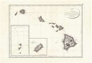
Carte des Iles Sandwich d'apres la reconnoissance qui en a ete faite dans les differentes relaches de la corvette La Decouverte et de sa conserve Le Chatham commandes par le Capt. Vancouver en 1792, 1793 et 1794.
sold
- Digital Map Information
- Suitable for large format printing
- Full resolution TIFF file
- ICC color profile embedded
- Delivered instantly via download link
This is a beautiful example of George Vancouver's seminal 1799 map of the Hawaiian Islands, considered the largest, most important, and most beautiful map of Hawaii to appear in the 18th century. George Vancouver first sighted Hawaii on January 18, 1778, as a midshipman on the HMS Discovery, consort ship to Captain James Cook's HMS Resolution, becoming one of the first Europeans to see the idyllic island group. Despite Cook's having been killed by angry Hawaiian natives, Vancouver formed a good opinion of the both the archipelago and the Hawaiian people. Fourteen years later and captain of his own ship, George Vancouver chose the Hawaiian Islands as a winter base while exploring the Northwest Coast of America in search of the elusive Northwest Passage. During his three seasonal visits to the Hawaiian Islands, Vancouver and his Lieutenant Joseph Baker completed this, the first complete map of the archipelago. His route, which zigzags around and between the islands, is carefully noted and includes visits in 1792, 1793, and 1794. (more details)