
Barber, Benoni Bissell (sold)

Benoni Bissell Barber (1798 - February 27, 1885) was a Hartford, Connecticut, based printer, bookseller, and publisher active in the first half of the 19th century. From 1822 to 1833, he partnered with David Franklin Robinson, as 'Barber and Robinson' to operate a small bookshop and bindery in Hartford. In 1833, he joined forces with Asaph Willard (1786 - 1880) to publish a map of the United States. This partnership was dissolved in 1835. Barber took on a new partner, William W. Reed (c. 1785 - 18??), in 1837. He reused and revised the plates from his early 'Barber and Willard' map of the United States to issued a new map under the imprint of 'Reed and Barber'. This map was issued in many editions form 1842 to 1855. While 'Barber and Reed' was based in Connecticut, Barber himself relocated to New York City sometime before 1850, where he is identified as a 'hotel-keeper' in the census. Sometime after 1870, he returned to Connecticut settling in Cromwell, where he died in 1885. (Thanks to Ashley Bayton-Williams for help researching Barber.)
Arguing the Texas Compromise of 1850. Mormons on Great Salt Lake.
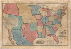
Map of the United States of America with its Territories and Districts. Including also a part of Upper and Lower Canada and Mexico.
sold
- Digital Map Information
- Suitable for large format printing
- File Size: 185.93 MB
- File Type: ZIP / TIFF
- ICC color profile embedded
- Delivered instantly via download link
A most intriguing unrecorded early 1850 variant of the Reed and Barber map of the United States reflecting a nation in flux. The map was issued to satisfy popular curiosity regarding the intensely debated newly acquired 'Mexican Cessions', as well as the new national and international borders. It illustrates ambiguity regarding the legislative arguments leading to the Compromise of 1850, which reshaped Texas into its modern configuration, Mormon settlement around Great Salt Lake, the changes brought about by the California Gold Rush, the Oregon Question, the Indian Territories, and more. (more details)
Arguing the Texas Compromise of 1850. Mormons on Great Salt Lake.
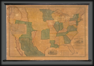
Map of the United States of America with its Territories and Districts. Including also a part of Upper and Lower Canada and Mexico.
sold
- Digital Map Information
- Suitable for large format printing
- DPI: 600
- File Size: 1774.84 MB
- File Type: ZIP / TIFF
- ICC color profile embedded
- Delivered instantly via download link
A most intriguing unrecorded early 1850 variant of the Reed and Barber map of the United States reflecting a nation in flux. The map was issued to satisfy popular curiously regarding the intensely debated newly acquired 'Mexican Cessions', as well as the new national and international borders. It illustrates ambiguity regarding the legislative arguments leading to the Compromise of 1850, which reshaped Texas into its modern configuration, Mormon settlement around Great Salt Lake, the changes brought about by the California Gold Rush, the Oregon Question, the Indian Territories, and more. (more details)