
Basire IV, James (sold)

James Basire IV (March 1796 – May 17, 1869) was an English engraver and lithographer active in London during the early to middle 19th century. James Basire was the fourth engraver of that name in a family dynasty dating to 1704. Much of Basire's business focused on the printing of maps and diagrams for parliamentary reports. Basire IV it notable for is disdain for steel engraving in favor of copper. In addition to engraving, he invested in a brick-making business that apparently went poorly leading to several bankruptcies between 1847 and 1853. His son, also James Basire V, apprenticed to him in 1836, but the family engraving business was lost in bankruptcy proceedings and the family never recovered. Basire V instead pursued a life in engineers and railroad work.
Rare map of the Virgin Islands with slave trade content, shipwrecks, and Necker Island!
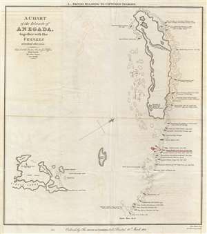
A Chart of the Island of Anegada, together with the Vessels wrecked thereon.
sold
- Digital Map Information
- Suitable for large format printing
- DPI: 300
- File Size: 4.13 MB
- File Type: ZIP / TIFF
- ICC color profile embedded
- Delivered instantly via download link
This is a rare 1825 map of Anegada Island, the northernmost of the British Virgin Islands, illustrating shipwrecks occurring between 1799 and 1823. This map was specifically prepared to illustrate the wreck of the Donna Paula , which is highlighted in red, a slave ... (more details)