
Becker, Francis Paul (sold)

Francis Paul Becker (fl. 1837 - 1861) was a British artist and engraver who founded F.P. Becker and Company. He also patented 'omnigraphy', a process by which individual letters were punched and not engraved into the plate.
One of the earliest maps of the colony of New Zealand.
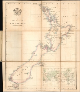
Map of the Colony of New Zealand from Official Documents.
sold
- Digital Map Information
- Suitable for large format printing
- File Size: 8.8 MB
- File Type: ZIP / TIFF
- ICC color profile embedded
- Delivered instantly via download link
This is a rare c. 1841 Smith, Elder and Company map of New Zealand issued soon after it became a British colony. Reduced from John Arrowsmith's May 2, 1841 map of the same title, this is among the earliest maps of the New Zealand colony. This Smith, Elder and Company edition was published by the New Zealand Company, as part of their efforts to promote settlement in the colony. Despite being derived from the first issue of Arrowsmith's map, the present work predates most examples of the Arrowsmith, which had a very long publication history. (more details)
One of the earliest maps of the colony of New Zealand.
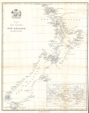
Map of the Colony of New Zealand from Official Documents.
sold
- Digital Map Information
- Suitable for large format printing
- DPI: 600
- File Size: 6.83 MB
- File Type: ZIP / TIFF
- ICC color profile embedded
- Delivered instantly via download link
This is a rare c. 1841 Smith, Elder and Company map of New Zealand issued soon after it became a British colony. One of the earliest maps of the New Zealand colony, the map depicts both the North and South Islands and labels several early settlements, including Auckland, New Plymouth, and Wellington. Although undated, the presence of Wellington solidifies that this map must have been produced after November 1840, when the directors of the New Zealand Company (whose crest adorns the title cartouche) decreed that the newly settled town at Lambton Harbor would henceforth be named after the Duke of Wellington, reflecting his support of the company’s principles of colonization. An inset map of the world in the lower right illustrates New Zealand's global location. (more details)