
Blackie and Sons (sold)

Blackie and Sons (1809 - 1991) was a Glasgow based publishing firm active from 1807 to 1991. The firm was established on November 20 1809 by John Blackie Sr. (1782 - 1874), Archibald Fullerton and William Sumerville as "Blackie, Fullerton and Company". Though trained as a weaver, Blackie envisioned a profitable business selling large books and novels by monthly subscription. Their first major publications appeared in 1811 and were subscription based religious and reference texts including several atlases. In 1931 Blackie bought out his partners and formally named the firm "Blackie and Son". While Blackie and Son had its main offices 7 Stanhope Street, Glasgow, it maintained subsidiary offices in London (6/18 William IV Street Charing Cross), Canada and India. In the next 100 years Blackie and Son grew into an enormous international publishing concern. Nonetheless, it remained a family business and was run by members of the Blackie family until it ceased publishing in 1991.
Map of North America with a view of the Niagara Falls.
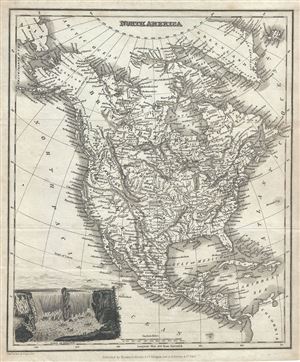
North America.
sold
- Digital Map Information
- Suitable for large format printing
- Full resolution TIFF file
- ICC color profile embedded
- Delivered instantly via download link
This is a nice 1834 map of North America by Blackie, Fullarton and Company. The map covers the entire North American continent from the Arctic Circle to the Isthmus of Panama, embracing all of Central America, Mexico, the United States, modern day Canada and ... (more details)
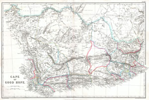
Cape of Good Hope.
sold
- Digital Map Information
- Suitable for large format printing
- File Size: 8.99 MB
- File Type: ZIP / TIFF
- ICC color profile embedded
- Delivered instantly via download link
An extremely attractive c. 1860 of South Africa and the Cape of Good Hope. Covers much of the southern top of Africa from S. Helena Bay and the Cape of Good Hope to 'Kaffir Land' in the east. This highly detailed map is most likely based on Edward Weller's ... (more details)