
Blaschnék Sámuel (sold)

Blaschnék Sámuel (1789 - November 21, 1854), also known as Blaschnek Sámuel Benjámin, was a Pest-based cartographer and surveyor of Silesian origin. His cartographic output primarily consisted of maps of Pest and environs along with a large and influential map of the Kingdom of Hungary prepared with Schedius Lajos, which was an update of the Lipszky János' 'Mappa Generalis Regni Hungariae…' prepared in the early 19th century. Aside from a handful of maps and his death date, little is known of his biographical details or work.
First Edition, First State of a later censured Map of Hungary.
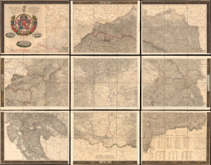
Magyar Ország, Horvát, Tót, Dalmát, és Erdély Országok, a tenger mellék és a végőri videkék kőzonséges pśták és útak főldabrosza... / Vollstaendige General Posten- und Strassen-Karte des Königreichs Ungran, der Königreiche Croatien, Slavonien, Dalmatien, des Grossfürstenth. Siebenbürgen, des Küstenlandes und der Militair-Grenze...
sold
- Digital Map Information
- Suitable for large format printing
- File Size: 591.44 MB
- File Type: ZIP / TIFF
- ICC color profile embedded
- Delivered instantly via download link
This is Blaschnék Sámuel and Schedius Lajos' lavish, very large-format bilingual (Hungarian-German) c. 1836 folding map of the Kingdom of Hungary, here in its first-edition first-state. It depicts the kingdom in the wake of the Napoleonic Wars, when it was in the midst of a reform movement, and represents the most detailed and up-to-date mapping of the kingdom in the first half of the 19th century. (more details)