
Boardman, Harvey (sold)

Harvey Boardman (October 14, 1833 - September 17, 1863) was an American surveyor and engineer in Griswold, Connecticut. The son of a wealthy farmer, it is likely that he was well educated, but we have no account of his particular training: accounts from 1857 have him surveying the White Mountains personally with an odometer, which suggests some expertise. He was acquainted with various important contemporaries in the surveying field, such as Arnold Guyot and the engraver J. H. Bufford. He was drafted into the Army in 1863 but refused to serve, believing that the Federal government had no constitutional power to prevent secession. He was arrested and imprisoned, first in Fort Trumbull in New London, and then Forrest Hall in Washington. The conditions of these prisons were both primitive and inhumane; Boardman died as a result in September of that year.
First edition of Boardman's important map.
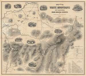
Map of the White Mountains New Hampshire from Original Surveys.
sold
- Digital Map Information
- Suitable for large format printing
- Full resolution TIFF file
- ICC color profile embedded
- Delivered instantly via download link
This is a first edition of Harvey Boardman's 1858 map of the White Mountains, New Hampshire. The remarkably useful map features roads, carriage ways, and summit trails throughout the presidential range as well as Mount Moriah, Mount Lafayette, Mount Willard, and Cannon Mountain. It notes the locations of public buildings, churches, mills, and hotels. It is attractively decorated with vignettes of public houses and hotels throughout the region, naming their proprietors. Two tables in the lower right allow easy calculation of distances between lodgings, making it relevant to the traveler. While Boardman is known to have surveyed the distances of the roads on his maps personally - contemporary reports have him trekking about the mountains with an odometer - he relied on the 1853 work of George Bond for elevations. (more details)
A Beautifully Engraved, Practical Tourists Map of New Hampshire's White Mountains
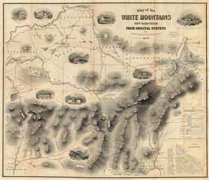
Map of the White Mountains New Hampshire from Original Surveys.
sold
- Digital Map Information
- Suitable for large format printing
- File Size: 33.25 MB
- File Type: ZIP / TIFF
- ICC color profile embedded
- Delivered instantly via download link
This is Harvey Boardman's 1859 map of the White Mountains, New Hampshire. The remarkably useful map features roads, carriage ways and summit trails throughout the presidential range as well as Mount Moriah, Mount Lafayette, Mount Willard and Cannon Mountain. It notes the locations of public buildings, churches, mills and hotels. It is attractively decorated with vignettes of public houses and hotels throughout the region, naming their proprietors. Two tables in the lower right-hand corner allow easy calculation of distances between lodgings in the area, making it particularly relevant to the tourist traveler relying on such dwellings. While Boardman is known to have surveyed the distances of the roads on his maps personally - contemporary reports have him trekking about the mountains with an odometer - he relied on the 1853 work of George Bond for the mountain elevations marked on the map, with few deviations. (more details)
Boardman's important map of the White Mountains - with striking arsenic-green covers.
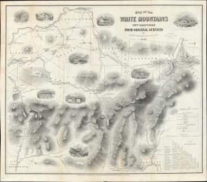
Map of the White Mountains New Hampshire from Original Surveys.
sold
- Digital Map Information
- Suitable for large format printing
- Full resolution TIFF file
- ICC color profile embedded
- Delivered instantly via download link
This is a first edition of Harvey Boardman's 1858 map of the White Mountains, New Hampshire. The remarkably useful map features roads, carriage ways, and summit trails throughout the presidential range as well as Mount Moriah, Mount Lafayette, Mount Willard, and Cannon Mountain. It notes the locations of public buildings, churches, mills, and hotels. It is attractively decorated with vignettes of public houses and hotels throughout the region, naming their proprietors. Two tables in the lower right allow easy calculation of distances between lodgings, making it relevant to the traveler. While Boardman is known to have surveyed the distances of the roads on his maps personally - contemporary reports have him trekking about the mountains with an odometer - he relied on the 1853 work of George Bond for elevations. (more details)