
Bodley, Helen Gertrude (sold)

Helen Gertrude Bodley (November 15, 1906 - January 19, 1997) was an American artist. Born in Boston to English immigrant parents, Bodley attended the Museum School of Boston. She published a pictorial map of Concord, Massachusetts, in 1928. In the summer of 1936 she was commissioned to paint portraits of the children at the Nursery Training School of Boston as a fundraiser for the school. She died in Seattle, Washington, on January 19, 1997. Little else is known about her life or her artistic career.
Evokes the earliest history of Concord, Massachusetts.
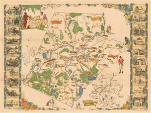
A Map of Concord. The Old Musketaquid Plantation.
sold
- Digital Map Information
- Suitable for large format printing
- Full resolution TIFF file
- ICC color profile embedded
- Delivered instantly via download link
This is a 1928 Helen Bodley pictorial map of Concord, Massachusetts. Depicting the town of Concord and its environs, Bodley provides an intriguing blend of the historical and the modern. Numerous American Revolutionary War references appear. One near Peter's Field states that it is the 'Birthplace of American Liberty April 19, 1775.' Other illustrations mark where the colonials ate breakfast the morning of the Battle of Lexington and Concord, and a trail of footprints marks the Colonial Army's path to intercept the British soldiers at Merriam's Corner on their way back to Boston. A minuteman and a British redcoat look at each other along the right side, perhaps the most obvious Revolutionary War illustration. Sites around Concord are identified as well, including the library, armory, the Concord Country Club. Branches of the New York, New Haven, and Hartford Railroad run through the area. Vignette views of historic houses and other important buildings create the left and right borders, yet another way Bodley brings the historical into the modern mindset. (more details)
Evokes the earliest history of Concord.
A Map of Concord. The Old Musketaquid Plantation.
sold
- Digital Map Information
- Suitable for large format printing
- Full resolution TIFF file
- ICC color profile embedded
- Delivered instantly via download link
This is a 1928 Helen Bodley pictorial map of Concord, Massachusetts. The map celebrates Concord's Revolutionary War history and many surviving historic homes. (more details)
Evokes the earliest history of Concord.
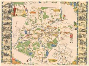
A Map of Concord. The Old Musketaquid Plantation.
sold
- Digital Map Information
- Suitable for large format printing
- Full resolution TIFF file
- ICC color profile embedded
- Delivered instantly via download link
This is a 1928 Helen Bodley pictorial map of Concord, Massachusetts. Depicting the town of Concord and its environs, Bodley provides an intriguing blend of the historical and the modern. Numerous American Revolutionary War references appear. One near Peter's Field states that it is the 'Birthplace of American Liberty April 19, 1775.' Other illustrations mark where the colonials ate breakfast the morning of the Battle of Lexington and Concord, and a trail of footprints marks the Colonial Army's path to intercept the British soldiers at Merriam's Corner while on their way back to Boston. A minuteman and a British redcoat look at each other along the right side. Sites around Concord are identified as well, including the library, armory, the Concord Country Club. Branches of the New York, New Haven, and Hartford Railroad run through the area. Vignette views of historic houses and other important buildings create the left and right borders, yet another way Bodley brings the historical into the modern mindset. (more details)