
Bradley, William M. (sold)

William M. Bradley (fl. 1880 - 1900) was a late 19th century map publisher. The Bradley family were active cartographic publishers whose imprint appears on a number of maps, geographies and atlases. The Bradley firm is best known for its publishing of S. A. Mitchell's important New General Atlas from 1880 - 1887.
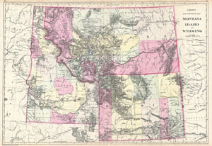
County and Township Map Montana Idaho and Wyoming.
sold
- Digital Map Information
- Suitable for large format printing
- File Size: 13.07 MB
- File Type: ZIP / TIFF
- ICC color profile embedded
- Delivered instantly via download link
This is the rare 1884 Bradley / Mitchell map of Montana, Idaho, and Wyoming. Covers the territories of Montana, Wyoming, and Idaho in considerable detail with color coding according to counties. Shows American Indian lands, geological formations, forts, cities, ... (more details)