This item has been sold, but you can get on the Waitlist to be notified if another example becomes available.
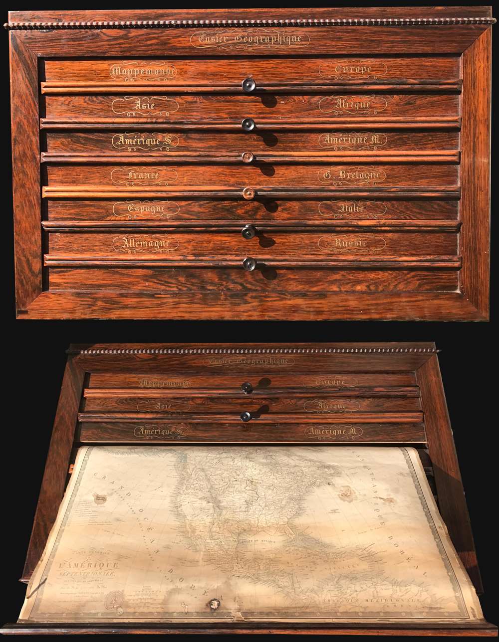
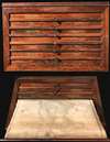
1840 Brué and Picquet Gentleman's Rosewood Map Cabinet w/12 maps
CaiserGeographique-brue-1840$4,500.00


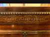

Title
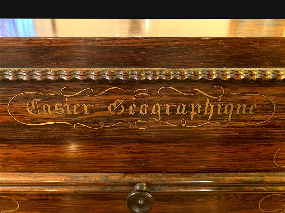
Caiser Géographique.
1840 (dated) 26 x 17 in (66.04 x 43.18 cm)
1840 (dated) 26 x 17 in (66.04 x 43.18 cm)
Description
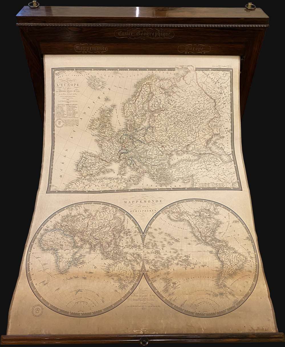
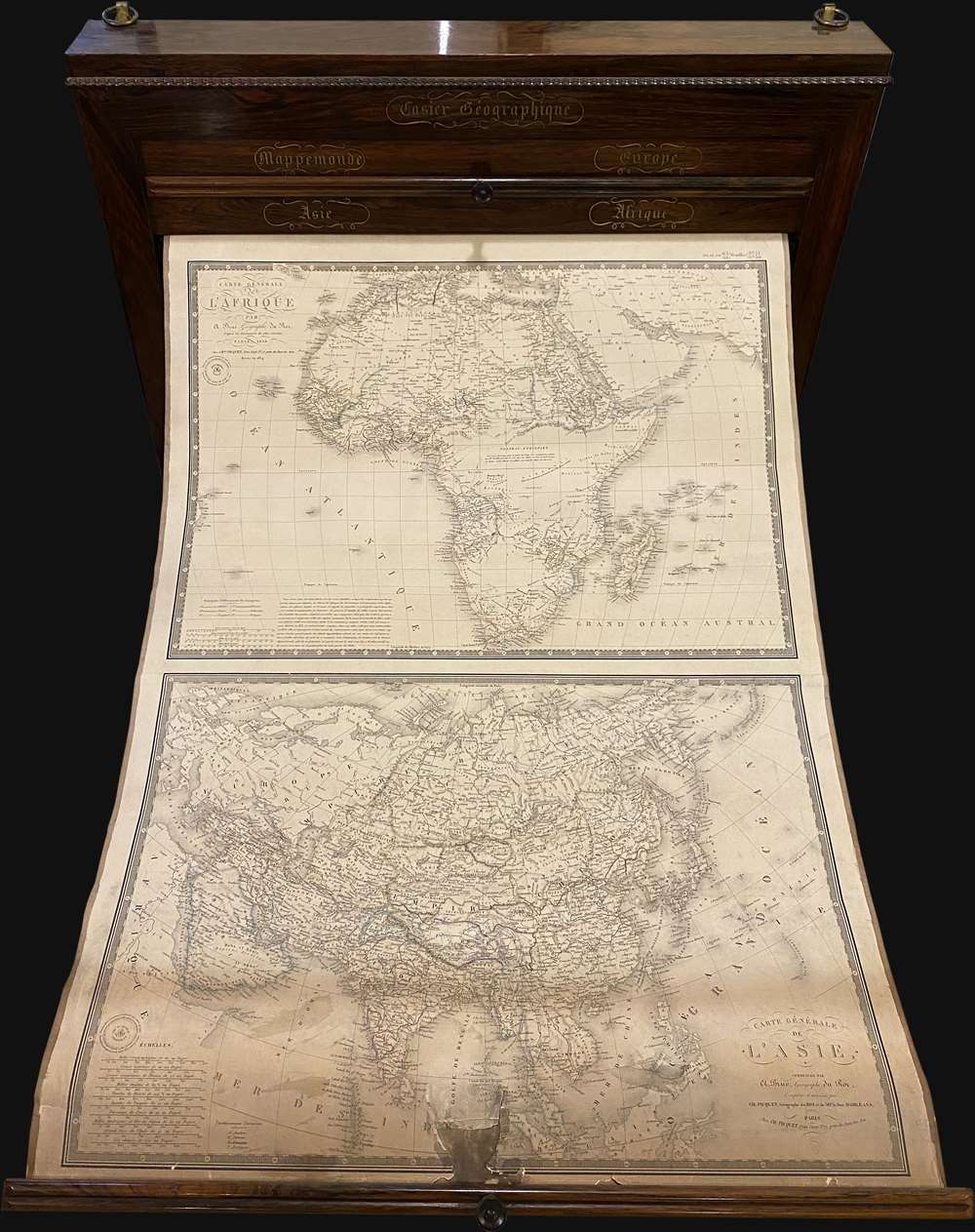
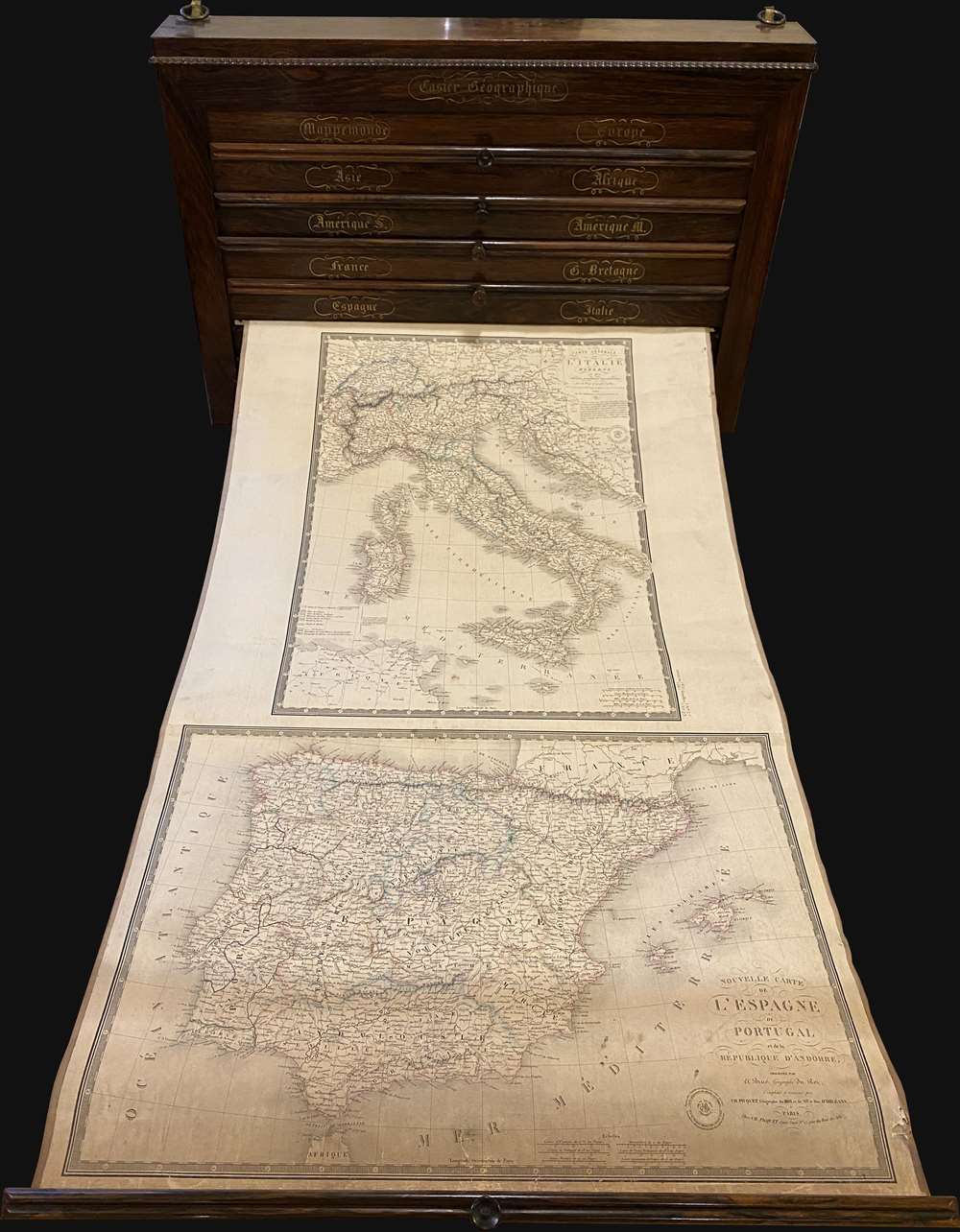
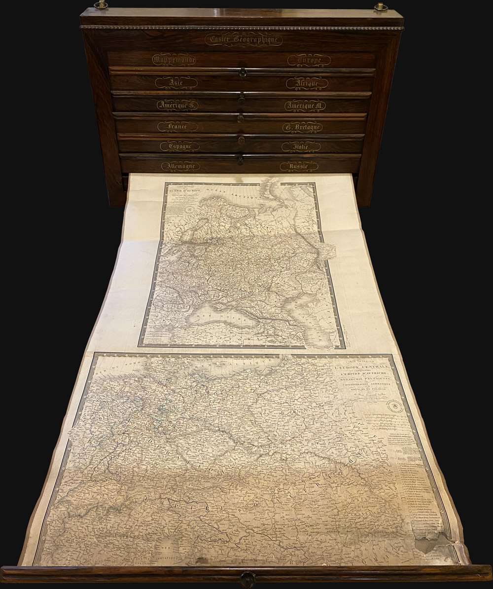
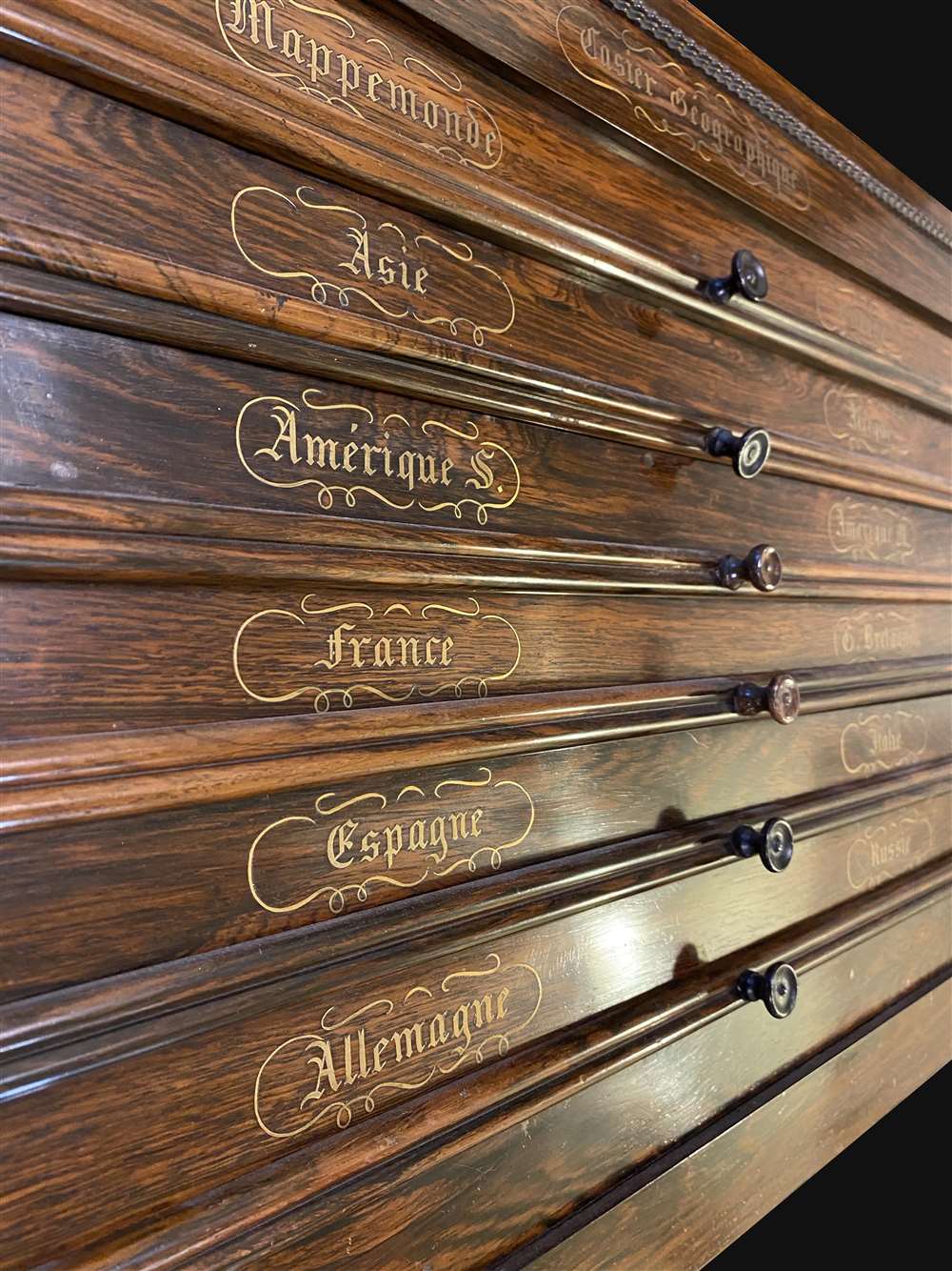
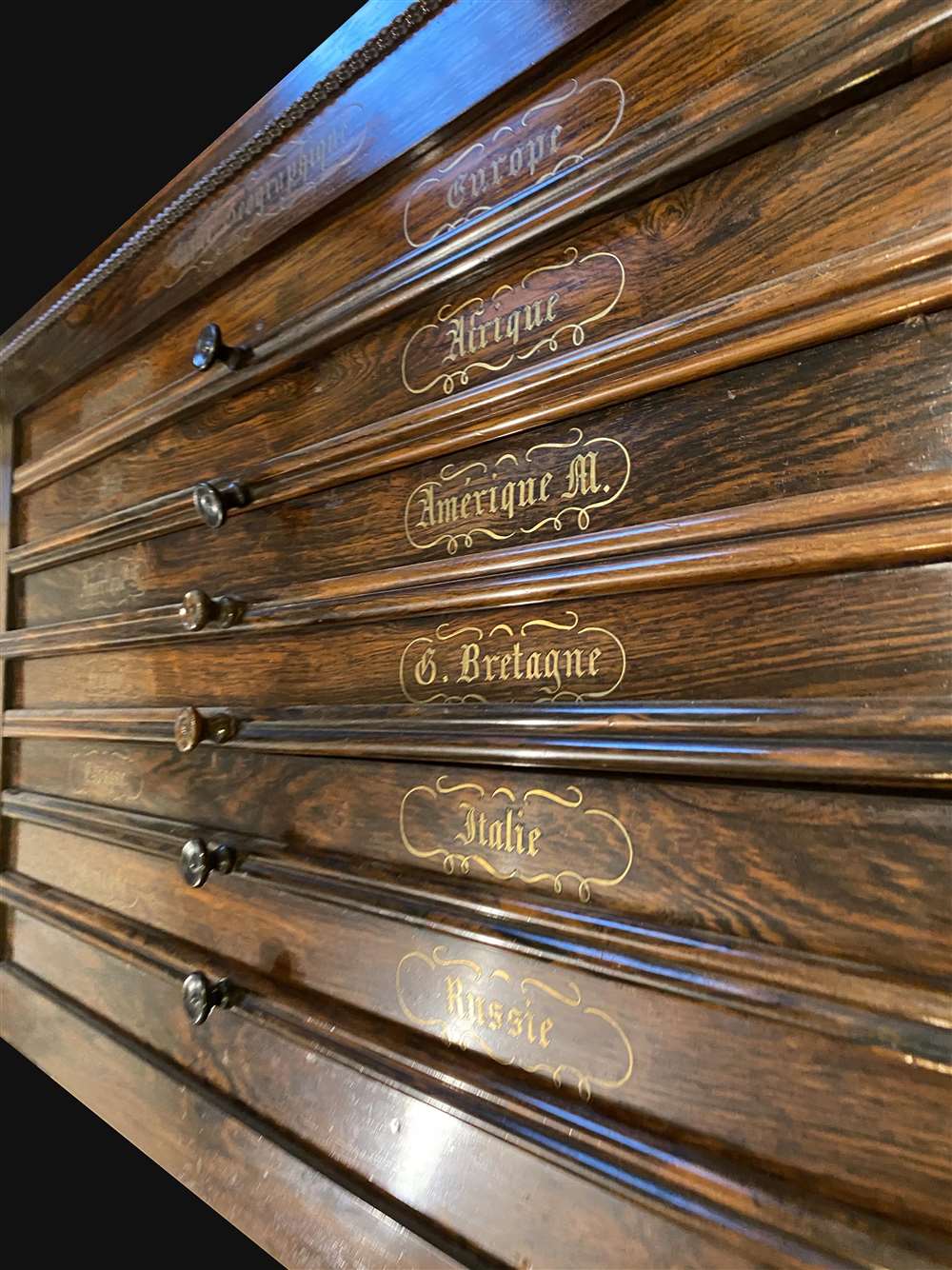
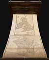
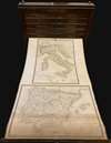
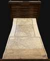
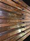
The Caiser Géographique or 'Geographical Locker' was issued by Charles Picquet and A. Brue. This wall mountable atlas is constructed of solid rosewood with masterful brass inlay. The box contains six spring loaded pulls, each attached to two maps, for a total of 12 maps. The maps are mounted on linen and can be pulled out and returned to the case by turning little wooden knobs on the right side of the case.
The Caiser Géographique was a somewhat unique cartographic innovation. It was designed with fine woods and exceptional workmanship to grace the gentleman's library. To our knowledge, only Brue/Picquet issued these cabinets. The earliest appeared around 1820 in somewhat baroque French Empire sthle. The present example, with brass inlay and a more streamlined ethic, appears to have been issued in 1840 based upon the dating of the individual maps.
The maps were designed by Adrien-Hubert Brué and Charles Picquet. They are all dated 1840 and reflect the most recent geography. The North America map, for example has been updated to include the Republic of Texas. In general, the maps are in good condition, with some chipping to a few, and some staining to the North America map, as seen here. We are aware of only 2 other surviving examples, both in private hands.On a personal note, the Caiser Géographique first came to my attention shortly after I started as a rare map dealer nearly 20 years ago. I found one in the flea markets of Paris, where the vendor, who wanted 5000 USD for it, refused to show it to me because I was, in his words, an enfant Américain stupide. Needless to say, I passed on that example, but have wanted one ever since. If found this one just recently. With so much time having passed, it is unclear if is the same case, or a different one by the same maker.
The Caiser Géographique was a somewhat unique cartographic innovation. It was designed with fine woods and exceptional workmanship to grace the gentleman's library. To our knowledge, only Brue/Picquet issued these cabinets. The earliest appeared around 1820 in somewhat baroque French Empire sthle. The present example, with brass inlay and a more streamlined ethic, appears to have been issued in 1840 based upon the dating of the individual maps.
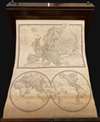
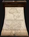
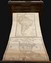
The maps were designed by Adrien-Hubert Brué and Charles Picquet. They are all dated 1840 and reflect the most recent geography. The North America map, for example has been updated to include the Republic of Texas. In general, the maps are in good condition, with some chipping to a few, and some staining to the North America map, as seen here. We are aware of only 2 other surviving examples, both in private hands.
CartographerS
Adrien-Hubert Brué (1786 – July 16, 1832) was a French cartographer active in the late 18th and early 19th centuries. Brué served on various ships from age 12. At 14 he was commissioned to the crew of the Naturalist, one of the two ships in Baudin Expedition (1800 – 1804) to the South Pacific. Later in life, Brué turned to cartography where his work was known for remarkable clarity and accuracy. Brué eventually acquired the prestigious office of Geographe du Roi and often signed his maps as such. In this position Brué contributed to thousands of maps and numerous atlases. Like most cartographers, many of his maps were published posthumously. His widow published several maps in 1834, before selling out to Brué's erstwhile partner, Charles Picquet's son and heir, Pierre-Jacques Picquet. Brue's maps were still being updated and republished decades after his death. More by this mapmaker...
Charles Picquet (April 15, 1771 – January 15, 1827) was a French cartographer active in Paris during the Napoleonic and post-Napoleonic Eras. Picquet was born in Romagna-sous-Montfaucon, Meuse, France. From about 1798 Picquet supplied maps to the Dépôt de la Guerre. From 1806 he was appointed to Napoleon's Cabinet Topographique. Being politically dexterous, he was able to retain this position after the fall of Napoleon under both Louis XVIII and Charles X. Under Louis XVIII he also obtained the Brevet de Géographe Ordinaire du Cabinet Topographique. He worked with the cartographer Adrien-Hubert Brué on a major atlas project. When Charles Picquet died in 1827, his son, Pierre-Jacques Picquet, continued to publish under his father's imprint name well into the middle part of the 19th century. Learn More...
Condition
Very good. Small piece of top molding missing, upper left side. Maps vary in condition with some exhibiting staining and light chipping, but all are intact and on their original linen. Some of the spring mechanisms need minor adjusting, but still work.