
Bruguière, Louis (sold)

Louis Bruguière (fl. c. 1820 - 1835) was a French mountaineer and geologist active in Europe in the first half of the 19th century. Bruguière is best known for his geological classification tables for the Alps which he laid out in his famous book, Orographie de l'Europe. He was a friend and correspondent of Alexander von Humboldt. In the 1830s he produced a series of 'Tableau Comparatif' charts for the publisher Andriveau-Goujon.
Comparative cartography.
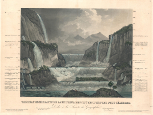
Tableau Comparatif de la Hauteur des Chutes d'Eau Les Plus Célèbres.
sold
- Digital Map Information
- Suitable for large format printing
- Full resolution TIFF file
- ICC color profile embedded
- Delivered instantly via download link
A striking c. 1835 comparative chart illustrating the world's most famous waterfalls. The chart, in the 'Tableau Comparatif' model, sets the world's greatest waterfalls, as understood in the early 19th century, in sharp contrast with one another. (more details)