
Calapoda, Giorgio Sideri (sold)

Giorgio Sideri, also known as Calapoda (fl. 1537–1565) was a Cretan cartographer, though he lived and worked in Venice. His surviving navigational and hydrographical work is wholly manuscript, dating between 1537 to 1565; he authored no printed work. His manuscript of his home island provided the basis for virtually every map of Crete produced in the 17th and early 18th century. His most recently famous work was a 1541 manuscript copy of a fifteenth-century portolan chart by Fra Mauro, not known to have survived in any other form.
A Classic Dutch Map of Crete.
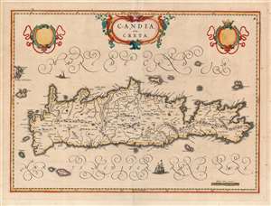
Candia olim Creta.
sold
- Digital Map Information
- Suitable for large format printing
- Full resolution TIFF file
- ICC color profile embedded
- Delivered instantly via download link
This is Joan Blaeu's map of the island of Crete, in its first edition. It was prepared for the 1640 Latin edition of the Blaeu Atlas Novus. Blaeu's map follows the work of Georgio Sideri Calapoda (fl. c. 1537 - 1565), also used by Ortelius, Mercator, and Hondius. The primacy of Calapoda's manuscripts was not misplaced: as a denizen of Crete, he knew the island and its history well. His model for the mapping of the island superseded the 1513 Waldseemüller model. The place names here reproduce those as they appeared in Jodocus Hondius' Candia cum Insulis Aliquot Graeciam, but Blaeu's fine engraving improves greatly in terms of legibility and brightness. (So far improved was Blaeu's version that Jan Jansson would copy it faithfully for his 1644 Candia olim Creta. (more details)