
Carolus, Joris (sold)

Joris Carolus (c. 1566 - c. 1636) was a Dutch cartographer, explorer, navigator, and soldier. He is thought to have been a native of Enkhuizen, in the Netherlands. Nothing is known of his youth, but he served as a soldier in the Eighty Years War, losing a leg at the Siege of Ostend (1601–04.) Contemporaries thereafter referred to him as 'Wooden Leg.' He survived the loss, and went on to learn the art of navigation, becoming a pilot for both the Noordsche Compagnie and the Vereenigde Oost-Indische Compagnie. In 1614 in the service of the Noordsche Compagnie he took part in an expedition to Spitsbergen, during which he produced a map of the islands which would remain the standard Dutch map of the newly discovered coastlines for many years. Carolus claimed to have reached 83° N during this voyage. The following year the Noordsche Compagnie sent him to the Davis Strait region - where he claimed to have sailed to the (impossible) latitude of 80° N. The chart of this voyage is now lost, but Carolus described Baffin Bay later, saying it extended to 79° N and was enclosed by land. in 1617 he was sent out again and claimed to have discovered New Holland and Opdams Island, about twenty miles east of Iceland. His travels appear to have taken him more than a few times to Iceland, and his synthesis of Ortelius' and Mercator's maps of the island would become the dominant depiction of it beginning in 1630. When age and infirmity caught up with him, he became a teacher of navigation in Amsterdam, publishing a book of charts to supplement this (the extremely rare Het nieuw vermeerde Licht, ghenaemt de Sleutel van’t Tresoor, Spiegel, Gesicht, ende vierighe Colon des Grooten Zeevaerts).
Dominant 17th-century map of Iceland.
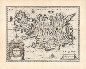
Tabula Islandiae Auctore Georgio Carolo Flandro.
sold
- Digital Map Information
- Suitable for large format printing
- DPI: 600
- File Size: 56.08 MB
- File Type: ZIP / TIFF
- ICC color profile embedded
- Delivered instantly via download link
This is Willem and Joan Blaeu's 1644 map of Iceland, among the most influential and widely copied 17th-century maps of the island. (more details)
Stunning example of the dominant 17th century map of Iceland.
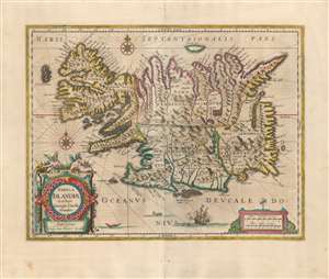
Tabula Islandiae Auctore Georgio Carolo Flandro.
sold
- Digital Map Information
- Suitable for large format printing
- Full resolution TIFF file
- ICC color profile embedded
- Delivered instantly via download link
This is a superb example of Willem and Joan Blaeu's map of Iceland, among the most influential and widely-copied seventeenth century maps of the island. It was engraved in 1628 by Jodocus Hondius the younger, who credited the map to Joris Carolus. Carolus was a noted Dutch navigator and explorer whose extensive travels to Spitzbergen, Davis Strait and other islands of the North Atlantic - and whose own exaggerations of the extent of those travels - established him as an authority on the northern oceans. Carolus' travels did take him to Iceland more than once, but it may be that Hondius used the navigator's name specifically in order to incorporate the navigators' authority without necessarily relying on any information from him. (more details)