
Géronimo de Chaves (sold)

Géronimo de Chaves,(1523-1574) was a Spanish cartographer, best known as the author of the first atlas map of Florida. His father, Alonso de Chaves, was examiner of pilots at the Casa de Contratacion (officially, La Casa y Audiencia de Indias.) This was the Spanish bureaucracy established by the Crown of Castile in 1503 to administer all matters pertaining to Spain's overseas empire. Its domain included the training of navigators and pilots, and the creation of maps and charts. Géronimo would follow his father in service to the Casa but as Chair of Cartography. It is not known how or precisely when his map passed from Spain to reach Ortelius in Antwerp, but since it did not reach print until ten years after Chaves' death it may be that it was allowed out of the country as obsolete.
First Specific Printed Maps of Florida and Peru.
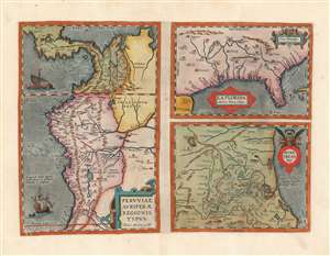
Peruviae Auriferae Regionis Typus./ La Florida./ Guastecan.
sold
- Digital Map Information
- Suitable for large format printing
- DPI: 600
- File Size: 53.05 MB
- File Type: ZIP / TIFF
- ICC color profile embedded
- Delivered instantly via download link
This is a beautiful, wide-margined example of Ortelius' 1584 engraving, including the first specific map of Florida, the earliest specific map of Peru, and the first map focusing on the Guastecan province of Mexico. The map is a prime example of Ortelius' strength not only as a mapmaker but also as a compiler. All these maps combined here are relevant to each other in that they all derive from Spanish sources, and reveal parts of the Spanish Empire in America, despite Spain forbidding the production and dissemination of such maps. That two of these maps credit specific Spanish sources suggests that Ortelius enjoyed an open connection with a member of the Spanish bureaucracy. Antwerp was part of the Spanish Empire at the time, but it is certainly testimony of Ortelius's far-reaching network of contacts throughout Europe that he was able to obtain maps such as these for publication. (more details)
Home Ports of the Spanish Treasure Fleet.
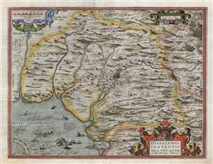
Hispalensis Conventus Delineatio Auctore Hieronÿmo Chiaves.
sold
- Digital Map Information
- Suitable for large format printing
- DPI: 600
- File Size: 45.23 MB
- File Type: ZIP / TIFF
- ICC color profile embedded
- Delivered instantly via download link
This is an attractive, first state example of Abraham Ortelius' 1581 map of Seville and its surroundings, Andalusia, Spain. This map details the most crucial home ports of the Spanish Empire, based on the report of Geronimo de Chavez, the chief geographer of Spain's Casa de Contratación at the peak of its power. It centers on a pictorial representation of the walled city of Seville and its cathedral on the Guadalquivir River. The vital port and city of Cadiz, home port of the Spanish treasure fleet, appears at bottom center. The region's mountainous terrain is dramatically and artfully depicted. Off the coast of Cadiz a sea battle rages, while hungry sea monsters prowl the waters. (more details)
Home Ports of the Spanish Treasure Fleet.
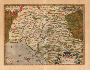
Hispalensis Conventus Delineatio Auctore Hieronÿmo Chiaves.
sold
- Digital Map Information
- Suitable for large format printing
- Full resolution TIFF file
- ICC color profile embedded
- Delivered instantly via download link
This is an attractive, original color example of Abraham Ortelius' 1581 map of Seville and its surroundings, Andalusia, Spain. This map details the most crucial home ports of the Spanish Empire, based on the report of Geronimo de Chavez (1523 - 1574), the chief geographer of Spain's Casa de Contratación at the peak of its power. It centers on a pictorial representation of the walled city of Seville and its cathedral on the Guadalquivir River. The vital port and city of Cadiz, home port of the Spanish treasure fleet, appears at bottom center. The region's mountainous terrain is dramatically and artfully depicted. Off the coast of Cadiz a sea battle rages, while hungry sea monsters prowl the waters. (more details)