
Clouet, Jean Baptiste Louis (sold)

Jean Baptiste Louis Clouet (c. 1730 - 1790) was a French cartographer active in the mid to late 18th century. Clouet, who held the post of Royal Geographer of the Academie des Sciences de Rouen, had offices in Paris and Cadiz. Clouet's most important work is his Geographie Moderne, which was published in various editions from 1776 - 1793. Clouet also produced a series of stunning and highly decorative wall maps depicting the various continents.
Magnificent 18th century wall map of Europe.
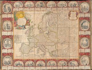
Carte D'Eurpe Divisee En ses Empires et Royaumes.
sold
- Digital Map Information
- Suitable for large format printing
- DPI: 300
- File Size: 77.43 MB
- File Type: ZIP / TIFF
- ICC color profile embedded
- Delivered instantly via download link
A large and impressively decorative 1776 case map or pocket map of europe by Jean Baptiste Louis Clouet. Clouet's map covers all of europe from Spain to the Ural Mountains and from Nova Zembla and the Arctic Ocean to North Africa, Turkey, and Persia. It includes ... (more details)
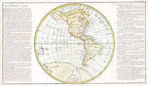
De L'Amerique en General..
sold
- Digital Map Information
- Suitable for large format printing
- Full resolution TIFF file
- ICC color profile embedded
- Delivered instantly via download link
This is a beautifully hand colored 1785 map of North America and South America. The cartography of the North America west coast is conjectural at best, with islands, inland seas, and hopeful northwest passages in abundance. The Antarctic regions are depicted in ... (more details)