
Coninck, Louis de (sold)

Louis de Coninck (February 24, 1788 - January 28, 1840) was a Danish sea captain active in the first half of the 19th century. Coninck was the son of Frédéric de Coninck (1740 - 1811) and Marie de Joncourt (1747 - 1821), a wealthy family of Dutch extraction who controlled a prosperous shipping business. Louis de Coninck was born in Copenhagen. He produced several important Danish nautical charts.
Scarce Danish blueback chart of the Öresund Strait (The Sound).
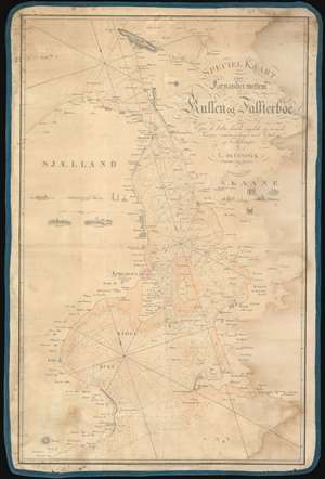
Speciel Kaart over Farvandet mellem Kullen og Falsterboe.
sold
- Digital Map Information
- Suitable for large format printing
- DPI: 600
- File Size: 61.42 MB
- File Type: ZIP / TIFF
- ICC color profile embedded
- Delivered instantly via download link
A very attractive 1830 blueback nautical chart or maritime map illustrating the waters around Copenhagen, and the Öresund Strait (The Sound) between Denmark and Sweden. Along the coastline Danish towns and villages are illustrated using tiny vignettes, presumably somewhat accurate to fact. There are several additional vignettes illustrating prominent castles, churches, villages, and estates. Unlike most early blueback charts, the present chart exhibits old color to distinguish between land and sea. This is a working sea chart and bears signs of use, including pen annotations relating to shipboard triangulation work. (more details)