
Cupet, Pierre Paul (sold)
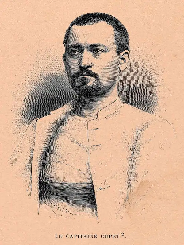
Pierre Paul Cupet (June 1, 1859 - 1907) was a French cartographer, photographer, and military officer. Cupet was born in Sermaize-les-Bains, Marne, the son of a local gendarme. At 18, with a thirst for adventure, he entered the École Spéciale Militaire de Saint-Cyr, where he exhibited aptitude at surveying and cartography. He left Saint-Cyr as lieutenant and was immediately sent with the Zouaves (light infantry) to Algeria. Afterwards, now a Captain of the 3rd Zouaves, he was sent to French Indochina where he participated in the Tonkin Campaign (1884 - 1885). From July 1887, he was part of the Franco-Siamese Commission organized to settle border between French Indochina and its neighbors. He became a close confident of Auguste Jean-Marie Pavie (May 31, 1847 - June 7, 1925) and participated in several of the 'Missions Pavie', where he was responsible for cartography. He was also a hobbyist photographer, and recorded friends, locals, and sights from his journeys. He returned to France to become battalion commander in the 56th Zouaves and then lieutenant colonel in 158th Zouaves. Was made an office of the Légion d'Honneur in 1905. He died in Montmeyran, in the Drôme, in 1907.
First scientific map of Laos.
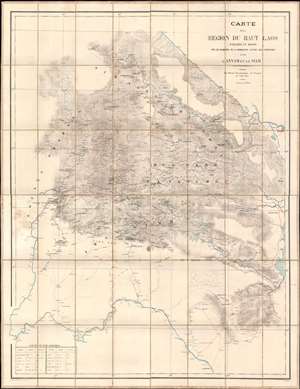
Carte de al Région du Haut Laos Explorée en 1888-1889 par les Membres e a Comission d'Etude des Frontieres entre L'Annam et le Siam.
sold
- Digital Map Information
- Suitable for large format printing
- Full resolution TIFF file
- ICC color profile embedded
- Delivered instantly via download link
Considered the first scientific survey of Laos, this seminal map was published immediately following the 1889 completion of the second Mission Pavie - the expedition that laid the groundwork for the French Protectorate in Laos. The map is signed by its creator, Auguste Jean-Marie Pavie, and dedicated to 'Monsieur Piquet', referring to Georges Jules Piquet (1839 - 1923), Gouverneur Général of French Indochina from 1888 - 1889, under whose auspices the Second Mission Pavie was undertaken. It further features manuscript content by another mission participant, Victor-Alphonse Massie (1854 - 1892), recommending the placement of a border watch post. The map further notes, in manuscript, Nam Youm (Laos), where the White Tai bandit leader Đèo Văn Trị, was then active. This map is significant on many levels: first as the result of one of the most extraordinary missions of exploration undertaken in Southeast Asia; second, as the first scientific survey of what is today northern Laos; third; as the underpinning of subsequent French Protectorate in Laos; fourth, as the personal copy owned by the Gouverneur Général of French Indochina who ordered the 2nd Mission Pavie. (more details)