
Darby, William (sold)

William Darby (August, 14 1775 – 1854) was a prominent American surveyor and mapmaker active in the United States during the first half of the 19th century. Of Irish descent, Darby was born in Pennsylvania one year before the outbreak of the Revolutionary War. His family relocated to Ohio where Darby grew up. In 1799 he moved to Natchez to establish himself as a cotton planter. It must have been around his time what he taught himself surveying, as his earliest survey work to about 1804 and includes commercial surveys in Attakapas County, Louisiana. A fire in that year destroyed much of his plantation and forced him into financial ruin. He subsequently took a commission as Deputy Surveyor for the United States General Land Office. During the War of 1812 he served under Andrew Jackson as a cartographer. Darby is best known for his important map of Louisiana, published by John Melish in 1816, the first and most influential map of the state to date. For this he is considered the 'Father of Louisiana geography.' He also worked to survey the American-Canada border after the War of 1812. Among his more important surveys are the first accurate maps of Lake Ponchartrain and the Sabine River. In all he claims to have covered some 20,000 miles doing survey work. Around 1838 he took a position as professor of history, geography, and astronomy at Jefferson College in Cannonsburg Pennsylvania. Two years later he moved to Washington D.C. From 1842 to 1854, when he died, Darby worked as a clerk in the General Land Office.
Superb early 19th century map arguing for U.S. annexation of Texas and encouraging westward migration into the newly acquired Louisiana Territory.
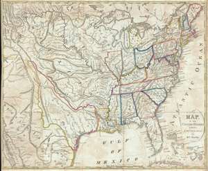
A Map of the United States Including Louisiana.
sold
- Digital Map Information
- Suitable for large format printing
- DPI: 300
- File Size: 13.66 MB
- File Type: ZIP / TIFF
- ICC color profile embedded
- Delivered instantly via download link
A fascinating 1818 map of the United States by William Darby. Intended for use by emigrants migrating westward in the early 19th century, this map covers from the Great Salt Lake (Lake Timpanagos) to the Atlantic seaboard and from Lake of the Woods to Cuba and ... (more details)