
Dawson, Edward B. (sold)

Edward B. Dawson (fl. c. 1820 - 1830) was an American engraver active in Philadelphia during the middle part of the 19th century. Dawson engraved extensively for the mapmaking firm of Henry Schenck Tanner (1786 - 1858).
One of the first large-scale maps o the United States made by Americans for Americans.
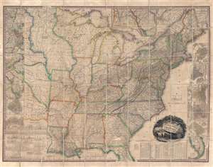
United States of America.
sold
- Digital Map Information
- Suitable for large format printing
- DPI: 600
- File Size: 144.44 MB
- File Type: ZIP / TIFF
- ICC color profile embedded
- Delivered instantly via download link
This, the first edition of Henry Schenck Tanner's 1829 wall map of the United States, is one of the most important American maps of the 19th century. With this important map Tanner initiated a new age of quintessentially American cartography. Unlike his predecessors, John Melish and Matthew Carey, Tanner was born and raised in the United States, and his maps are uniquely American productions, embracing American values and interests. Note the cartouche, with two deer grazing in a dense forest, while in the background three miniscule trains steam westward - a fitting metaphor for the United States, at the time undergoing brisk industrialization fueled by unlimited natural resources. Within the historical context, this map follows the territorial acquisitions of the 1819 Adams-Onís Treaty (Florida, Oregon?), but predates the major expansions in the southwest following the Mexican-American War (1846 - 1848) and the Treaty of Guadalupe-Hidalgo (1848). (more details)
World - from the American Perspective.
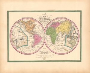
A New Map of the World in the Globular Projection.
sold
- Digital Map Information
- Suitable for large format printing
- File Size: 9.29 MB
- File Type: ZIP / TIFF
- ICC color profile embedded
- Delivered instantly via download link
This is the 1846 first edition of S. Augustus Mitchell's double-hemisphere world map. (more details)