
De Mayne, Anthony (sold)

Anthony De Mayne (c. 1790 - 1828) was a Royal Navy officer and hydrographer active in the early 19th century. De Mayne achieved the rank of Master on July 31, 1806. His earliest known surveys date to 1811, when he was assigned to the west coast of Africa on the Amelia and produced surveys of the coast from the River Gambia to Cape Lopez. Then, he was sent to North America, where he completed influential surveys of the American coast from the Chesapeake Bay to St. Augustine. Around this time he also caught the attention of Thomas Hurd, head Hydrographer of the British Admiralty from 1808 - 1823, who admired his hydrographic skills and who was eager to support his rise in rank. Subsequently, on the Royal Navy schooner Kangaroo, he conducted surveys in the West Indies, including in and around Cuba, the Bahamas, Florida, Jamaica, and Belize. When the Kangaroo was recalled to England in 1827, De Mayne was left behind in the Bahamas, possibly due to illness. He died there a year later.
Manuscript Whaler's Annotations in Gulf of Mexico.
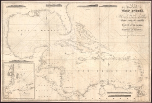
Blachfords, New General Chart of the West Indies, Including the Caribee and Virgin Islands, Porto Rico, St. Domingo, Jamaica and Cuba. The Windward Passages gulfs of Florida and Mexico, Bay of Honduras, And Coast of Colombia Compiled from the best Authorities, Including the surveys of Mr. A. de Mayne R.N., Mr. Lockwood etc.
sold
- Digital Map Information
- Suitable for large format printing
- File Size: 113.86 MB
- File Type: ZIP / TIFF
- ICC color profile embedded
- Delivered instantly via download link
A spectacular 1838 / 1843 Blachford blueback nautical map of the West Indies, including Florida, the Gulf of Mexico, the Caribbean, and Central America. This beautiful map features pencil manuscript annotations in the Gulf of Mexico that strongly suggest whaling. (more details)