
Deposito Topografico (sold)

Deposito Topografico (1819 - 1898) was a Spanish mapping agency based in Manila, the Philippines, during the Spanish period. The Deposito was founded by Ildefonso de Aragón y Abollado (1760 - 1838) in 1819 to bring modern surveying and mapmaking techniques to the archipelago. It issued numerous maps of the Philippines and Philippine provinces, as well as textual geographies. Most were engraved and printed locally using fine Philippine rice paper. It remained in operation until 1898, when 300 years of Spanish rule abruptly ended.
First map of a Philippine Province - printed in Manila!
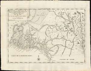
Plano de la Prouincia de Bulacan Comprehendida Entra La Lon gitud de 18' Occidental à los 14' Oriental Respecto al Meridiano de Manila Su Latiud Norte de 14° y 42' à 15° Año de 1818 en La Ysla de Luzon ò Nueua Castilla de la Yslas Filipinas.
sold
- Digital Map Information
- Suitable for large format printing
- DPI: 600
- File Size: 459.07 MB
- File Type: ZIP / TIFF
- ICC color profile embedded
- Delivered instantly via download link
An outstanding example of the 1818 Deposito Topografico / Ildefonso de Aragón map of the province of Bulacan, Philippines, accompanied by the 21-page text Provicia de Bulacan. This is the first specific map of a Philippine province, compiled as part of Ildefonso, and the Deposito's flagship effort to bring structured modern survey techniques to the archipelago. (more details)
First map of a Philippine Province - printed in Manila!
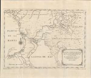
Plano de la Prouincia de Tondo situada al Norte de la Equinocial.
sold
- Digital Map Information
- Suitable for large format printing
- DPI: 600
- File Size: 14.89 MB
- File Type: ZIP / TIFF
- ICC color profile embedded
- Delivered instantly via download link
An outstanding example of the 1819 Deposito Topografico / Ildefonso de Aragón map of the province of Tondo, Philippines, accompanied by the 56-page text ' Provicia de Tondo. This is the first specific map of a Philippine province, compiled as part of Ildefonso, and the Deposito's flagship effort to bring structured modern survey techniques to the archipelago. (more details)