
D'iakov, Ivan Andreevich (sold)

Ivan Andreevich D'Iakov (Дьяков Иван Андреевич; September 14, 1881 - August 23, 1969), commonly Anglicized as John A. Diakoff, was a Russian orientalist and traveler in Asia. D'Iakov was born in Kishal, Tambov province, Russia. A scientist and orientalist, D'Iakov conducted research in the pacific islands, borneo, and hong kong. He came to Harbin, Manchuria, from Hong Kong in 1931. There he established himself as was scientific collaborator of the Russian Orientalist Society, a group of Russian scholars (and many say spies) based in Harbin, China. He was also an inspector of Russian schools and in 1945 was teaching at the St. Nicholas School in Harbin. He returned to Russia around 1950, fleeing the Cultural Revolution. There he served as the region of Morshansk, Tambov, until his death in 1969. He is known for one map, an impressive pictorial map of China published for academic purposes in Harbin, 1931. He is also the author of several works on sinology and the Russian experience in Harbin.
Most magnificent pictorial map of China.
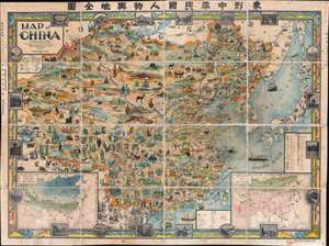
A Map of China. / 象形中華民國人物輿地全圖 / Xiàngxíng Zhōnghuá Mínguó Rénwù Yúdì Quántú (Pictorial Full Map of the People and Geography of the Republic of China.)
sold
- Digital Map Information
- Suitable for large format printing
- Full resolution TIFF file
- ICC color profile embedded
- Delivered instantly via download link
The most extraordinary pictorial map we have seen and the best specifically of China, a masterpiece. This enormous and lavish chromolithograph pictorial map of China was compiled in 1931 by John A. Diakoff, drawn by G. Primakoff, and printed by Yao-Hsiun. The map covers China from Kashgar to Taiwan, including neighboring Korea, Japan, Mongolia, and Nepal. All lands within China are rich in color and detail with countless vignettes illustrating a diversity of plant and animal life, human cultures, architectures, and resources. Text and annotations throughout are in both English and Chinese. Regions outside of China, like Japan, Korea, and India, are also heavily illustrated with vignettes, but are not in color. (more details)
The most magnificent pictorial map of China ever produced.
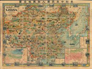
A Map of China. / 象形中華民國人物輿地全圖 / Xiàngxíng Zhōnghuá Mínguó Rénwù Yúdì Quántú (Pictorial Full Map of the People and Geography of the Republic of China.)
sold
- Digital Map Information
- Suitable for large format printing
- Full resolution TIFF file
- ICC color profile embedded
- Delivered instantly via download link
Among the most extraordinary pictorial maps we have seen to date, a masterpiece. This enormous and lavish chromolithograph pictorial map of China was compiled in 1931 by John A. Diakoff, drawn by G. Primakoff, and printed by Yao-Hsiun. The map covers all of China from Kashgar to Taiwan, including neighboring Korea, Japan, Mongolia, and Nepal. All lands within the borders of China are rich in color and detail with countless vignettes illustrating a diversity of plant and animal life, distinct cultures, architectures, and resources. Text and annotations throughout are in both English and Chinese. Regions outside of China, like Japan, Korea, and India, are also heavily illustrated with vignettes, but are not in color. (more details)