
Alexander, William DeWitt (1833 - 1913) (sold)

William De Witt Alexander (1833 - 1913) was a Hawaiian born historian, publisher, writer, surveyor, and teacher. Alexander was born in Honolulu in 1833 and received a degree from Yale University in 1855. After completing his studies Alexander returned to Hawaii where he taught Greek and history at the Punahou School. During this time Alexander published a number of books on Hawaiian history and ethnography. After nearly thirteen years in education Alexander accepted a commission with Royal Bureau of Government Survey. In this office Alexander did much of his most important work in mapping the Hawaiian Islands. Eventually he attained the office of Surveyor-General of the Territory of Hawaii and a high position in the Privy Council of Kalakaua and Lili'uokalani. When Hawaii was annexed into the United States, Alexander assisted the United States Coast and Geodetic Survey in properly mapping the islands.
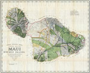
Hawaiian Government Survey, W.D. Alexander. Surveyor- General.Maui Hawaiian Islands.
sold
- Digital Map Information
- Suitable for large format printing
- File Size: 79 MB
- File Type: ZIP / TIFF
- ICC color profile embedded
- Delivered instantly via download link
This very large, rare, and extraordinary 1885 map of the island of Maui, Hawaii, was prepared for the 1906 Report of the Governor of the Territory of Hawaii to the Secretary of the Interior. Covers the entire island in stupendous detail. Though the cartographic ... (more details)
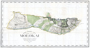
Hawaiian Government Survey. Molokai.
sold
- Digital Map Information
- Suitable for large format printing
- File Size: 14.73 MB
- File Type: ZIP / TIFF
- ICC color profile embedded
- Delivered instantly via download link
This rare and extraordinary 1897 map of the island of Molokai, in the Hawaiian group, was prepared for the 1906 Report of the Governor of the Territory of Hawaii to the Secretary of the Interior. Though the cartographic work that produced this map was started ... (more details)
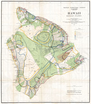
Hawaii, Hawaiian Islands.
sold
- Digital Map Information
- Suitable for large format printing
- File Size: 16.33 MB
- File Type: ZIP / TIFF
- ICC color profile embedded
- Delivered instantly via download link
This rare and extraordinary 1901 map of the island of Hawaii was prepared for the 1906 Report of the Governor of the Territory of Hawaii to the Secretary of the Interior. Though the cartographic work that produced this map was started in 1878, during the ... (more details)