
Flinders, Matthew (sold)
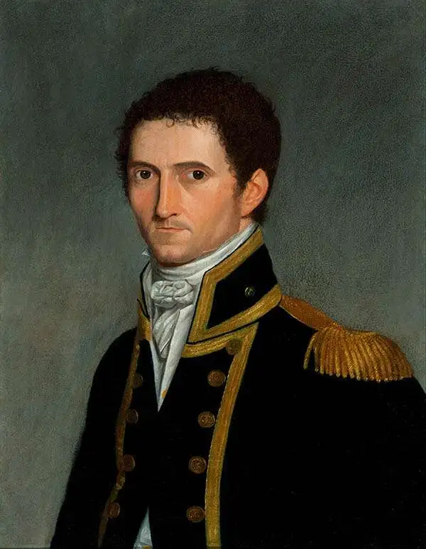
Matthew Flinders (March 16, 1774 - July 19, 1840) was a British navigator and cartographer, renowned for his pioneering work in charting the coastline of Australia. Born in Lincolnshire, England, Flinders studied at Cowley's Charity School, Donington, from 1780 and then at the Reverend John Shinglar's Grammar School at Horbling in Lincolnshire. He joined the Royal Navy at a 15, having developed a passion for naval exploration after reading Robinson Crusoe. He was part of several exploratory and military voyages, including a voyage under the notorious William Bligh, steadily rising in rank. In 1798, as a lieutenant, he embarked on an expedition exploring the Australian coast. Over the course of his voyages, Flinders meticulously charted much of the Australian coastline, including the circumnavigation of the continent, confirming it as a single landmass. He is often falsely credited as being the first person to utilize the name Australia to describe the entirety of that continent - however he did encourage this usage. Flinders' work significantly contributed to the understanding of Australia's geographical layout and was instrumental in the development of safe sea routes for future maritime exploration and trade. Despite facing numerous challenges, including shipwrecks and a lengthy imprisonment by the French on the island of Mauritius due to suspicions during the Napoleonic Wars, Flinders remained dedicated to his scientific pursuits. Flinders died, aged 40, on July 19, 1814, from kidney disease, at his home at 14 London Street (Maple Street), London. This was on the day after his book, A Voyage to Terra Australis, and its accompanying atlas were published. The location of his grave was subsequently lost until rediscovered by archeologists in 2019. Flinders is scheduled to be reburied in the summer of 2024.
One of the first maps to depict Tasmania as an island following the circumnavigation of Tasmania by this map's creator.
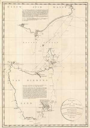
Kaart van Basses Straat Tusschen Nieuw Zuid Wales en Van Diemens-Land.
sold
- Digital Map Information
- Suitable for large format printing
- DPI: 600
- File Size: 31.3 MB
- File Type: ZIP / TIFF
- ICC color profile embedded
- Delivered instantly via download link
Created by Captain Matthew Flinders during his circumnavigation of Tasmania or Van Diemens Land, this c. 1800 map is one of the first to depict Tasmania as a separate island. Resulting from the first circumnavigation of the island, Tasmania is illustrated in some detail, but it is also evident that Flinders was not exceptionally confident about his reconnaissance of the entire coastline. He uses gaps and ghosting to mark uncertainties, particularly along the northwest coast. The eastern coast is much more tenuously sketched, probably due to the distance from shore Flinders maintained. Two large block texts, one situated in New South Wales and the other in the interior of Tasmania, furnish more information, with all text in Dutch. (more details)