
Freycinet, Louis Claude de Saulces de (sold)
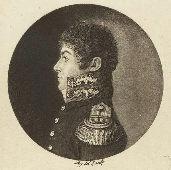
Louis Claude de Saulces de Freycinet (August 8, 1779 - August 18, 1841) was a French Navy officer and circumnavigator. In 1811, he published the first map to show a full outline of Australia's coastline. Louis-Claude de Saulces de Freycinet joined the French Navy as a midshipman in 1793, and took part in several engagements against the British during the French Revolution (1789 - 1799). In 1800, Freycinet and his brother Louis-Henri were attached to an expedition to Australia under Nicolas Baudin (1754 - 1803), on the ships Naturaliste and Géographe. Between 1802 and 1803, Freycinet captained the schooner Casuarina, executing surveys of the Australian coast. He returned to France in 1804. Back in Paris, he prepared the maps and plans of the expedition, as well as the accompanying narrative, Voyage de découvertes aux terres australes (Paris, 1807-1816). Later, in 1817, he was given command of the corvette Uranie, which he led on scientific expeditions to Rio de Janeiro and, later, throughout the Pacific - a successful voyage, despite the loss of his ship on his return. Freycinet was admitted into the French Academy of Sciences in 1825 and was one of the founders of the Paris Geographical Society.
First Full Map of Australia, and the First to name Sydney
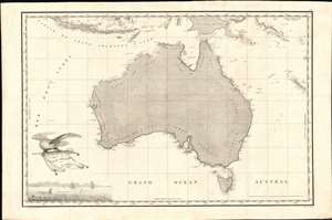
Carte Generale de la Nouvelle Hollande dressee par M L Freycinet Commandant La Goelette, Le Casuarina an 1808.
sold
- Digital Map Information
- Suitable for large format printing
- Full resolution TIFF file
- ICC color profile embedded
- Delivered instantly via download link
This is Louis de Freycinet's 1811 map of Australia, summing up French surveys of the continent undertaken between 1801 and 1808. Freycinet's mapping was executed as part of voyages under the command of Nicolas Baudin, which took place at the same time as Flinders made his surveys of the same region. (more details)