
Gauld, George (sold)

George Gauld (October 26, 1732 - June 8, 1782) was a Scottish surveyor, painter, and military engineer active in the mid to late 18th century. Gauld was born in Ardbrack, Banffshire, Scotland and educated at King's College, Aberdeen. He subsequently served in 1861 briefly on the HMS Deptford while it was testing John Harrison's revolutionary marine chronometer. He served in North America during the French and Indian War (1754 - 1763). In the immediate aftermath of the war, between 1764 and 1781, he was made Surveyor General of West Florida assigned to survey the coast. Gauld's survey efforts ended in 1781 when Spain besieged Pensacola and invaded West Florida, capturing him. It is not clear if his survey work found its way into Spanish hydrographic charts, but it may have been incorporated into general Direccion Hidrografía knowledge. Gauld was repatriated to England in 1782 and died shortly after. His survey work remained unpublished throughout the American Revolutionary War (1775 - 1783), when the valuable data might have fallen into rebel hands. It remained the best and most detailed survey of the Gulf Coast until the work of the U.S. Coast Survey in the 1840s.
Rare chart of the Gulf.
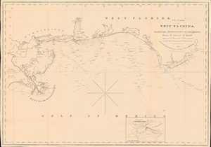
The Coasts of West Florida, Alabama, Mississippi and Louisiana; From the surveys of Gauld improved by those of the U.S. Government and the latest Astronomical Observations.
sold
- Digital Map Information
- Suitable for large format printing
- Full resolution TIFF file
- ICC color profile embedded
- Delivered instantly via download link
A rare Edmund March Blunt 1840 nautical map of West Florida, embracing the Gulf Coast from the mouths of the Mississippi to the Saint Marks River. The survey is based upon the groundbreaking work of Scottish hydrographer George Gould following the French and Indian War (1754 - 1763). Despite being nearly seventy years old by the time this chart was published, it remained the definitive mapping of the Gulf Coast until after the American Civil War (1861 - 1865). (more details)
New cartography in the wake of the Seminole Wars.

The Bahama Banks and the Gulf of Florida.
sold
- Digital Map Information
- Suitable for large format printing
- File Size: 63.88 MB
- File Type: ZIP / TIFF
- ICC color profile embedded
- Delivered instantly via download link
This is a scarce, detailed, and elegant 1848 nautical chart or maritime map of Florida and the Bahamas by E. and G. W. Blunt. Blunt's chart, which first appeared in his 10-sheet 1827 maritime atlas, represented the height of nautical mapping in and around the Florida peninsula prior to the U.S. Coast Survey in the 1850s. (more details)