
Germain, Louis (sold)

Louis Germain (1733 – c. 1791) was French engraver, draughtsman, and painter active in Paris during the middle part of the 18th century. Little is known of his life but he appears to have produced few works. Most his engravings are architectural and landscape pieces.
A fine early map of Kamchatka.
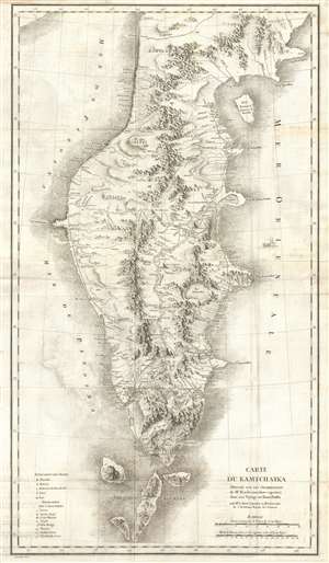
Carte du Kamtchatka Dressee sur Les Observations de Mr. Kacheninnikow raportees dans son Voyage au Kamtchatka.
sold
- Digital Map Information
- Suitable for large format printing
- DPI: 300
- File Size: 17.63 MB
- File Type: ZIP / TIFF
- ICC color profile embedded
- Delivered instantly via download link
A stunning 1768 map of Kamchatka by Jean-Baptiste Chappe d'Auteroche and Stepan Petrovič Krašeninnikov. This map covers from Korfa Bay south to the northernmost Kuril Islands, and from the Sea of Okhotsk to the Pacific Ocean. There is superb detail throughout, including beautiful profile renderings of inland mountain ranges, river systems, lakes, and roadways. When this map was issued Kamchatka was one of the most remote and sparsely inhabited places on Earth – it remains very much the same today. (more details)