
Habenicht, Hermann (sold)

Hermann Habenicht (March 3, 1844 - March 30, 1917) was a German cartographer. Born in Gotha to a porcelain painter and modeler, he attended the Gotha secondary school. His teachers at this school recommended him to the Justus Perthes cartographic institute (which was also in Gotha) as a drawing apprentice. Habenicht began his training at age fifteen, under the guidance of renowned cartographer Augustus Petermann. Soon after Habenicht's arrival, Petermann recognized and began encouraging his talent for terrain drawing. After Petermann's death in 1878, Habenicht took over many of the responsibilities for editing atlases published by Perthes, including the seventh edition of Stieler's Hand Atlas and many of the school atlases. He worked for the Perthes publishing company for fifty-five years.
German interest in the Transvaal?
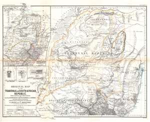
Original Map of the Transvaal or South-African Republic.
sold
- Digital Map Information
- Suitable for large format printing
- File Size: 26.44 MB
- File Type: ZIP / TIFF
- ICC color profile embedded
- Delivered instantly via download link
This is an 1868 Frederick Jeppe and Augustus Petermann map of the Transvaal, South Africa. Composed in English but published by a German publishing house (likely to capitalize on a British audience), the map details the emerging Transvaal Republic and surrounding region. The Transvaal Republic is outlined in orange and the 'limit of the tsetse fly' is emphasized by light green. The treks of eight explorers active 1844 until 1867 are traced and highlighted. Cities, towns, and villages are labeled, including Pretoria and Potchefstroom. A large inset in the upper left situates the Transvaal Republic within the greater region and labels numerous surrounding polities, including the Oranje River Freestate. Smaller inset maps detail Rustenburg, Pretoria, and Potchefstroom. (more details)