
Harvey, Fred (sold)

Fred Harvey (June 27, 1835 – February 9, 1901) was a British immigrant active in the southwestern United States in the late 19th century. His firm, The Fred Harvey Company was a hospitality chain operating branded restaurants conveniently located (rent-free) along the Atchison Topeka and Santa Fe Railroad. The first Harvey House was opened in Topeka in 1876, and its success led to the opening of more Harvey Houses down the ATSF line, who considered the presence of the Harvey Houses a welcome promotional expense. Through the 1930s, the ATSF funded Harvey ventures throughout Kansas, Colorado, New Mexico, Arizona, and California, ranging from lunch counters to railway newsstands to luxury hotels. Fred’s son Ford took over the chain on Fred’s death in 1901. Ford, an enthusiast of the southwest, incorporated the arts and culture of North American Indians living near the Harvey hotels and restaurants, to attract more travelers to New Mexico and Arizona. They established the Fred Harvey Indian Department in 1901, hiring Indian artist-demonstrators to weave blankets and make pottery and jewelry in an annex of the grand Alvarado Hotel in Albuquerque, New Mexico. The company operated until 1965.
Promoting Tourism in the American Southwest.
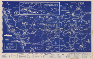
Illustrated Map of the Great Southwest including Points of Interest in Nevada and Arizona.
sold
- Digital Map Information
- Suitable for large format printing
- Full resolution TIFF file
- ICC color profile embedded
- Delivered instantly via download link
This is a 1946 pictorial map of the American Southwest produced by the Fred Harvey Company, the concessioner for the Atchison Topeka and Santa Fe Railroad. The map promotes not only the famous geological attractions of the Southwest, but also 'Harvey Car' cultural tourism to both Native American historic sites and living villages. (more details)
Promoting Tourism in the American Southwest
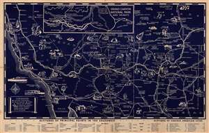
(Illustrated Map of the Great Southwest Including Points of Interest in New Mexico and Arizona Published by Fred Harvey.)
sold
- Digital Map Information
- Suitable for large format printing
- File Size: 19.11 MB
- File Type: ZIP / TIFF
- ICC color profile embedded
- Delivered instantly via download link
This attractive 1946 pictorial map of the American Southwest was produced by the Fred Harvey Company, the concessioner for the Atchison Topeka and Santa Fe Railroad. The map promotes not only the famous geological attractions of the Southwest, but also 'Harvey Car' cultural tourism to both Native American historic sites and living villages. (more details)
Promoting Tourism in the American Southwest.
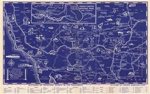
(Illustrated Map of the Great Southwest Including Points of Interest in New Mexico and Arizona Published by Fred Harvey.)
sold
- Digital Map Information
- Suitable for large format printing
- File Size: 18.35 MB
- File Type: ZIP / TIFF
- ICC color profile embedded
- Delivered instantly via download link
This attractive 1946 pictorial map of the American Southwest was produced by the Fred Harvey Company, the concessioner for the Atchison Topeka and Santa Fe Railroad. The map promotes not only the famous geological attractions of the Southwest, but also 'Harvey Car' cultural tourism to both Native American historic sites and living villages. (more details)