
Hayward, John (sold)

John Hayward (fl. c. 1840 - 1860) was a publisher of Gazetteers based in Hartford Connecticut. His work included by national and state Gazetteers, though most of his work focused on New England. Little is known of Hayward's life, but he seems to have been successful and may have attended Yale. Upon his death he was survived by his wife.
One the earliest American railroad maps.

Map of a Survey of the proposed Boston and Providence Rail-Way
sold
- Digital Map Information
- Suitable for large format printing
- DPI: 300
- File Size: 8.57 MB
- File Type: ZIP / TIFF
- ICC color profile embedded
- Delivered instantly via download link
A rare and important discovery, this is the one of the first railroad maps printed in the United States. Issued in 1828 by James Hayward, this is a topographic strip map illustrating two alternate routes for a horse powered rail line between Boston, Massachusetts ... (more details)
The United States on the eve of the Gadsden Purchase.
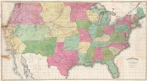
The United States from the Latest Authorities for Hayward's Gazetteer.
sold
- Digital Map Information
- Suitable for large format printing
- Full resolution TIFF file
- ICC color profile embedded
- Delivered instantly via download link
This is a scarce and attractive large format 1853 John Hayward map of the United States issued in Hayward's Gazetteer of the United States of America. The map is significant for illustrating the united states during the ephemeral period between the Treaty of Guadeloupe Hidalgo (1849) and the Gadsden Purchase. (more details)
Scarce large map showing the United States on the eve of the Gadsden Purchase.
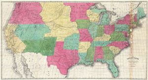
The United States from the Latest Authorities for Hayward's Gazetteer.
sold
- Digital Map Information
- Suitable for large format printing
- DPI: 300
- File Size: 30.01 MB
- File Type: ZIP / TIFF
- ICC color profile embedded
- Delivered instantly via download link
A scarce and attractive large format map of the United States issued in 1853 for John Hayward's Gazetteer of the United States of America . The map covers the United States in full from the 49th parallel to the southern tip of Florida. Cartographically Hayward's ... (more details)