
Hellfarth, Carl (sold)
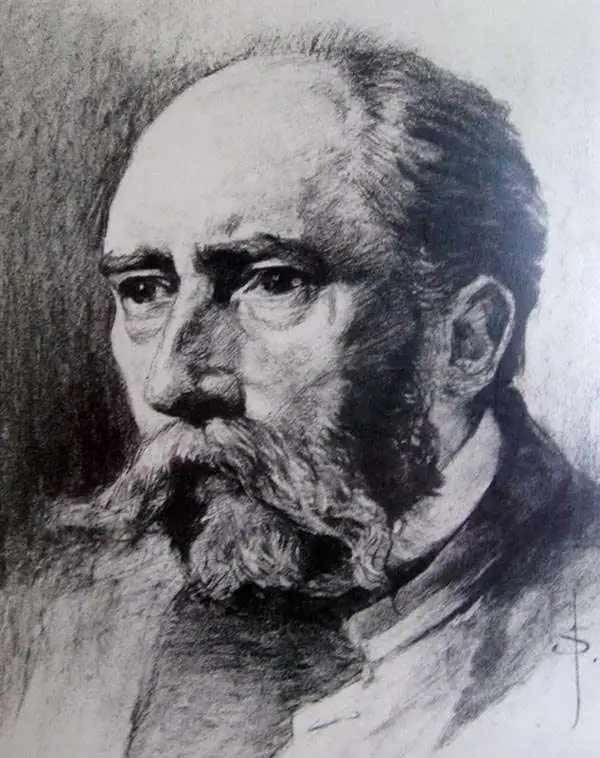
Carl Hellfarth (November 30, 1846 - July 12, 1918) was a German printer. Hellfarth was born in Gotha, Germany. He married Amalie Friederike Marie Möller (1850 - 1916) on June 16, 1873, and they had eight children.
Exploring the Arctic and Antarctic.
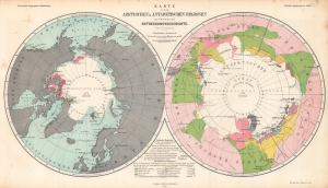
Karte der Arktischen und Antarktischen Regionen zur Übersicht der Entdeckungsgeschichte. / Map of the Arctic and Antarctic Regions for the Overview of the History of Discovery.
sold
- Digital Map Information
- Suitable for large format printing
- File Size: 25.7 MB
- File Type: ZIP / TIFF
- ICC color profile embedded
- Delivered instantly via download link
Consisting of two polar projection maps on one sheet, this is an 1865 Augustus Petermann map of the Arctic and Antarctic. Both maps highlight areas recorded by European explorers beginning in the 1770s through the 1860s. Islands, straits, bays, seas, and other locations are noted in both regions. A key explaining the various colors employed is situated at bottom center. (more details)
Starring the Global Telegraph Network.
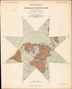
Weltkarte in Nordpolar-Sternprojektion nach einer Idee von G. Jäger, in Wien.
sold
- Digital Map Information
- Suitable for large format printing
- File Size: 8.37 MB
- File Type: ZIP / TIFF
- ICC color profile embedded
- Delivered instantly via download link
A fascinating star-shaped polar projection, prepared by Augustus Petermann in 1865 for Petermann's Geographische Mitteheilungen. Aside from demonstrating a sophisticated polar projection, the map is notable for reflecting the global telegraph network at the time. (more details)
German interest in the Transvaal?
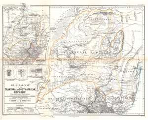
Original Map of the Transvaal or South-African Republic.
sold
- Digital Map Information
- Suitable for large format printing
- File Size: 26.44 MB
- File Type: ZIP / TIFF
- ICC color profile embedded
- Delivered instantly via download link
This is an 1868 Frederick Jeppe and Augustus Petermann map of the Transvaal, South Africa. Composed in English but published by a German publishing house (likely to capitalize on a British audience), the map details the emerging Transvaal Republic and surrounding region. The Transvaal Republic is outlined in orange and the 'limit of the tsetse fly' is emphasized by light green. The treks of eight explorers active 1844 until 1867 are traced and highlighted. Cities, towns, and villages are labeled, including Pretoria and Potchefstroom. A large inset in the upper left situates the Transvaal Republic within the greater region and labels numerous surrounding polities, including the Oranje River Freestate. Smaller inset maps detail Rustenburg, Pretoria, and Potchefstroom. (more details)
Steam packets routes and global steam navigation companies.
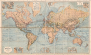
Chart of the World on Mercators Projection.
sold
- Digital Map Information
- Suitable for large format printing
- Full resolution TIFF file
- ICC color profile embedded
- Delivered instantly via download link
This is a c. 1870 Hermann Berghaus large-scale map of the world. Typical of German maps production in the late 19th century, this map is both cartographically and informationally dense, featuring a wealth of detail and data systematically organized for easy digestion. This ranges from land and sea transportation networks to climatological data, topography, political distinctions, communication infrastructure (telegraph lines), oceanographic content, and more. Of particular interest is Berghaus' focus on global ocean steam navigation companies and steam packet communication. (more details)
Landstraßen...
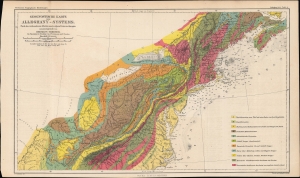
Geognostische Karte des Alleghany-Systems. Nach den vorhandenen Arbeiten sowie eignen Untersuchungen zusammengestellt von Herman Credner.
sold
- Digital Map Information
- Suitable for large format printing
- File Size: 10.45 MB
- File Type: ZIP / TIFF
- ICC color profile embedded
- Delivered instantly via download link
A colorful geologic map of the Appalachian Mountains, produced in 1871 by Augustus Petermann and published by Justus Perthes for his Petermann's geographische Mitteilungen, a leading German geographical journal of the era. (more details)
Colonial competition in the Chad Basin.
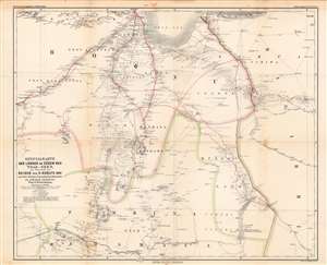
Specialkarte der Länder im Süden des Tsad-See's...
sold
- Digital Map Information
- Suitable for large format printing
- File Size: 60.93 MB
- File Type: ZIP / TIFF
- ICC color profile embedded
- Delivered instantly via download link
This is August Petermann's 1872 map of what is today the Borno (or Bornu) region of Nigeria and neighboring territories, sitting at the meeting point of Nigeria, Cameroon, and Chad along the southern banks of Lake Chad. In the years and decades following this map's publication, this region would play an important role in the Scramble for Africa. (more details)